Nakrakonda
Nakrakonda (also spelled Nakraconda, Naksrakanda, Naxrakanda) is a village and gram panchayat in Khoyrasol CD Block in Suri Sadar subdivision of Birbhum district in the Indian state of West Bengal.
Nakrakonda | |
|---|---|
Village | |
 Nakrakonda Location in West Bengal, India | |
| Coordinates: 23.8091°N 87.2586°E | |
| Country | |
| State | West Bengal |
| District | Birbhum |
| Population (2011) | |
| • Total | 2,683 |
| Languages | |
| • Official | Bengali, English |
| Time zone | UTC+5:30 (IST) |
| PIN | 731125 (Nakrakonda) |
| Telephone/STD code | 03462 |
| Lok Sabha constituency | Birbhum |
| Vidhan Sabha constituency | Dubrajpur |
| Website | birbhum |
Geography
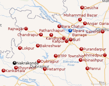 |
| Cities and towns in Suri Sadar subdivision of Birbhum district M: municipal city/ town, CT: census town, R: rural/ urban centre, B: Barrage. Owing to space constraints in the small map, the actual locations in a larger map may vary slightly |
Location
Khoyrasol, the CD Block headquarters, is 1.2 km away from Nakrakonda and Dubrajpur, the nearest town, is 10 km away. Suri, headquarters of the district, is 36 km away. [1]
Gram panchayat
Villages in Nakrakanda gram panchayat are: Ahmadpur, Bastabpur, Bhadulia, Bhurjora, Birjuri, Gangarampur, Gangpur, Kharikabad, Naopara, Nakrakanda, Paschim Sibpur, Puratan Nagrakonda, Sagarbhanga, Sahebpur, Shermara, Shilabatpur and Uttar Hazaratpur.[1]
Demographics
As per the 2011 Census of India, Naxrakanda had a total population of 2,683 of which 1,357 (51%) were males and 1,326 (49%) were females. Population below 6 years was 345. The total number of literates in Naxrakanda was 1,723 (73.70% of the population over 6 years).[2]
Post Office
Nakrakonda has a delivery branch post office, with PIN 731125, under Khoyrasol sub office and Suri head office. Khoyrasol sub office has the same PIN. Branch offices with the same PIN are Babuijore, Barhara, Bhadulia, Geruapahari, Hazratpur, Jahidpur, Kankartala, Kendragoria, Nabasan, Pursundi, Rasa and Sagarbhanga.[3]
Education
Nakraconda High School, a co-educational higher secondary institution, has arrangements for teaching the following subjects: accountancy, Bengali, bio science, business economics & mathematics, chemistry, eco-geography, English, history, mathematics, philosophy, Physics and political science. [4]
Culture
Nakrakonda Falguni Pathagar, a government-sponsored library, was established in 1978. It has its own pucca building.[5]
Healthcare
Nakrakonda Rural Hospital with 30 beds is the main medical facility in the Khoyrasol CD Block. There are primary health centres at Barrah (10 beds), Panchra (PO Panchrahat) (6 beds) and Lokepur (6 beds).[6]
References
- "Indian Village Directory". Naxrakanda. villageinfo.in. Retrieved 7 February 2018.
- "2011 Census – Primary Census Abstract Data Tables". West Bengal – District-wise. Registrar General and Census Commissioner, India. Retrieved 7 February 2018.
- "Birbhum Postal Zip Code Finder by Post Office". pincodezip.in. Retrieved 7 February 2018.
- "West Bengal Council of Higher Secondary Education". Nakraconda High School. WBCHSE. Retrieved 1 February 2018.
- "List of Govt. Sponsored Libraries in the district of BIRBHUM" (PDF). Government of West Bengal. Retrieved 7 February 2018.
- "Health & Family Welfare Department" (PDF). Health Statistics – Rural Hospitals. Government of West Bengal. Retrieved 7 February 2018.
Cities, towns and locations in Birbhum district, West Bengal | |||||||
|---|---|---|---|---|---|---|---|
| Cities, municipal and census towns |
| ||||||
| Locations other than cities and towns |
| ||||||
| See also |
| ||||||