Lohapur
Lohapur is a village in Nalhati II CD block in Rampurhat subdivision of Birbhum district in the Indian state of West Bengal.
Lohapur | |
|---|---|
Village | |
 Lohapur Location in West Bengal, India  Lohapur Lohapur (India) | |
| Coordinates: 24.31212°N 87.962141°E | |
| Country | |
| State | West Bengal |
| District | Birbhum |
| Population (2011) | |
| • Total | 4,133 |
| Languages | |
| • Official | Bengali, English |
| Time zone | UTC+5:30 (IST) |
| PIN | 731237 (Lohapur) |
| Telephone/STD code | 03465 |
| Lok Sabha constituency | Birbhum |
| Vidhan Sabha constituency | Hansan |
| Website | birbhum |
History
Bhadrapur
Bhadrapur is a village with Gram Panchayat. It has links with Maharaja Nandakumar, is about 4–5 miles from Lohapur railway station. Maharaja Nandakumar was born around 1700 at Bhadrapur. The ruins of the Raj bari are still there. Bhadrapur is culturally and educationally the most enriched village in the Lohapur Block. Bhadrapur is also quite famous for its Durga Puja. The Banerjee Thakur Bari puja is one of the grand and glorious puja of the village Bhadrapur, this Durga Puja commenced 400 years back. And it itself is a grandeur. At Akalipur, nearby, on the banks of the Brahmani River there is a Kali temple built by Maharaja Nandakumar.[1]
Baragram
Baragram is located near Lohapur railway station. It is a predominantly Muslim village. There are graves of many pirs and Muslim religious persons in this village – Lohajang, Sultan Shah, Nangta Shah, Jamal Shah, Makhdum Zilani, Makhdom Husseini, Syed Shah, Hossain Ali, Muharam Ali, Lang Shah, Darab Shah and others. Many of them came from places in the Middle-east or Central Asia, but a vast majority of the population were local converts to Islam. Over the years, the local people have been digging out numerous stone idols from all around. Most of these seem to be belonging to the Pala era. There are a large number of idols of Hindu deities but the majority are Buddhist deities, including a number of figures showing Buddha in the vajrasana pose. Many of the idols were damaged in the process of crude methods of recovery. These recoveries lead to the belief that the area was once dominated by Buddhists, who converted to Islam.[2]
Binoy Ghosh opines that the main centres of Buddhism were in eastern and northern Bengal, and it was easier to convert them to Islam because of the strong anti-Hindu mentality that the Buddhists had. Such centres were rare in western Bengal. He also notes the strong feelings of amity between Hindus and a fairly large Muslim population that he observed in Rampurhat subdivision.[2]
Geography
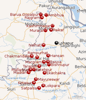 |
| Cities and towns in Rampurhat subdivision of Birbhum district M: municipal city/ town, CT: census town, R: rural/ urban centre. Owing to space constraints in the small map, the actual locations in a larger map may vary slightly |
CD block HQ
The headquarters of Nalhati II CD block are located at Lohapur.[3]
Overview
The northern portion of Rampurhat subdivision (shown in the map alongside) is part of the Nalhati Plains, a sub-micro physiographic region, and the southern portion is part of the Brahmani-Mayurakshi Basin, another sub-micro physiographic region occupying the area between the Brahmani in the north and the Mayurakshi in the south. There is an occasional intrusion of Rajmahal Hills, from adjoining Santhal Parganas, towards the north-western part of the subdivision. On the western side is Santhal Parganas and the boder between West Bengal and Jharkhand can be seen in the map. Murshidabad district is on the eastern side. A small portion of the Padma River and the border with Bangladesh (thick line) can be seen in the north-eastern corner of the map.[4] 96.62% of the population of Rampurhat subdivision live the rural areas and 3.38% of the population live in the urban areas.[5]
Note: The map alongside presents some of the notable locations in the area. All places marked in the map are linked in the larger full screen map.
Demographics
As per the 2011 Census of India, Lohapur had a total population of 4,133 of which 2,152 (52%) were males and 1,981 (48%) were females. Population below 6 years was 568. The total number of literates in Lohapur was 2,262 (74.67% of the population over 6 years).[6]
Transport
Barharwa–Azimganj–Katwa loop | |||||||||||||||||||||||||||||||||||||||||||||||||||||||||||||||||||||||||||||||||||||||||||||||||||||||||||||||||||||||||||||||||||||||||||||||||||||||||||||||||||||||||||||||||||||||||||||||||||||||||||||||||||||||||||||||||||||||||||||||||||||||||||||||||||||||||||||||||||||||||||||||||||||||||||||||||||||||||||||||||||||||||||||||||||||||||||||||||||||||||||||||||||||||||||||||||||||||||||||||||||||||||||||||||||||||||||||||||||||||||||
|---|---|---|---|---|---|---|---|---|---|---|---|---|---|---|---|---|---|---|---|---|---|---|---|---|---|---|---|---|---|---|---|---|---|---|---|---|---|---|---|---|---|---|---|---|---|---|---|---|---|---|---|---|---|---|---|---|---|---|---|---|---|---|---|---|---|---|---|---|---|---|---|---|---|---|---|---|---|---|---|---|---|---|---|---|---|---|---|---|---|---|---|---|---|---|---|---|---|---|---|---|---|---|---|---|---|---|---|---|---|---|---|---|---|---|---|---|---|---|---|---|---|---|---|---|---|---|---|---|---|---|---|---|---|---|---|---|---|---|---|---|---|---|---|---|---|---|---|---|---|---|---|---|---|---|---|---|---|---|---|---|---|---|---|---|---|---|---|---|---|---|---|---|---|---|---|---|---|---|---|---|---|---|---|---|---|---|---|---|---|---|---|---|---|---|---|---|---|---|---|---|---|---|---|---|---|---|---|---|---|---|---|---|---|---|---|---|---|---|---|---|---|---|---|---|---|---|---|---|---|---|---|---|---|---|---|---|---|---|---|---|---|---|---|---|---|---|---|---|---|---|---|---|---|---|---|---|---|---|---|---|---|---|---|---|---|---|---|---|---|---|---|---|---|---|---|---|---|---|---|---|---|---|---|---|---|---|---|---|---|---|---|---|---|---|---|---|---|---|---|---|---|---|---|---|---|---|---|---|---|---|---|---|---|---|---|---|---|---|---|---|---|---|---|---|---|---|---|---|---|---|---|---|---|---|---|---|---|---|---|---|---|---|---|---|---|---|---|---|---|---|---|---|---|---|---|---|---|---|---|---|---|---|---|---|---|---|---|---|---|---|---|---|---|---|---|---|---|---|---|---|---|---|---|---|---|---|---|---|---|---|---|---|---|---|---|---|---|---|---|---|---|---|---|---|---|---|---|---|---|---|---|---|---|---|---|---|---|---|---|---|---|---|---|---|---|---|---|---|---|---|---|---|---|---|---|---|---|---|---|---|---|---|---|
| |||||||||||||||||||||||||||||||||||||||||||||||||||||||||||||||||||||||||||||||||||||||||||||||||||||||||||||||||||||||||||||||||||||||||||||||||||||||||||||||||||||||||||||||||||||||||||||||||||||||||||||||||||||||||||||||||||||||||||||||||||||||||||||||||||||||||||||||||||||||||||||||||||||||||||||||||||||||||||||||||||||||||||||||||||||||||||||||||||||||||||||||||||||||||||||||||||||||||||||||||||||||||||||||||||||||||||||||||||||||||||
Lohapur is off National Highway 14, running from Morgram (in Murshidabad district) to Kharagpur (in Paschim Medinipur district) and State Highway 7 running from Rajgram (in Birbhum district) to Midnapore (in Paschim Medinipur district) (it is a common route in this section).[7]
There is a station at Lohapur on the Nalhati-Azimganj branch line.[8]
Post Office
Lohapur has a delivery sub post office, with PIN 731237, under Rampurhat head office. Branch offices using the same PIN are situated at Bandhkhola, Bara, Bhadrapur, Gopalchak, Jesthabhanipur, Kantagoria, Krishnapur, Noapara, Salisand, Sitalpur and Ujirpur. [9]
Healthcare
Lohapur Block Primary Health Centre at Lohapur has 15 beds.[10]
References
- Ghosh, Binoy, Paschim Banger Sanskriti, (in Bengali), part I, 1976 edition, pages 281-284, Prakash Bhaban, Kolkata
- Ghosh, Binoy, Paschim Banger Sanskriti, (in Bengali), part I, 1976 edition, pages 284-289, Prakash Bhaban, Kolkata
- "District Census Handbook: Birbhum, Series 20, Part XII B" (PDF). Map of Birbhum with CD Block HQs and Police Stations (on the fourth page). Directorate of Census Operations, West Bengal, 2011. Retrieved 1 February 2018.
- "District Census Handbook Birbhum, Census of India 2011, Series 20, Part XII A" (PDF). Page 15: Physiography. Directorate of Census Operations, West Bengal. Retrieved 30 January 2018.
- "2011 Census - Primary Census Abstract Data Tables". West Bengal – District-wise. Registrar General and Census Commissioner, India. Retrieved 30 January 2018.
- "2011 Census – Primary Census Abstract Data Tables". West Bengal – District-wise. Registrar General and Census Commissioner, India. Retrieved 1 February 2018.
- Google maps
- "73033 Azimganj Nalhati DEMU". Time Table. Indiarailinfo. Retrieved 1 February 2018.
- "Birbhum Postal Zip Code Finder by Post Office". pincodezip.in. Retrieved 1 February 2018.
- "Health & Family Welfare Department" (PDF). Health Statistics – Block Primary Health Centres. Government of West Bengal. Retrieved 26 January 2018.
Cities, towns and locations in Birbhum district, West Bengal | |||||||
|---|---|---|---|---|---|---|---|
| Cities, municipal and census towns |
| ||||||
| Locations other than cities and towns |
| ||||||
| See also |
| ||||||