Dunigram
Dunigram is a village and gram panchayat in Rampurhat II community development block in Rampurhat subdivision of Birbhum district in the Indian state of West Bengal.
Dunigram | |
|---|---|
Village | |
 | |
| Nickname(s): Small township village | |
 Dunigram Location in West Bengal, India  Dunigram Dunigram (India) | |
| Coordinates: 24.221451°N 87.916242°E | |
| Country | |
| State | West Bengal |
| District | Birbhum |
| Government | |
| • Type | Gram Panchayat |
| • MP | Satabdi Roy |
| • MLA | Milton Rashid |
| Population (2011) | |
| • Total | 8,282 |
| Languages | |
| • Official | Bengali, English, Hindi |
| Time zone | UTC+5:30 (IST) |
| PIN | 731241 (Dunigram B.O) |
| Telephone/STD code | 03461 |
| ISO 3166 code | IN-WB |
| Vehicle registration | WB 46 |
| Lok Sabha constituency | 42,Birbhum |
| Vidhan Sabha constituency | 292,Hansan |
| Website | birbhum |
Culture
Dunigram Janakalyan Samity a N.G.O Club, established in 1935. This club rules about 80% of the area. Dunigram is also well known for cultural activities. A number of schools teach music, dance, recitation and drama. Every year annual program a big function is arranged in Dunigram Janakalyan Samity, Dunigram High school, primary school and political party involving multiple cultural performance groups. During Saraswati puja, Durga Puja, Independent, Republic Day and Eid etc cultural programmes are organized in the schools and NGO. Dunigram Janakalyan samity (Local Level) and Birbhum Matribhumi Janaseva Samity (District Level) and state and national lavel Bangla Sanskrit Mancha is a proactive cultural and social service organization based out of the village. At present, the people of Dunigram are working with the various volunteer organizations from district to state level.They are primarily aware and working with people on education health pollution and fighting for society, better nation. [1]
Transport
Dunigram nearly railway station Rampurhat Junction railway station, 15 KM Distance. Dunigram is on the Dunigram Road that links NH 14 (know also NH60) at Rampurhat, 13 KM Distance.[2]
Demographics
As per the 2011 Census of India, Dunigram had a total population of 8,282 of which 4,295 (52%) were males and 3,987 (48%) were females. Population below 6 years was 1,180. The total number of literates in Dunigram was 4,910 (69.14% of the population over 6 years).[3]
Post Office
Dunigram has a delivery branch post office, with PIN 731241, under Rampurhat head office and Chandpara sub office. Other post offices having the same PIN are Chandpara, Koyemba and Nonadanga.[4]
Healthcare
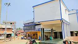
There is a primary health centre (PHC) with 6 beds at Dunigram.[5]
See also
References
- "List of Dunigram Janakalyan Samity". N.G.O INDIA. Retrieved 1 February 2018.
- Google maps
- "2011 Census – Primary Census Abstract Data Tables". West Bengal – District-wise. Registrar General and Census Commissioner, India. Retrieved 6 February 2018.
- "Birbhum Postal Zip Code Finder by Post Office". pincodezip.in. Retrieved 6 February 2018.
- "Health & Family Welfare Department" (PDF). Health Statistics – Primary Health Centres. Government of West Bengal. Retrieved 6 February 2018.
Cities, towns and locations in Birbhum district, West Bengal | |||||||
|---|---|---|---|---|---|---|---|
| Cities, municipal and census towns |
| ||||||
| Locations other than cities and towns |
| ||||||
| See also |
| ||||||