Fatehpur, Birbhum
Fatehpur is a census town in Mayureswar I CD block in Rampurhat subdivision of Birbhum district.
Fatehpur | |
|---|---|
Census Town | |
 Fatehpur Location in West Bengal  Fatehpur Fatehpur (India) | |
| Coordinates: 24.0846°N 87.7302°E | |
| Country | |
| State | West Bengal |
| District | Birbhum |
| Area | |
| • Total | 3.1509 km2 (1.2166 sq mi) |
| Population (2011) | |
| • Total | 10,176 |
| • Density | 3,200/km2 (8,400/sq mi) |
| Languages | |
| • Official | Bengali, English |
| Time zone | IST |
| PIN | 731234 |
| Telephone code | 03461 |
| Lok Sabha constituency | Bolpur |
| Vidhan Sabha constituency | Mayureswar |
| Website | birbhum |
Geography
 |
| Cities and towns in Rampurhat subdivision of Birbhum district M: municipal city/ town, CT: census town, R: rural/ urban centre. Owing to space constraints in the small map, the actual locations in a larger map may vary slightly |
Location
Fatehpur is located at 24.0846°N 87.7302°E.
Overview
The northern portion of Rampurhat subdivision (shown in the map alongside) is part of the Nalhati Plains, a sub-micro physiographic region, and the southern portion is part of the Brahmani-Mayurakshi Basin, another sub-micro physiographic region occupying the area between the Brahmani in the north and the Mayurakshi in the south. There is an occasional intrusion of Rajmahal Hills, from adjoining Santhal Parganas, towards the north-western part of the subdivision. On the western side is Santhal Parganas and the boder between West Bengal and Jharkhand can be seen in the map. Murshidabad district is on the eastern side. A small portion of the Padma River and the border with Bangladesh (thick line) can be seen in the north-eastern corner of the map.[1]96.62% of the population of Rampurhat subdivision live the rural areas and 3.38% of the population live in the urban areas.[2]
Note: The map alongside presents some of the notable locations in the area. All places marked in the map are linked in the larger full screen map.
Demographics
As per the 2011 Census of India, Fatehpur had a total population of 10,176 of which 5,193 (51%) were males and 4,983 (49%) were females. Population below 6 years was 1,110. The total number of literates in Fatehpur was 7,292 (80.43% of the population over 6 years).[3]
Infrastructure
As per the District Census Handbook 2011, Fatehpur covered an area of 3.1509 km2. There is a railway station at Fatehpur. Buses are available in the town. It has 2 km roads and open drains. The major source of protected water supply is from bore well pumping. There are 1,961 domestic electric connections and 104 road light points. Amongst the medical facilities it has are 1 hospital with 10 beds, 1 dispensary/ health cente, 1 family welfare centre, 13 medicine shops. Amongst the educational facilities it has are 6 primary schools, 2 middle schools, 2 secondary schools and 2 senior secondary schools. The nearest degree college is at Madian 2.5 km away. There is a public library and a reading room. It has a rice mill and amongst the commodities it produces is mustard oil.[4]
Transport
Fatehpur is on National Highway 14.[5]
Education
Turku Hansda-Lapsa Hemram Mahavidyalaya at Madian is located nearby.[6][7]
Culture
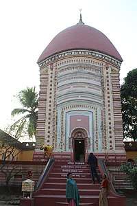
David J. McCutchion mentions the Dabukesvara temple at Dabuk, located nearby, as a char chala temple with a tall facade, 22 feet2 base, largely plain, built around 1881.[8]
References
- "District Census Handbook Birbhum, Census of India 2011, Series 20, Part XII A" (PDF). Page 15: Physiography. Directorate of Census Operations, West Bengal. Retrieved 30 January 2018.
- "2011 Census - Primary Census Abstract Data Tables". West Bengal – District-wise. Registrar General and Census Commissioner, India. Retrieved 30 January 2018.
- "2011 Census – Primary Census Abstract Data Tables". West Bengal – District-wise. Registrar General and Census Commissioner, India. Retrieved 16 July 2019.
- "District Census Handbook Birbhum, Census of India 2011, Series 20, Part XII A" (PDF). Section II Town Directory, Pages 1025- 1033. Directorate of Census Operations V, West Bengal. Retrieved 16 July 2019.
- Google maps
- "Turku Hansda Lapsa Hembram Mahavidyalaya". THLHM. Retrieved 9 February 2018.
- "Turku Hansda Lapsa Hembram Mahavidyalaya". College Admission. Retrieved 9 February 2018.
- McCutchion, David J., Late Mediaeval Temples of Bengal, first published 1972, reprinted 2017, page 31. The Asiatic Society, Kolkata, ISBN 978-93-81574-65-2
- "Health & Family Welfare Department" (PDF). Health Statistics – Rural Hospitals. Government of West Bengal. Retrieved 26 January 2018.
Cities, towns and locations in Birbhum district, West Bengal | |||||||
|---|---|---|---|---|---|---|---|
| Cities, municipal and census towns |
| ||||||
| Locations other than cities and towns |
| ||||||
| See also |
| ||||||