Chandrapur, Birbhum
Chandrapur is a village and gram panchayat in Rajnagar CD Block in Suri Sadar subdivision of Birbhum district in the Indian state of West Bengal.
Chandrapur | |
|---|---|
Village | |
 Chandrapur Location in West Bengal, India | |
| Coordinates: 23.928212°N 87.384867°E | |
| Country | |
| State | West Bengal |
| District | Birbhum |
| Population (2011) | |
| • Total | 2,012 |
| Languages | |
| • Official | Bengali, English |
| Time zone | UTC+5:30 (IST) |
| PIN | 731130 (Chandrapur) |
| Telephone/STD code | 03462 |
| Lok Sabha constituency | Birbhum |
| Vidhan Sabha constituency | Suri |
| Website | birbhum |
Geography
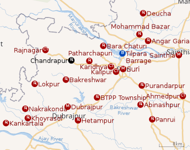 |
| Cities and towns in Suri Sadar subdivision of Birbhum district M: municipal city/ town, CT: census town, R: rural/ urban centre, B: Barrage. Owing to space constraints in the small map, the actual locations in a larger map may vary slightly |
Location
Rajnagar, the CD block headquarters, is 11 km away from Chandrapur. Suri, the district headquarters, is 15 km away.[1]
Police station
There is a police station at Chandrapur.[2]
Gram panchayat
Villages in Chandrapur gram panchayat are: Baishnabdaspur, Balarampur, Baraghata, Bhabanandapur, Chaktulsi, Chandrapur, Daldala, Durgapur, Fakirdas, Faridpur, Gamarkunda, Ganeshpur, Haripur, Jamira, Kanaipur, Kanchannagar, Kusmasul, Madhaipur, Monoharpur, Pataldanga, Rajpur, Sajina, Takipur and Tarasol.[1]
Demographics
As per the 2011 Census of India, Chandrapur had a total population of 2,012 of which 1,033 (51%) were males and 979 (49%) were females. Population below 6 years was 211. The total number of literates in Chandrapur was 1,363 (75.68% of the population over 6 years).[3]
Post Office
Chandrapur has a delivery sub post office, with PIN 731130, under Suri head office. Branch offices with the same PIN are Aligarh, Joypur, Kundira, Kurulmetia, Lauberia, Laujore, Muktipur and Ranigram.[5]
References
- "Indian Village Directory". Chandrapur. villageinfo.in. Retrieved 6 February 2018.
- "Birbhum Police". Police Stations. West Bengal Police. Retrieved 6 February 2018.
- "2011 Census – Primary Census Abstract Data Tables". West Bengal – District-wise. Registrar General and Census Commissioner, India. Retrieved 6 February 2018.
- Google maps
- "Birbhum Postal Zip Code Finder by Post Office". pincodezip.in. Retrieved 6 February 2018.
Cities, towns and locations in Birbhum district, West Bengal | |||||||
|---|---|---|---|---|---|---|---|
| Cities, municipal and census towns |
| ||||||
| Locations other than cities and towns |
| ||||||
| See also |
| ||||||