Karidhya
Karidhya is a census town in Suri I CD block in Suri Sadar subdivision of Birbhum district in the Indian state of West Bengal.
Karidhya | |
|---|---|
Census Town | |
 Karidhya Location in West Bengal, India  Karidhya Karidhya (India) | |
| Coordinates: 23.912833°N 87.493889°E | |
| Country | |
| State | West Bengal |
| District | Birbhum |
| Area | |
| • Total | 2.4489 km2 (0.9455 sq mi) |
| Population (2011) | |
| • Total | 10,466 |
| • Density | 4,300/km2 (11,000/sq mi) |
| Languages | |
| • Official | Bengali, English |
| Time zone | UTC+5:30 (IST) |
| PIN | 731126 |
| Telephone code | 03462 |
| Vehicle registration | WB |
| Lok Sabha constituency | Birbhum |
| Vidhan Sabha constituency | Suri |
| Website | birbhum |
Geography
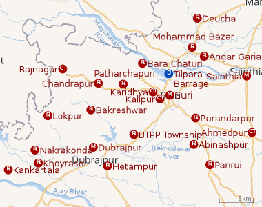 |
| Cities and towns in Suri Sadar subdivision of Birbhum district M: municipal city/ town, CT: census town, R: rural/ urban centre, B: Barrage. Owing to space constraints in the small map, the actual locations in a larger map may vary slightly |
CD block HQ
The headquarters of Suri I CD block are located at Karidhya.[1]
Demographics
As per the 2011 Census of India, Karidhya had a total population of 10,466 of which 5,325 (51%) were males and 5,141 (49%) were females. Population below 6 years was 1,038. The total number of literates in Karidhya was 8,005 (84.91% of the population over 6 years).[2]
Infrastructure
As per the District Census Handbook 2011, Karidhya covered an area of 2.4489 km2. The nearest railway station is at Suri 4 km away. Buses are available in the town. It has 9 km roads and open drains. The major source of protected water supply is from bore well pumping and over head tank. There are 872 domestic electric connections. Amongst the medical facilities it has are 1 medicine shop. Amongst the educational facilities it has are 6 primary schools, 1 middle school, 1 secondary school and 1 senior secondary school. The nearest general degree college is at Suri. Amongst the recreational and cultural facilities it has 1 working women’s hostel, 1 public library and 1 reading room. It has the branch of 1 non-agricultural credit society. Amongst the commodities it produces are handloom goods, conch shell products and sal leaf plates.[3]
Transport
State Highway 6 (locally popular as Saptagram, Tribeni, Kalna, Katwa Road or STKK), running from Rajnagar (in Birbhum district) to Alampur (in Howrah district), passes through Karidhya.[4]
Post office
Karidhya has a delivery sub post office, with PIN 731126, under Suri head office. Branch offices having the same PIN are Bhabanipur, Ganeshpur, Ghatdurlavpur, Gohaliara, Madhaipur, Nagari, Paruliahazrapur, Patadanga, Patharchapuri, Rajganj, Rautara, Sajina, Tabadurga and Tantipara.[5]
Culture
Karidhya Town Library, a government-sposored library, was established in 1953. It has its own pucca building.[6]
References
- "District Census Handbook: Birbhum, Series 20, Part XII B" (PDF). Map of Birbhum with CD block HQs and Police Stations (on the fourth page). Directorate of Census Operations, West Bengal, 2011. Retrieved 1 February 2018.
- "2011 Census – Primary Census Abstract Data Tables". West Bengal – District-wise. Registrar General and Census Commissioner, India. Retrieved 1 February 2018.
- "District Census Handbook Birbhum, Census of India 2011, Series 20, Part XII A" (PDF). Section II Town Directory, Pages 1025- 1033. Directorate of Census Operations V, West Bengal. Retrieved 16 July 2019.
- Google maps
- "Birbhum Postal Zip Code Finder by Post Office". pincodezip.in. Retrieved 1 February 2018.
- "List of Govt. Sponsored Libraries in the district of BIRBHUM" (PDF). Government of West Bengal. Retrieved 1 February 2018.
Cities, towns and locations in Birbhum district, West Bengal | |||||||
|---|---|---|---|---|---|---|---|
| Cities, municipal and census towns |
| ||||||
| Locations other than cities and towns |
| ||||||
| See also |
| ||||||