Ambhua
Ambhua is a census town in Murarai I CD block in Rampurhat subdivision of Birbhum district.
Ambhua | |
|---|---|
Census Town | |
 Ambhua Location in West Bengal  Ambhua Ambhua (India) | |
| Coordinates: 24.5568°N 87.8651°E | |
| Country | |
| State | West Bengal |
| District | Birbhum |
| Area | |
| • Total | 4.8803 km2 (1.8843 sq mi) |
| Population (2011) | |
| • Total | 10,477 |
| • Density | 2,100/km2 (5,600/sq mi) |
| Languages | |
| • Official | Bengali, English |
| Time zone | IST |
| Telephone code | 03465 |
| Lok Sabha constituency | Birbhum |
| Vidhan Sabha constituency | Murarai |
| Website | birbhum |
Geography
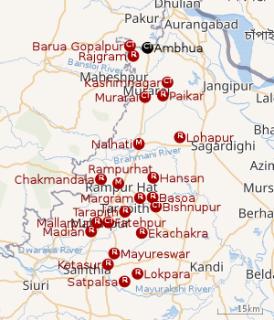 |
| Cities and towns in Rampurhat subdivision of Birbhum district M: municipal city/ town, CT: census town, R: rural/ urban centre. Owing to space constraints in the small map, the actual locations in a larger map may vary slightly |
Location
Ambhua is located at 24.5568°N 87.8651°E.
Overview
The northern portion of Rampurhat subdivision (shown in the map alongside) is part of the Nalhati Plains, a sub-micro physiographic region, and the southern portion is part of the Brahmani-Mayurakshi Basin, another sub-micro physiographic region occupying the area between the Brahmani in the north and the Mayurakshi in the south. There is an occasional intrusion of Rajmahal Hills, from adjoining Santhal Parganas, towards the north-western part of the subdivision. On the western side is Santhal Parganas and the boder between West Bengal and Jharkhand can be seen in the map. Murshidabad district is on the eastern side. A small portion of the Padma River and the border with Bangladesh (thick line) can be seen in the north-eastern corner of the map.[1]96.62% of the population of Rampurhat subdivision live the rural areas and 3.38% of the population live in the urban areas.[2]
Note: The map alongside presents some of the notable locations in the area. All places marked in the map are linked in the larger full screen map.
Demographics
As per the 2011 Census of India, Ambhua had a total population of 10,477 of which 5,300 (51%) were males and 5,177 (49%) were females. Population below 6 years was 1,760. The total number of literates in Ambhua was 5,006 (57.43% of the population over 6 years).[3]
Infrastructure
As per the District Census Handbook 2011, Ambhua covered an area of 4.8803 km2. There is a railway station at Rajgram 1 km away. Buses are available in the town. It has 11 km roads and both open and closed drains. The major source of protected water supply is from overhead tank. There are 1,420 domestic electric connections and 21 road light points. Amongst the medical facilities it has are 1 hospital with 50 beds, 1 family welfare centre and 2 medicine shops. Amongst the educational facilities it has are 3 primary schools, 1 secondary school and 1 senior secondary school. The nearest general degree college is 13 km away. Public library and reading room are available at Rajgram. It has branches of 1 nationalised and 1 cooperative bank.[4]
Transport
Ambhua is off State Highway 7, running from Rajgram to Midnapore.[5]
Education
Ambhua Junior High School, a Bengali-medium co-educational institution, was established in 2010. It has arrangements for teaching from class V to class VII.[6]
There is a Government Model School at Ambhua. [7]
References
- "District Census Handbook Birbhum, Census of India 2011, Series 20, Part XII A" (PDF). Page 15: Physiography. Directorate of Census Operations, West Bengal. Retrieved 30 January 2018.
- "2011 Census - Primary Census Abstract Data Tables". West Bengal – District-wise. Registrar General and Census Commissioner, India. Retrieved 30 January 2018.
- "2011 Census – Primary Census Abstract Data Tables". West Bengal – District-wise. Registrar General and Census Commissioner, India. Retrieved 16 July 2019.
- "District Census Handbook Birbhum, Census of India 2011, Series 20, Part XII A" (PDF). Section II Town Directory, Pages 1025- 1033. Directorate of Census Operations V, West Bengal. Retrieved 16 July 2019.
- Google maps
- "Ambhua Junior High School". ICBSE. Retrieved 18 July 2019.
- "Murarai 1 Government Model School". Justdial. Retrieved 18 July 2019.
Cities, towns and locations in Birbhum district, West Bengal | |||||||
|---|---|---|---|---|---|---|---|
| Cities, municipal and census towns |
| ||||||
| Locations other than cities and towns |
| ||||||
| See also |
| ||||||