Miles, Queensland
Miles is a town and a locality in the Western Downs Region, Queensland, Australia.[3][4] In the 2016 census, Miles had a population of 1,746 people.[1]
| Miles Queensland | |||||||||||||||
|---|---|---|---|---|---|---|---|---|---|---|---|---|---|---|---|
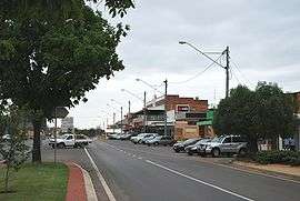 The main street of Miles | |||||||||||||||
 Miles | |||||||||||||||
| Coordinates | 26.6572°S 150.1897°E | ||||||||||||||
| Population | 1,746 (2016 census)[1] | ||||||||||||||
| • Density | 3.6007/km2 (9.326/sq mi) | ||||||||||||||
| Established | 1878 | ||||||||||||||
| Postcode(s) | 4415 | ||||||||||||||
| Elevation | 302 m (991 ft)[2] | ||||||||||||||
| Area | 484.9 km2 (187.2 sq mi) | ||||||||||||||
| Location | |||||||||||||||
| LGA(s) | Western Downs Region | ||||||||||||||
| State electorate(s) | |||||||||||||||
| Federal Division(s) | Maranoa | ||||||||||||||
| |||||||||||||||
| |||||||||||||||
Geography
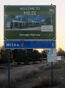
The town is on the Warrego Highway, 340 kilometres (210 mi) west of Brisbane, the state capital.
History
Formerly known as Dogwood Crossing, the town is situated on Dogwood Creek, named by German explorer Ludwig Leichhardt in 1844. The town was renamed Miles in honour of the Queensland Colonial Secretary, William Miles.[3][4] Miles Post Office opened on 3 January 1878.[5]
Miles Provisional School opened on 31 May 1880, becoming Miles State School on 18 January 1886.[6]
Holy Cross School opened in 1926. It closed on 15 December 1989.[6]
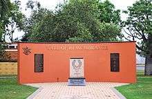
The Miles War Memorial and Wall of Remembrance was erected by the Murilla Shire Council and dedicated on 25 April 1967.[7]
Miles State High School opened on 30 January 1979.[6]
Miles Library facility opened in 2002.[8]
At the 2011 census, Miles had a population of 1,170.[9]
Industry
The economy of Miles is based mainly on agriculture and cropping, producing wheat, sorghum, barley and cotton. Timber production is another area of economic activity and in common with much of Western Queensland, cattle and sheep grazing, including feedlots is widespread.
A mining industry utilising rich deposits of bentonite clay is developing.[10]
In addition, there are the following developing industries:
- Coal seam gas
- coal mining
- electricity generation
Transport
Miles is connected to Brisbane, Toowoomba and Roma by the Warrego Highway and Goondiwindi and Rockhampton by the Leichhardt Highway. Greyhound Australia operates 3 daily bus services between Brisbane and Mount Isa via Longreach and Charleville, and Coach QLD operates three buses a week between Toowoomba and Rockhampton, via Miles. The Westlander train also comes through Miles twice a week, on its way between Brisbane and Charleville, at very early hours of Wednesday & Friday mornings (westbound) and Thursdays & Saturdays (Eastbound).
The town is served by the Miles Airport (IATA: WLE) which is located along the Leichhardt Highway approximately 19 km (12 mi) south of the Leichhardt and Warrego Highway intersection, Miles, Queensland, and 14 km (8.7 mi) north of the Leichhardt Highway and Roma-Condamine Road intersection, Condamine, Queensland.
Education
Miles State School is a government co-educational primary (P-6) school at 17 Pine Street. In 2016, the school had an enrolment of 223 students with 18 teachers (16 full-time equivalent) with 12 non-teaching staff (9 full-time equivalent).[11]
Miles State High School is a government co-educational secondary school (7-12) in Pine Street. In 2016, the school had an enrolment of 190 students with 22 teachers (21 full-time equivalent) and 20 non-teaching staff (13 full-time equivalent).[12]
Community facilities
Western Downs Regional Council operates Miles Library at Dogwood Crossing on the corner of Dawson and Murilla Streets, Miles.[13]
The Miles branch of the Queensland Country Women's Association has its rooms in Corbett Drive.[14]
Attractions
Miles Historical Village Museum is at 141 Murilla Street. It is laid out in the style of town main street in an early Queensland rural town. There are 34 buildings including 15 historic structures relocated from the local area.[15] It regarded as one of the best historical villages in Australia, and is used as a film set and special events venue, in addition to its normal operations as a museum.[16]
Climate
Miles is located on the Western Downs, at an elevation of 304 m. The region around Miles has hot summers with mean maximum temperatures in January of 33.4° Celsius falling to 19.6 in July. Average rainfall is 655.7 mm, falling mainly in the period between November and March[17]
| Climate data for Miles (Combined sites, 1885–2014) | |||||||||||||
|---|---|---|---|---|---|---|---|---|---|---|---|---|---|
| Month | Jan | Feb | Mar | Apr | May | Jun | Jul | Aug | Sep | Oct | Nov | Dec | Year |
| Record high °C (°F) | 43.2 (109.8) |
42.1 (107.8) |
41.4 (106.5) |
36.1 (97.0) |
33.0 (91.4) |
31.1 (88.0) |
28.4 (83.1) |
36.2 (97.2) |
39.9 (103.8) |
40.7 (105.3) |
41.9 (107.4) |
43.8 (110.8) |
43.8 (110.8) |
| Average high °C (°F) | 33.4 (92.1) |
32.4 (90.3) |
31.0 (87.8) |
27.7 (81.9) |
23.5 (74.3) |
20.0 (68.0) |
19.6 (67.3) |
21.9 (71.4) |
25.8 (78.4) |
29.0 (84.2) |
31.0 (87.8) |
32.7 (90.9) |
27.3 (81.1) |
| Average low °C (°F) | 19.9 (67.8) |
19.6 (67.3) |
17.3 (63.1) |
12.9 (55.2) |
7.8 (46.0) |
5.4 (41.7) |
3.9 (39.0) |
5.1 (41.2) |
9.3 (48.7) |
13.4 (56.1) |
16.7 (62.1) |
18.8 (65.8) |
12.5 (54.5) |
| Record low °C (°F) | 10.9 (51.6) |
7.4 (45.3) |
4.3 (39.7) |
0.1 (32.2) |
−4.4 (24.1) |
−5.0 (23.0) |
−6.1 (21.0) |
−4.9 (23.2) |
−2.2 (28.0) |
−0.6 (30.9) |
3.4 (38.1) |
7.9 (46.2) |
−6.1 (21.0) |
| Average rainfall mm (inches) | 84.7 (3.33) |
75.4 (2.97) |
56.3 (2.22) |
35.1 (1.38) |
33.6 (1.32) |
40.6 (1.60) |
26.6 (1.05) |
31.4 (1.24) |
26.1 (1.03) |
43.8 (1.72) |
60.6 (2.39) |
94.6 (3.72) |
608.8 (23.97) |
| Average rainy days (≥ 0.2mm) | 8.0 | 7.5 | 5.9 | 4.7 | 5.2 | 5.7 | 5.0 | 4.2 | 4.4 | 6.2 | 8.0 | 8.6 | 73.4 |
| Source: Bureau of Meteorology[18][19] | |||||||||||||
References
- Australian Bureau of Statistics (27 June 2017). "Miles (SSC)". 2016 Census QuickStats. Retrieved 15 May 2018.

- Bureau of Meteorology Archived 27 August 2006 at the Wayback Machine. Retrieved on 5 July 2008.
- "Miles - town in Western Downs Region (entry 22031)". Queensland Place Names. Queensland Government. Retrieved 12 September 2017.
- "Miles - locality in Western Downs Region (entry 47727)". Queensland Place Names. Queensland Government. Retrieved 12 September 2017.
- Premier Postal History. "Post Office List". Premier Postal Auctions. Retrieved 10 May 2014.
- Queensland Family History Society (2010), Queensland schools past and present (Version 1.01 ed.), Queensland Family History Society, ISBN 978-1-921171-26-0
- "Miles War Memorial and Wall of RemembrancePrint Page". Monument Australia. Archived from the original on 7 April 2014. Retrieved 3 April 2014.
- "Public Libraries Statistical Bulletin 2016-17" (PDF). Public Libraries Connect. State Library of Queensland. November 2017. p. 16. Archived (PDF) from the original on 30 January 2018. Retrieved 31 January 2018.
- Australian Bureau of Statistics (31 October 2012). "Miles (Urban Centre/Locality)". 2011 Census QuickStats. Retrieved 5 July 2008.
- "Queensland Department of State Development and Industry" Archived 22 August 2007 at the Wayback Machine Retrieved 22 October 2006
- "Annual Report 2016" (PDF). Miles State School. Archived (PDF) from the original on 18 September 2017. Retrieved 18 September 2017.
- "Annual Report 2016" (PDF). Miles State High School. Archived (PDF) from the original on 18 September 2017. Retrieved 18 September 2017.
- "Miles Library". Public Libraries Connect. State Library of Queensland. 6 September 2016. Archived from the original on 31 January 2018. Retrieved 31 January 2018.
- "Branch locations". Queensland Country Women's Association. Archived from the original on 26 December 2018. Retrieved 26 December 2018.
- "About the Village". Miles Historical Village Museum. Retrieved 22 November 2019.
- Queensland Weekender (9 July 2016). "Living history in Miles". Queensland Weekender. Retrieved 22 November 2019.
- Bureau of Meteorology (Australia) Archived 27 August 2006 at the Wayback Machine Retrieved 22 October 2006
- "MILES CONSTANCE STREET". Climate statistics for Australian locations. Bureau of Meteorology. January 2014. Retrieved 7 January 2014.
- "MILES POST OFFICE". Climate statistics for Australian locations. Bureau of Meteorology. January 2014. Retrieved 7 January 2014.
External links
| Wikimedia Commons has media related to Miles, Queensland. |
- "Miles". Queensland Places. Centre for the Government of Queensland, University of Queensland.
- Town map of Miles, 1983
- Sydney Morning Herald Travel
- Dogwood Crossing - The local gallery, library and IT resource centre.