Condamine, Queensland
Condamine is a town and a locality in the Western Downs Region, Queensland, Australia.[2][3] At the 2016 census, Condamine had a population of 384.[1]
| Condamine Queensland | |||||||||||||||
|---|---|---|---|---|---|---|---|---|---|---|---|---|---|---|---|
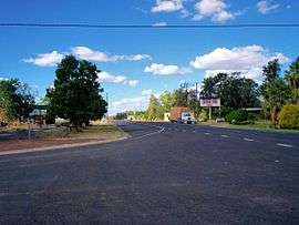 The Leichhardt Highway, passing through Condamine | |||||||||||||||
 Condamine | |||||||||||||||
| Coordinates | 26.9258°S 150.1363°E | ||||||||||||||
| Population | 384 (2016 census)[1] | ||||||||||||||
| • Density | 0.4337/km2 (1.1232/sq mi) | ||||||||||||||
| Postcode(s) | 4416 | ||||||||||||||
| Area | 885.5 km2 (341.9 sq mi) | ||||||||||||||
| Location |
| ||||||||||||||
| LGA(s) | Western Downs Region | ||||||||||||||
| State electorate(s) | Warrego | ||||||||||||||
| Federal Division(s) | Maranoa | ||||||||||||||
| |||||||||||||||
Condamine is claimed to be the location of the invention of the 'Condamine Bell', a small bell made from sheet metal used to locate herds of cattle.[4]
Geography
The town is 333 kilometres (207 mi) north west of the state capital Brisbane and 34 kilometres (21 mi) south from the town of Miles, in the Western Downs Region local government area. It is located in the centre of the locality.[5]
The Leichhardt Highway traverses the locality from north to south passing through the town.[5]
The Condamine River passes to the west of the town.[5]
The Roma to Brisbane gas pipeline passes to the south of Condamine. There are two gas compression facilities to the east of Condamine. This location is the intersection of the Roma to Brisbane pipeline, the Peat/Scotia Lateral and the Braemar Line Pack Pipeline.[6][7]
History
Tieryboo Post Office opened on 21 May 1856. It was renamed Condamine in July of that year.[8]
Condamine State School opened in 1863.[9]
On 30 December 2010, flooding forced evacuation of the town, with the level of the river expected to exceed 15 metres (49 ft).[10] The town was evacuated twice in 10 days during January 2011 as the rains continued and caused flash floods. The first flood peaked at 13.2 metres (43 ft).[11]
Population
In the 2016 Census, there were 384 people in Condamine. 75.5% of people were born in Australia and 80.9% of people spoke only English at home. The most common response for religion was Anglican at 32.9%.[1]
Facilities
Condamine is serviced by a small hotel and a roadhouse. The roadhouse is an old style classic truckies' roadhouse.
Education
Condamine State School is a government co-educational primary school (P-6) at 5 Kennedy Street. The school opened on 1 January 1863.[12] In 2016, the school had an enrolment of 32 students with 5 teachers (3 equivalent full-time) and 4 non-teaching staff (2 equivalent full-time).[13] It is one of the oldest state primary schools in Queensland.[14]
Sport
Condamine has a rugby union team which compete in the Darling Downs Rugby Union competition, against such teams as the University of Southern Queensland Rugby Union Club, Toowoomba Rangers Rugby Union Club, Toowoomba City Rugby Club, Roma Echidnas, the Condamine Cods, the Dalby Wheatmen, the Goondiwindi Emus, the Warwick Water Rats and the University of Queensland Rugby Union Club (Gatton Campus).
References
- Australian Bureau of Statistics (27 June 2017). "Condamine (Murilla Shire) (State Suburb)". 2016 Census QuickStats. Retrieved 4 November 2018.


- "Condamine - town in Western Downs Region (entry 7875)". Queensland Place Names. Queensland Government. Retrieved 12 September 2017.
- "Condamine - locality in Western Downs Region (entry 48291)". Queensland Place Names. Queensland Government. Retrieved 12 September 2017.
- "Condamine, Queensland". AboutAustralia.com.au. Archived from the original on 17 April 2011. Retrieved 15 September 2010.
- "Queensland Globe". State of Queensland. Retrieved 15 September 2017.
- "Peat Lateral - Connecting coal seam gas to Queensland". Lucas Group. Archived from the original on 18 February 2011. Retrieved 15 September 2010.
- "Australian pipeline industry delivers on Braemar Pipeline". The Australian Pipeliner. Great Southern Press. April 2006. Archived from the original on 10 June 2011. Retrieved 15 September 2010.
- Premier Postal History. "Post Office List". Premier Postal Auctions. Retrieved 10 May 2014.
- Queensland Family History Society (2010), Queensland schools past and present (Version 1.01 ed.), Queensland Family History Society, ISBN 978-1-921171-26-0
- Calligeros, Marissa and Cameron Atfield (30 December 2010). "Second Queensland town evacuated due to floodwater". The Sydney Morning Herald. Fairfax. Retrieved 30 December 2010.
- "Flood-weary residents abandon homes again". ABC News. ABC (Australia). 11 January 2011. Retrieved 12 January 2011.
- "Opening and closing dates of Queensland Schools". Queensland Government. Retrieved 18 April 2019.
- "Annual Report 2016" (PDF). Condamine State School. Archived (PDF) from the original on 15 September 2017. Retrieved 15 September 2017.
- "The oldest state primary schools in Queensland". education.qld.gov.au. Archived from the original on 23 January 2018. Retrieved 24 January 2018.
External links
![]()
| Authority control |
|
|---|