Maraial
Maraial is a city in Pernambuco, Brazil. It is located in Zona da mata Pernambucana, 154 km from the state capital, Recife.
Maraial | |
|---|---|
 Flag | |
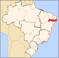
 Maraial Maraial located in Brazil Map | |
| Coordinates: 8°48′10″S 35°49′44″W | |
| Country | |
| State | Pernambuco |
| Region | Zona da mata |
| Area | |
| • Total | 192.25 km2 (74.23 sq mi) |
| Elevation | 212 m (696 ft) |
Geography
- State - Pernambuco
- Region - Zona da mata Pernambucana
- Boundaries - Jaqueira (N); Alagoas state (S); Xexéu and Catende (E); São Benedito do Sul (W)
- Area - 192.25 km2
- Elevation - 212 m
- Hydrography - Una river
- Vegetation - Subperenifólia forest
- Climate - Hot tropical and humid
- Annual average temperature - 23.6 c
- Distance to Recife - 154 km
Economy
The main economic activities in Maraial are based in food and beverage industry and agribusiness, especially sugarcane, bananas, pineapples, cattle and goats.
References
- IBGE Population 2009 Maraial, page 33
- Maraial 2007 GDP IBGE page 31 Archived 2016-03-04 at the Wayback Machine
- PE State site - City by city profile
Capital: Recife | ||||||||||||||
| Mesoregion Agreste Pernambucano |
|  | ||||||||||||
| Mesoregion Mata Pernambucana |
| |||||||||||||
| Mesoregion Metropolitana de Recife |
| |||||||||||||
| Mesoregion Sao Francisco Pernambucano |
| |||||||||||||
| Mesoregion Sertao Pernambucano |
| |||||||||||||
This article is issued from Wikipedia. The text is licensed under Creative Commons - Attribution - Sharealike. Additional terms may apply for the media files.