Lagoa do Ouro
Lagoa do Ouro (Golden Pond) is a city located in the state of Pernambuco, Brazil, located 263 km west from Recife.
Lagoa do Ouro | |
|---|---|
| Município de Lagoa do Ouro Municipality of Lagoa do Ouro | |
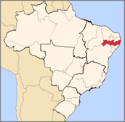
.png) Location in the state of Pernambuco | |
 Lagoa do Ouro Location in Brazil | |
| Coordinates: 09°07′37″S 36°27′32″W | |
| Country | |
| Region | Northeast |
| State | |
| Founded | December 31, 1958 |
| Government | |
| • Mayor | Marquidoves Viera Marques (Brazilian Socialist Party) |
| Area | |
| • Total | 198.760 km2 (76.742 sq mi) |
| Elevation | 653 m (2,142 ft) |
| Population (2015)[2] | |
| • Total | 12,865 |
| • Density | 65/km2 (170/sq mi) |
| Time zone | UTC-3 (BRT) |
| • Summer (DST) | UTC-2 (BRST) |
| Postal Code | 55320-000 |
| Area code(s) | +55 87 |
| ISO 3166 code | BR |
| Website | Lagoa do Ouro, PE |
History
In early 1902, Captain Amador José Monteiro of the Brazilian National Guard presented a manifesto to the Municipal Council of the municipality Correntes. The council gathered on February 9, 1902, and authorized the first fair of the village. The council also approved of the town's name of Igatauá during this meeting. On December 9, 1938, the name was changed to Lagoa do Ouro due to an urban legend that arose in the village, where nuggets or gold bars were believed to be in a local pond belonging to the estate of João Alves da Silva, who became known as John Gold.[3]
Geography
The municipality contains part of the Pedra Talhada Biological Reserve, a fully protected conservation unit created in 1989.[4]
Climate
Lagoa do Ouro has a tropical savanna climate (Aw) according to the Köppen climate classification.
Economy
The main economic activities in Lagoa do Ouro are based in agribusiness. Beans, manioc, corn and livestock such as cattle, sheep and poultry are the main agricultural resources within the municipality.
References
- "Brazilian Territorial Area. Brazilian Institute of Geography and Statistics (IBGE) (1 July 2013)". Ibge.gov.br. Archived from the original on 2011-11-09. Retrieved June 23, 2016.
- "Estimativas da população residente no Brasil e Unid Ades da Federação com data de referência emM 1º de julho de 2015" (PDF) (in Portuguese). Ibge.gov.br. Retrieved October 24, 2018.
- "Lagoa do Ouro História". Cidades.ibge.gov.br (in Portuguese). Retrieved October 24, 2018.
- Helaeson de Almeida (November 2006), Plano Operativo de Prevenção e Combate aos Incêndios Florestais da Reserva Biológica de Pedra Talhada (PDF) (in Portuguese), archived from the original (PDF) on 2012-08-24, retrieved April 16, 2016
- Lagoa do Ouro 2007 GDP IBGE page 30 Archived March 4, 2016, at the Wayback Machine
- "PE State site - City by city profile". Archived from the original on 2009-08-04. Retrieved 2009-08-20.
Capital: Recife | ||||||||||||||
| Mesoregion Agreste Pernambucano |
|  | ||||||||||||
| Mesoregion Mata Pernambucana |
| |||||||||||||
| Mesoregion Metropolitana de Recife |
| |||||||||||||
| Mesoregion Sao Francisco Pernambucano |
| |||||||||||||
| Mesoregion Sertao Pernambucano |
| |||||||||||||