São Bento do Una
São Bento do Una is a city from the Northeastern Region of Brazil at the Pernambuco state. According with IBGE, has an estimated population of 49,372 inhabitants (2009). It is located at latitude 08°31'22" South and longitude 36°26'40" West, and at approximately 614 meters of the sea level.
São Bento do Una | |
|---|---|
 Flag  Seal | |
.png) Location in Pernambuco state | |
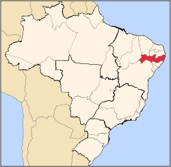
 São Bento do Una Location in Brazil | |
| Coordinates: 8°31′22″S 36°26′38″W | |
| Country | Brazil |
| Region | Northeast |
| State | Pernambuco |
| Area | |
| • Total | 727 km2 (281 sq mi) |
| Elevation | 614 m (2,014 ft) |
| Population (2009) | |
| • Total | 49,372 |
| • Density | 68/km2 (180/sq mi) |
| Time zone | UTC-03:00 (BRT) |
Fun Facts
- The city has a popular street party which the main attraction is a race of chickens.
Geography
- State - Pernambuco
- Region - Agreste Pernambucano
- Boundaries - Belo Jardim (N); Jucati, Jupi and Lajedo (S); Capoeiras, Pesqueira and Sanharó (W); Cachoeirinha (E)
- Area - 727 km2
- Elevation - 614 m
- Hydrography - Ipojuca and Una rivers
- Vegetation - Hipoxerófila caatinga
- Climate - Semi arid hot
- Distance to Recife - 207 km
Economy
The main economic activities in São Bento do Una are based in commerce and agribusiness, especially plantations of beans, corn and manioc and creations of livestock such as: chickens, quails and their eggs, cattle, milk, pigs, sheep, goats and donkeys .
References
- http://www.ibge.gov.br/home/estatistica/populacao/estimativa2009/POP2009_DOU.pdf IBGE Population 2009 São Bento do Una, page 34]
- São Bento do Una 2007 GDP IBGE page 31 Archived 2016-03-04 at the Wayback Machine
- PE State site - City by city profile
External links
- www.portalsbu.com.br - A web site in Portuguese about the city
Capital: Recife | ||||||||||||||
| Mesoregion Agreste Pernambucano |
|  | ||||||||||||
| Mesoregion Mata Pernambucana |
| |||||||||||||
| Mesoregion Metropolitana de Recife |
| |||||||||||||
| Mesoregion Sao Francisco Pernambucano |
| |||||||||||||
| Mesoregion Sertao Pernambucano |
| |||||||||||||
This article is issued from Wikipedia. The text is licensed under Creative Commons - Attribution - Sharealike. Additional terms may apply for the media files.