Arcoverde
Arcoverde (Green Arch) is a municipality in Pernambuco, Brazil. It is located in the mesoregion of Sertão Pernambucano . Arcoverde has a total area of 353.4 square kilometers and had an estimated population of 68,000 inhabitants [1] in 2009 according with IBGE.
Arcoverde | |
|---|---|
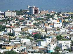 Downtown Arcoverde | |
 Flag  Coat of arms | |
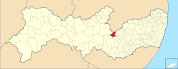 Location in Pernambuco state | |
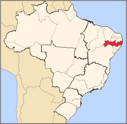
 Arcoverde Location in Brazil | |
| Coordinates: 8°25′08″S 37°03′14″W | |
| Country | Brazil |
| Region | Northeast |
| State | Pernambuco |
| Area | |
| • Total | 353.4 km2 (136.4 sq mi) |
| Population (2009) | |
| • Total | 68,000 |
| • Density | 190/km2 (500/sq mi) |
| Time zone | UTC-03:00 (BRT) |
Geography
Arcoverde is located in the Sertao of Pernambuco state. The municipality has the following data:
- Boundaries - Paraiba (N); Buíque and Pedra (S), Pesqueira (E), Sertânia (W)
- Area - 353.4 km2
- Elevation - 663 m
- Hydrography - Ipanema, Ipojuca and Moxotó rivers
- Vegetation - Caatinga.
- Climate - Semi desertic, ( Sertao) - hot and dry
- Annual average temperature - 22.4 c
- Main road - BR 232
- Distance to Recife - 254 km
Economy
The main economic activities in Arcoverde are based in general commerce, services and primary sector.
References
- "Estimativa das Populações Residentes" (PDF) (in Portuguese). IBGE. Retrieved 11 October 2012.
- Arcoverde 2007 GDP IBGE pag 29 Archived March 4, 2016, at the Wayback Machine
- PE State site - City by city profile
Capital: Recife | ||||||||||||||
| Mesoregion Agreste Pernambucano |
|  | ||||||||||||
| Mesoregion Mata Pernambucana |
| |||||||||||||
| Mesoregion Metropolitana de Recife |
| |||||||||||||
| Mesoregion Sao Francisco Pernambucano |
| |||||||||||||
| Mesoregion Sertao Pernambucano |
| |||||||||||||
This article is issued from Wikipedia. The text is licensed under Creative Commons - Attribution - Sharealike. Additional terms may apply for the media files.