List of historic places in British Columbia Coast
The following list includes all of the Canadian Register of Historic Places listings in the British Columbia Coast area, excluding Vancouver Island. This includes the following districts:
- Central Coast Regional District
- Kitimat-Stikine Regional District
- Mount Waddington Regional District
- Powell River Regional District
- Skeena-Queen Charlotte Regional District
- Strathcona Regional District
- Sunshine Coast Regional District
| Name | Address | Coordinates | IDF | IDP | IDM | Image | |
|---|---|---|---|---|---|---|---|
| Kitwankul National Historic Site of Canada | Near the confluence of Kitwankul Creek and the Kitwanka River, in Kitwankul Indian Reserve 1, Gitanyow, BC | 55°15′48″N 128°03′41″W | 19634 |  | |||
| Dorreen Store and Railway Station | , Kitimat-Stikine C, BC | 54°50′27″N 128°20′38″W | 20268 | | |||
| Meanskinisht Cemetery | Cedarvale Ferry Road, Cedarvale, BC | 55°01′22″N 128°18′44″W | 20269 | | |||
| Gitwangak Battle Hill | Kitwanga, Kitimat-Stikine Regional District, BC | 55°7′10″N 128°1′1″W | 7633 | Q1527840 |  More images | ||
| Metlakatla Pass | Metlakatla, British Columbia, North Coast Regional District, BC | 54°19′27″N 130°27′29″W | 10473 | Q23768240 | | ||
| Kitselas Canyon | Kitselas, Kitimat-Stikine Regional District, BC | 54°36′0″N 128°25′59″W | 10522 | Q1546580 | 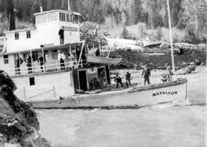 More images | ||
| Pulteney Point Lighthouse | Southwestern tip of Malcolm Island, Port McNeill, BC | 50°37′50″N 127°09′18″W | 200838 | | |||
| Powell River Townsite Historic District National Historic Site of Canada | Powell River, Powell River, BC | 49°52′05″N 124°32′49″W | 10728 | 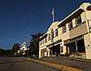 | |||
| Dryad Point Lighthouse | Northeast tip of Campbell Island, Central Coast Regional District, BC | 52°11′06″N 128°06′42″W | 20780 | | |||
| Boat Bluff Lighthouse | Southern tip of Sarah Island, Regional District of Kitimat-Stikine, BC | 52°38′35″N 128°31′27″W | 20776 | | |||
| Meziadin Fish Ladder | Meziadin River near its mouth at the Nass River, Regional District of Kitimat-Stikine, BC | 56°01′20″N 129°09′11″W | 19436 | | |||
| Simon Gunanoot Gravesite | Graveyard Point, Bowser Lake, Regional District of Kitimat-Stikine, BC | 56°25′55″N 129°32′08″W | 19434 | | |||
| Egg Island Lighthouse | Egg Island, off the coast at the northeast entrance to the Queen Charlotte Strait, Central Coast Regional District, BC | 51°14′59″N 127°50′11″W | 20781 | | |||
| Langara Point Lighthouse | Langara Point, Langara Island, BC | 54°15′19″N 133°03′34″W | 9496 21113 |
| |||
| McInnes Island Lighthouse | McInnes Island, off the southern tip of Price Island, McInnes Island, BC | 52°15′44″N 128°43′18″W | 20798 | | |||
| Green Island Lighthouse | Green Island, east of Dundas Island in Chatham Sound, Skeena-Queen Charlotte A, BC | 54°34′07″N 130°42′31″W | 20796 | | |||
| Capilano Shipwreck | Strait of Georgia south of Savary Island, Powell River Regional District, BC | 49°52′47″N 124°46′15″W | 10311 | | |||
| North Pacific Cannery National Historic Site of Canada | Port Edward, Skeena-Queen Charlotte, BC | 54°11′41″N 130°13′26″W | 12321 | | |||
| Pacific Roundhouse | 35km by rail north of Terrace, Pacific, BC | 54°46′13″N 128°16′15″W | 20270 | | |||
| Yukon Telegraph Trail | 500km of former telegraph line route in Kitimat-Stikine Regional District, Telegraph Creek, BC | 57°55′14″N 131°10′07″W | 17944 | | |||
| Triple Island Lighthouse National Historic Site of Canada | Prince Rupert, Skeena-Queen Charlotte, BC | 54°17′41″N 130°52′48″W | 12770 11407 |
20835 | | ||
| Butedale Cannery | Butedale, Kitimat-Stikine, BC | 53°09′36″N 128°41′49″W | 14603 | | |||
| Old Skeena Bridge | 3100 Old Highway 16, Terrace, Kitimat-Stikine, BC | 54°30′54″N 128°33′40″W | 14604 |  | |||
| Hagwilget Bridge | Highway 62, near Hazelton, Kitimat-Stikine, BC | 55°15′26″N 127°36′18″W | 14605 | | |||
| Anyox Powerhouse No. 1 | Anyox, Kitimat-Stikine, BC | 55°24′59″N 129°49′41″W | 14606 | | |||
| First Crossing of North America National Historic Site of Canada | Bella Coola, Central Coast Regional District, BC | 52°22′27″N 126°46′23″W | 14662 | 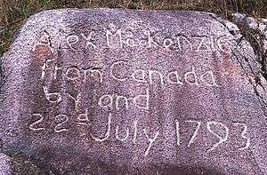 | |||
| Merry Island Lighthouse | Eastern tip of Merry Island, Sunrise Beach, BC | 49°28′03″N 123°54′44″W | 20799 | | |||
| George Little House | 3100 Kalum Street, Terrace, Kitimat-Stikine, BC | 54°30′53″N 128°35′13″W | 15923 | | |||
| Great War Veterans' Association Hall | 4552 Lakelse Avenue, Terrace, BC | 54°30′59″N 128°35′09″W | 21053 | | |||
| Kitsumgallum Pioneer Cemetery | 101 Kalum Lake Drive, Terrace, BC | 54°31′18″N 128°38′14″W | 21055 | | |||
| Terrace Heritage Park Museum | 4702 Kerby Avenue, Terrace, BC | 54°32′04″N 128°35′32″W | 21054 | | |||
| British Columbia Provincial Police Station | 3224 Kalum Street, Terrace, Kitimat-Stikine, BC | 54°31′00″N 128°35′10″W | 16164 | | |||
| Kwinitsa Railway Foreman's Residence | 4805 Highway 16 West, Terrace, Kitimat-Stikine, BC | 54°30′56″N 128°36′00″W | 16185 | | |||
| Telegraph Creek | Telegraph Creek, Kitimat-Stikine, BC | 57°54′06″N 131°09′54″W | 17922 | |
References
- (references appear in the table above as external links)
This article is issued from Wikipedia. The text is licensed under Creative Commons - Attribution - Sharealike. Additional terms may apply for the media files.