Mount Douglas, Greater Victoria
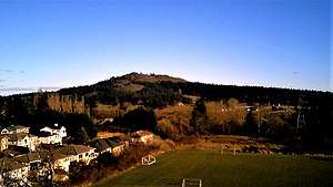
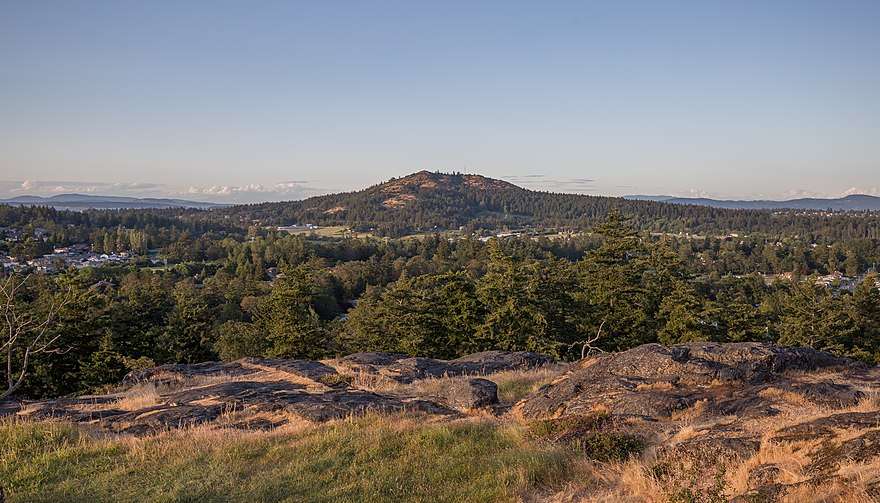
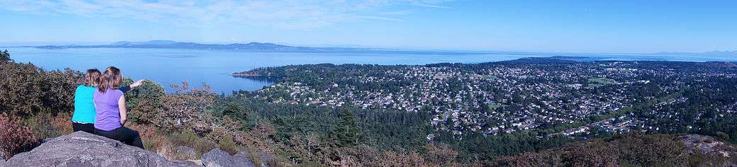
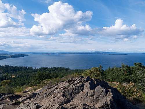
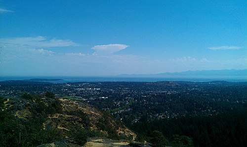
Mount Douglas (SENĆOŦEN: pq̕áls or PKOLS) is a prominent, 225 m (738 ft)[2] hill in Greater Victoria, British Columbia. It is located on the ancestral lands of the Saanich and Songhees people.
| Mount Douglas | |
|---|---|
 | |
| Highest point | |
| Elevation | 225 m (738 ft) |
| Prominence | 225 m (738 ft) |
| Coordinates | 48°29′35.05″N 123°20′48.44″W [1] |
| Geography | |
 Mount Douglas | |
Name
The aboriginal Saanich and Songhees people called the mountain PKOLS [pq̕áls], meaning "White Head" in SENĆOŦEN dialect. This mountain was a culturally significant gathering and meeting place of the SENĆOŦEN and Lekwungen peoples, a site for ceremonies and sharing important news. [3]
In the mid-nineteenth century, it was called Cedar Hill, and was home to logging operations. Local mills supplied the growing city of Victoria, including the original Hudson's Bay Company fort, transporting lumber south along present day Cedar Hill Road. It was brought under protected status in 1889. Finding no cedars on the hill called "Cedar Hill," Captain Henry Kellett renamed it "Mount Douglas," as recorded in the Fort Victoria Journal by Roderick Finlayson.[4] Although this informal renaming occurred in Douglas' lifetime (it was given the appellation "Mount" in order to honour the governor's status), the name "Mt. Douglas" was not officially adopted until 1910.
In 2013, an effort was started to reestablish its aboriginal name.[5][6][7] The Reclaim PKOLS movement has appealed to the BC Geographical Names Office for a formal name change. There has yet to be an approval of this petition.
The Neighbourhood
The namesake neighbourhood around the base of Mt. Douglas is a mix of residential neighbourhoods, hobby farms and working farms, roughly bounded by Cedar Hill Road, Cordova Bay Road, the Blenkinsop Valley and Parkside Crescent. The farms of the Blenkinsop Valley (such as Madrona Farm) are protected by the provincial Agricultural Land Reserve.
Mount Douglas Mining Cave
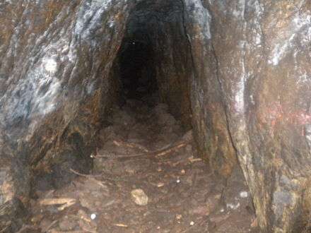
Mount Douglas has many trails. One trail in particular, on its south side (near the north-most point of Glendenning Trail), has an old abandoned mine. The mine has a small entrance, but it opens up inside. The mine is about 50 to 60 feet (15.24 to 18.29 m) in length.
Blenkinsop Valley Plane Crash
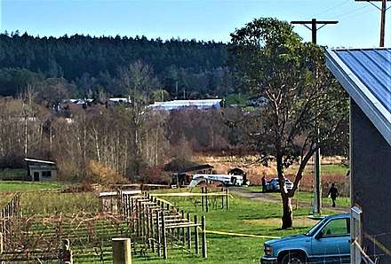
Shortly before 9:00 On the morning of February 18, 2020, a Cessna 172P Skyhawk crashed into a farm in the Blenkinsop Valley near Mount Douglas. It had departed from the Victoria International Airport earlier that morning and belonged to the Victoria Flying Club. The pilot had recently obtained a private license and was accumulating flight hours. The two passengers were taken to the hospital with minor injuries. Officials say oil obscured the pilots view out of the windscreen and played a factor in the crash. The engine was reported to have failed and dropped parts. The plane's propeller fell from the aircraft as it flew over Mount Douglas Park, and was later found by authorities within a kilometre of the crash site. [8]
References
- https://latitude.to/articles-by-country/ca/canada/110434/mount-douglas-greater-victoria
- http://www.saanich.ca/EN/main/parks-recreation-culture/parks/parks-trails-amenities/signature-parks/mount-douglas-park.html
- "Archived copy". Archived from the original on 2014-06-20. Retrieved 2014-06-20.CS1 maint: archived copy as title (link)
- http://www.fortvictoriajournal.ca/1846-august.php?hl=de&q=hill
- "Reclaim PKOLS". Retrieved 2013-05-22.
- Hill, Edward (2013-05-18). "First Nations act to reclaim name of Mount Doug". Victoria News. Retrieved 2013-05-22.
- Mount Douglas Name Change Supported By Noam Chomsky, Canadian Press, May 22, 2013
- https://vancouverisland.ctvnews.ca/it-was-smoking-really-bad-no-injuries-reported-after-small-plane-crashes-near-victoria-1.4816923
External links
- Article about Blenkinsop valley plane crash.
- Description of the location and nomenclature from the BC Ministry of Sustainable Resource Management.
- Description of the park from the Saanich municipal website.
- A description of the area, including some historical information.
- Website for Mount Douglas High School