Sunshine Coast Regional District
The Sunshine Coast Regional District of British Columbia is located on the southern mainland coast, across Georgia Strait (part of the Salish Sea) from Vancouver Island. It borders on the Powell River Regional District to the north, the Squamish-Lillooet Regional District to the east, and, across Howe Sound, the Metro Vancouver District to the south. The regional district offices are located in the District Municipality of Sechelt.
Sunshine Coast | |
|---|---|
| Sunshine Coast Regional District | |
.jpg) Sechelt Inlet | |
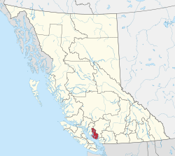 Location in British Columbia | |
| Country | Canada |
| Province | British Columbia |
| Office location | Sechelt |
| Government | |
| • Type | Regional district |
| • Body | Board of Directors |
| • Chair | Lori Pratt (B) |
| • Vice Chair | Darnelda Siegers (Sechelt) |
| • Electoral Areas |
|
| Area | |
| • Land | 3,773.73 km2 (1,457.05 sq mi) |
| Population (2016)[2] | |
| • Total | 29,970 |
| • Density | 7.94/km2 (20.6/sq mi) |
| Website | scrd.ca |
Geography
The majority of the Sunshine Coast is sparsely populated. The Coast Mountains make up the inland area. Population is concentrated along the coast. Midway up the coast, beginning at the town of Sechelt, the coastal area forms a peninsula separated from the inland area by Sechelt Inlet. The 2001 census reported a total population of 25,599 persons living on a land area of 3,778.17 km² (1,458.76 sq mi).
The Sunshine Coast is typically accessed via boat or plane; no roads connect the district with the rest of the province. From Vancouver, ferries run from Horseshoe Bay to Gibsons across Howe Sound. At the northern end of the peninsula, ferries run from Earl's Cove to Saltery Bay.
Communities
District municipality
Town
- Gibsons
Indian government district
- Sechelt (Part)
Indian reserves
- Chekwelp 26
- Chekwelp 26A
- Schaltuuch 27
Unincorporated
- Roberts Creek
- Halfmoon Bay
- Madeira Park
- Garden Bay
- Egmont
- Hopkins Landing
Electoral areas
- Pender Harbour/Egmont/Madeira Park (Electoral Area A) - Pop 2,678 [3]
- Halfmoon Bay (Electoral Area B) - Pop 2,675 [4]
- Roberts Creek (Electoral Area D) - Pop 3,244 [5]
- Elphinstone (Electoral Area E) - Pop 3,482 [6]
- West Howe Sound (Electoral Area F) - Pop 2,043 [7]
(all population figures from 2011 Census)
Demographics
(Statistics Canada, 2011)[8]
- Population: 28,619
- Population change (2006–2011): 3.1%
- Dwellings: 12,839
- Land area (km².): 3,776.62
Provincial Parks
References
- Sources
- Notes
- "Board of Directors". Retrieved 2019-07-09.
- Census Profile. 2.statcan.gc.ca. Retrieved on 2014-04-12.
- Census Profile. 2.statcan.gc.ca. Retrieved on 2014-04-12.
- Census Profile. 2.statcan.gc.ca. Retrieved on 2014-04-12.
- Census Profile. 2.statcan.gc.ca. Retrieved on 2014-04-12.
- http://www12.statcan.ca/census-recensement/2016/dp-pd/prof/details/page.cfm?Lang=E&Geo1=CSD&Code1=5929028&Geo2=CD&Code2=5929&Data=Count&SearchText=V0N1V6&SearchType=Begins&SearchPR=01&B1=All&TABID=2
- Census Profile. 2.statcan.gc.ca. Retrieved on 2014-04-12.
External links
- Sunshine Coast Regional District
- Town of Gibsons
- District of Sechelt
- Vancouver Coastal Health
- Sechelt Indian Government District
- Caren Range
- "Sunshine Coast Regional District". BC Geographical Names.
Places adjacent to Sunshine Coast Regional District | ||||||||||
|---|---|---|---|---|---|---|---|---|---|---|
| ||||||||||
| Subdivisions |  | |
|---|---|---|
| Communities | ||
| Metro areas and agglomerations |
| |
| Regional districts |
| |
| ||