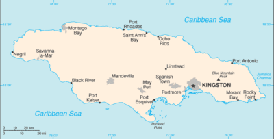
List of airports in Jamaica

This is a list of airports in Jamaica, grouped by type and sorted by location.

Map of Jamaica

List of airports by name

Names shown in bold indicate the airport has scheduled passenger service on commercial airlines.

City/town served Parish ICAO IATA Airport name Coordinates LID
International airports
Kingston Kingston / St. Andrew MKJP KIN Norman Manley International Airport 17°56′08″N 076°47′15″W
Montego Bay Saint James MKJS MBJ Sangster International Airport 18°30′13″N 077°54′48″W
Ocho Rios/Boscobel Saint Mary MKBS OCJ Ian Fleming International Airport 18°24′15″N 076°58′08″W
Domestic airports
Kingston Kingston / St. Andrew MKTP KTP Tinson Pen Aerodrome 17°59′18″N 076°49′25″W
Negril Westmoreland MKNG NEG Negril Aerodrome 18°20′24″N 078°20′08″W
Port Antonio Portland MKKJ POT Ken Jones Aerodrome 18°11′55″N 076°32′04″W
Military airports
Kingston Kingston / St. Andrew Up Park Camp [1] 17°59′18″N 076°46′34″W
Moneague Saint Ann Moneague Training Camp [2] 18°16′56″N 077°06′18″W JM-0015
Private airports
Bath Saint Thomas Bath Airfield 17°56′24″N 076°18′27″W JM-0016
Bog Walk Saint Catherine Tulloch Airfield 18°06′15″N 076°59′20″W JM-0003
Discovery Bay Saint Ann Puerto Seco Airstrip 18°28′00″N 77°23′40″W JM-0007
Ewarton Saint Catherine Ewarton Airstrip 18°10′26″N 077°04′07″W JM-0004
Manchioneal Portland Manchioneal Airstrip 18°03′17″N 76°17′00″W JM-0002
Nain Saint Elizabeth Nain Airstrip 17°58′38″N 77°36′25″W JM-0010
Old Harbour Bay Saint Catherine Port Esquivel Airstrip 17°53′30″N 77°08′10″W JM-0006
Williamsfield Manchester Kirkvine Airstrip 18°04′45″N 77°28′40″W JM-0009
Duncans Trelawny Braco Airfield 18°28′35″N 77°29′25″W JM-0012
Closed
Spanish Town Saint Catherine Caymanas Airfield 18°00′52″N 076°55′27″W Closed
Vernam Field Clarendon Vernam Field 17°53′18″N 077°18′11″W Closed
Rocky Point Clarendon Rocky Point Airstrip [3] 17°46′37″N 077°15′36″W Closed
Mandeville Manchester MVJ Marlboro Airport (Marlborough Airport) 18°01′11″N 077°29′42″W Closed

See also

References

  • Airports Authority of Jamaica
  • Jamaica Civil Aviation Authority
  • "Ministry of Transport and Works: Annual Transport Statistics Report 2003-2004" (PDF). Archived from the original (PDF) on 2013-03-15., contains list of aerodromes in Jamaica
  • "ICAO Location Indicators by State" (PDF). International Civil Aviation Organization. 2006-01-12.
  • "UN Location Codes: Jamaica". UN/LOCODE 2009-2. UNECE. 2010-02-08. - includes IATA codes
  • Great Circle Mapper: Airports in Jamaica, reference for airport codes
  • World Aero Data: Airports in Jamaica, reference for coordinates

Footnotes

  1. "Archived copy". Archived from the original on 2006-11-27. Retrieved 2006-10-09.CS1 maint: archived copy as title (link)
  2. "Archived copy". Archived from the original on 2008-03-23. Retrieved 2008-03-07.CS1 maint: archived copy as title (link)
  3. UK Directorate of Overseas Surveys 1:50,000 map of Jamaica sheet H, 1973.


This article is issued from Wikipedia. The text is licensed under Creative Commons - Attribution - Sharealike. Additional terms may apply for the media files.