List of airports in Trinidad and Tobago
This is a list of airports in Trinidad and Tobago.
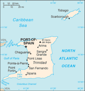
Map of Trinidad and Tobago
Trinidad and Tobago, officially known as the Republic of Trinidad and Tobago, is an archipelagic state in the southern Caribbean, lying northeast of Venezuela and south of Grenada in the Lesser Antilles. It shares maritime boundaries with other nations including Barbados to the northeast, Guyana to the southeast, and Venezuela to the south and west. The country covers an area of 5,128 square kilometres (1,980 sq mi) and consists of two main islands, Trinidad and Tobago, along with numerous smaller landforms. Trinidad is the larger and more populous of the main islands.
Airports
Airport names shown in bold indicate the airport has scheduled service on commercial airlines.
| City served / Location | Island | ICAO | IATA | Airport name | Coordinates |
|---|---|---|---|---|---|
| Port of Spain / Piarco | Trinidad | TTPP | POS | Piarco International Airport | 10°35′43″N 61°20′14″W |
| Scarborough / Crown Point | Tobago | TTCP | TAB | A.N.R. Robinson International Airport | 11°08′59″N 60°49′56″W |
| Couva / Couva | Trinidad | Camden Base (Camden Airfield) | 10°25′34″N 61°26′23″W |
See also
- Transport in Trinidad and Tobago
- List of airports by ICAO code: T#TT - Trinidad and Tobago
- Wikipedia: WikiProject Aviation/Airline destination lists: North America#Trinidad and Tobago
References
- "ICAO Location Indicators by State" (PDF). International Civil Aviation Organization. 12 January 2006.
- "UN Location Codes: Trinidad and Tobago". UN/LOCODE 2009-1. UNECE. 23 September 2009. - includes IATA codes
- World Aero Data: Airports in Trinidad and Tobago - ICAO codes, coordinates
- Great Circle Mapper: Airports in Trinidad and Tobago - IATA and ICAO codes, coordinates
This article is issued from Wikipedia. The text is licensed under Creative Commons - Attribution - Sharealike. Additional terms may apply for the media files.