Les Cèdres, Quebec
Les Cèdres is a municipality located north of the Saint Lawrence River in the Montérégie of Quebec, Canada, near Vaudreuil-Dorion. The population as of the Canada 2011 Census was 6,079. The name means "The Cedars" in French.
Les Cèdres | |
|---|---|
Municipality | |
 | |
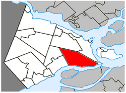 Location within Vaudreuil-Soulanges RCM. | |
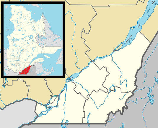 Les Cèdres Location in southern Quebec. | |
| Coordinates: 45°18′N 74°03′W[1] | |
| Country | |
| Province | |
| Region | Montérégie |
| RCM | Vaudreuil-Soulanges |
| Constituted | March 9, 1985 |
| Government | |
| • Mayor | Raymond Larouche |
| • Federal riding | Vaudreuil-Soulanges |
| • Prov. riding | Soulanges |
| Area | |
| • Total | 88.50 km2 (34.17 sq mi) |
| • Land | 77.85 km2 (30.06 sq mi) |
| Population (2011)[4] | |
| • Total | 6,079 |
| • Density | 78.1/km2 (202/sq mi) |
| • Pop 2006-2011 | |
| • Dwellings | 2,408 |
| Time zone | UTC−5 (EST) |
| • Summer (DST) | UTC−4 (EDT) |
| Postal code(s) | J7T 1A1 |
| Area code(s) | 450 and 579 |
| Highways | |
| Website | www |
There is an extensive rapid on the St. Lawrence River at this location.[5] During the American Revolution, the Battle of the Cedars was fought in the vicinity. In 1959-1960 Swedish writer, Stig Claesson, lived in the village at a place called Point Charlie and later wrote a book about it called My friend Charlie.
Demographics
Population
| Canada census – Les Cèdres, Quebec community profile | |||
|---|---|---|---|
| 2011 | 2006 | ||
| Population: | 6,079 (+6.1% from 2006) | 5,732 (+11.8% from 2001) | |
| Land area: | 77.85 km2 (30.06 sq mi) | 77.85 km2 (30.06 sq mi) | |
| Population density: | 78.1/km2 (202/sq mi) | 73.6/km2 (191/sq mi) | |
| Median age: | 38.8 (M: 38.6, F: 39.1) | 37.0 (M: 37.3, F: 36.8) | |
| Total private dwellings: | 2,408 | 2,165 | |
| Median household income: | $76,394 | $65,228 | |
| References: 2011[4] 2006[6] earlier[7] | |||
| Historical Census Data - Les Cèdres, Quebec[8] | ||||||||||||||||||||||||||
|---|---|---|---|---|---|---|---|---|---|---|---|---|---|---|---|---|---|---|---|---|---|---|---|---|---|---|
|
|
| ||||||||||||||||||||||||
Language
| Canada Census Mother Tongue - Les Cèdres, Quebec[8] | ||||||||||||||||||
|---|---|---|---|---|---|---|---|---|---|---|---|---|---|---|---|---|---|---|
| Census | Total | French |
English |
French & English |
Other | |||||||||||||
| Year | Responses | Count | Trend | Pop % | Count | Trend | Pop % | Count | Trend | Pop % | Count | Trend | Pop % | |||||
2011 |
6,045 |
5,360 | 88.67% | 470 | 7.78% | 80 | 1.32% | 135 | 2.23% | |||||||||
2006 |
5,720 |
5,175 | 90.47% | 350 | 6.12% | 70 | 1.22% | 125 | 2.19% | |||||||||
2001 |
5,115 |
4,650 | 90.91% | 275 | 5.38% | 120 | 2.34% | 70 | 1.37% | |||||||||
1996 |
4,630 |
4,225 | n/a | 91.25% | 265 | n/a | 5.72% | 45 | n/a | 0.97% | 95 | n/a | 2.05% | |||||
Infrastructure
Transportation
The west end of Quebec Autoroute 30, a Montreal Island bypass route, runs through this area to link up with Autoroute 20. Montréal/Les Cèdres Airport, a single-runway general aviation airport, is located north of Quebec Autoroute 20 in the Les Cèdres area.
Schools
Commission Scolaire des Trois-Lacs operates Francophone schools.[9]
- École Marguerite-Bourgeoys
- Some areas are served by École Du Papillon-Bleu (pavillons Saint-Jean-Baptiste and Sainte-Trinité) in Vaudreuil-Dorion and by École Des Étriers in Saint-Lazare[10]
Lester B. Pearson School Board operates Anglophone schools. It is zoned to Birchwood Elementary School and Evergreen Elementary School in Saint-Lazare and St. Patrick Elementary School in Pincourt.[11]
References
- Reference number 148078 of the Commission de toponymie du Québec (in French)
- "Ministère des Affaires Municipales et Regions Quebec: Les Cèdres". Archived from the original on 2014-02-23. Retrieved 2012-03-11.
- "Parliament of Canada Federal Riding History: VAUDREUIL--SOULANGES (Quebec)". Archived from the original on 2009-06-18. Retrieved 2009-03-22.
- "2011 Community Profiles". 2011 Canadian Census. Statistics Canada. July 5, 2013. Retrieved 2014-02-02.
-

- "2006 Community Profiles". 2006 Canadian Census. Statistics Canada. March 30, 2011. Retrieved 2014-02-02.
- "2001 Community Profiles". 2001 Canadian Census. Statistics Canada. February 17, 2012.
- Statistics Canada: 1996, 2001, 2006, 2011 census
- "Les écoles et les centres". Commission Scolaire des Trois-Lacs. Retrieved 18 January 2013.
- "Liste des bassins desservis par les écoles en 2017-2018." Commission Scolaire des Trois-Lacs. Retrieved on September 30, 2017.
- "School Board Map." Lester B. Pearson School Board. Retrieved on September 28, 2017.
Adjacent Municipal Subdivisions | |
|---|---|
| Cities & towns | |
|---|---|
| Municipalities | |
| Villages | |
| |