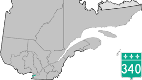
Quebec Route 340
Route 340 is a provincial highway situated in the Montérégie region of Quebec west of Montreal. It runs for just over 40 kilometers from the Ontario-Quebec border in Saint-Télesphore (as a continuation of Stormont, Dundas and Glengarry County Road 18) and ends in Vaudreuil-Dorion at the junction of Autoroute 20.
| ||||
|---|---|---|---|---|
 | ||||
| Route information | ||||
| Maintained by Transports Québec | ||||
| Length | 40.2 km[1] (25.0 mi) | |||
| Major junctions | ||||
| West end | County Road 18 at South Glengarry, Ontario | |||
| East end | ||||
| Location | ||||
| Counties | Vaudreuil-Soulanges | |||
| Highway system | ||||
| ||||

Municipalities along Route 340
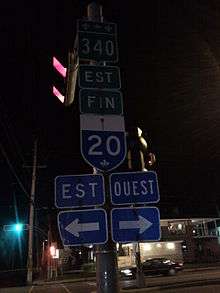
A 2011 photo for the eastern terminal of Route 340 in Vaudreuil-Dorion installed during the city's former Dorion days prior to the Vaudreuil-Dorion merger of 1994.
Major intersections
| RCM or ET | Municipality | Km | Junction | Notes |
|---|---|---|---|---|
Western terminus of Route 340 | ||||
| Vaudreuil-Soulanges | Sainte-Télesphore | 0.0 | Ontario County Road 18 | WEST: to South Glengarry, Ontario |
| 2.8 | 325 SOUTH: to Rivière-Beaudette 325 NORTH: to Sainte-Justine-de-Newton | |||
| Saint-Polycarpe | 12.1 | Chemin Sainte-Catherine | SOUTH: to Saint-Zotique | |
| 15.0 | Chemin Ranger | SOUTH: to Les Coteaux | ||
| Saint-Clet | 21.0 | 201 SOUTH: to Coteau-du-Lac 201 NORTH: to Hudson | ||
| Vaudreuil-Dorion | 34.3 | 342 SOUTH: to Vaudreuil-Dorion 342 NORTH: to Hudson | ||
| 34.8 35.2 |
30 SOUTH: to 30 NORTH: to | |||
| 40.1 40.2 |
20 WEST: to Les Cèdres 20 EAST: to Pincourt | |||
Eastern terminus of Route 340 | ||||
See also
References
- Ministère des transports, "Distances routières", page 98, Les Publications du Québec, 2005
This article is issued from Wikipedia. The text is licensed under Creative Commons - Attribution - Sharealike. Additional terms may apply for the media files.