Saint-Polycarpe, Quebec
Saint-Polycarpe is a municipality located in the Vaudreuil-Soulanges Regional County Municipality in the Montérégie region west of Montreal, Quebec, Canada, and just east of the Quebec-Ontario border. It was named for Polycarp, a 2nd-century bishop of Smyrna. The population as of the 2016 Canadian Census was 2,224.
Saint-Polycarpe | |
|---|---|
Municipality | |
 | |
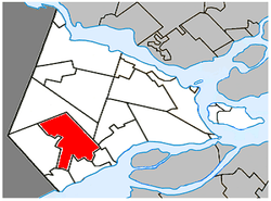 Location within Vaudreuil-Soulanges RCM | |
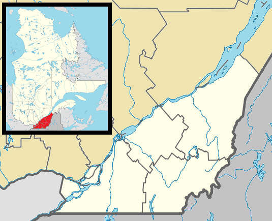 Saint-Polycarpe Location in southern Quebec | |
| Coordinates: 45°18′N 74°18′W[1] | |
| Country | |
| Province | |
| Region | Montérégie |
| RCM | Vaudreuil-Soulanges |
| Constituted | 31 December 1988 |
| Government | |
| • Mayor | Jean-Yves Poirier |
| • Federal riding | Salaberry—Suroît |
| • Prov. riding | Soulanges |
| Area | |
| • Total | 70.90 km2 (27.37 sq mi) |
| • Land | 69.97 km2 (27.02 sq mi) |
| Population (2016)[4] | |
| • Total | 2,224 |
| • Density | 31.8/km2 (82/sq mi) |
| • Pop 2011-2016 | |
| • Dwellings | 947 |
| Time zone | UTC−5 (EST) |
| • Summer (DST) | UTC−4 (EDT) |
| Postal code(s) | J0P 1X0 |
| Area code(s) | 450 and 579 |
| Highways | |
| Website | munstpolycarpe |
While a parish during the 18th century, its territory included portions of what is now part of Saint-Zotique.
Demographics
Population
| Canada census – Saint-Polycarpe, Quebec community profile | |||
|---|---|---|---|
| 2016 | 2011 | 2006 | |
| Population: | 2,224 (+13.0% from 2011) | 1,969 (+15.3% from 2006) | 1,708 (+3.1% from 2001) |
| Land area: | 70.00 km2 (27.03 sq mi) | 69.97 km2 (27.02 sq mi) | 69.97 km2 (27.02 sq mi) |
| Population density: | 31.8/km2 (82/sq mi) | 28.1/km2 (73/sq mi) | 24.4/km2 (63/sq mi) |
| Median age: | 37.7 (M: 38.2, F: 37.2) | 37.2 (M: 38.3, F: 36.1) | 39.7 (M: 40.2, F: 39.4) |
| Total private dwellings: | 947 | 829 | 664 |
| Median household income: | $62,144 | $52,451 | $43,369 |
| References: 2016[5] 2011[6] 2006[7] earlier[8] | |||
| Historical Census Data - Saint-Polycarpe, Quebec[9] | ||
|---|---|---|
| Year | Pop. | ±% |
| 1991 | 1,640 | — |
| 1996 | 1,676 | +2.2% |
| 2001 | 1,657 | −1.1% |
| 2006 | 1,708 | +3.1% |
| 2011 | 1,969 | +15.3% |
Language
| Canada Census Mother Tongue - Saint-Polycarpe, Quebec[9] | ||||||||||||||||||
|---|---|---|---|---|---|---|---|---|---|---|---|---|---|---|---|---|---|---|
| Census | Total | French |
English |
French & English |
Other | |||||||||||||
| Year | Responses | Count | Trend | Pop % | Count | Trend | Pop % | Count | Trend | Pop % | Count | Trend | Pop % | |||||
2016 |
2,180 |
2,075 | 93.2% | 120 | 5.4% | 30 | 1.3% | 10 | 0.5% | |||||||||
2011 |
1,965 |
1,790 | 91.09% | 95 | 4.83% | 15 | 0.76% | 65 | 3.31% | |||||||||
2006 |
1,710 |
1,625 | 95.03% | 35 | 2.05% | 10 | 0.58% | 40 | 2.34% | |||||||||
2001 |
1,640 |
1,590 | 96.95% | 50 | 3.05% | 0 | 0.00% | 0 | 0.00% | |||||||||
1996 |
1,650 |
1,500 | n/a | 90.91% | 130 | n/a | 7.88% | 10 | n/a | 0.61% | 10 | n/a | 0.61% | |||||
Infrastructure
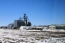
Silos at St-Polycarpe
Transportation
Saint-Polycarpe is located along Route 340 with nearby Quebec Autoroute 20 running south of the municipality.
Education
Commission Scolaire des Trois-Lacs operates Francophone schools.[10]
- École secondaire Soulanges
- École du Val-des-Prés Sacré-Cœur
Lester B. Pearson School Board operates Anglophone schools.[11]
- Soulanges Elementary School in Saint-Télesphore or Evergreen Elementary and Forest Hill Elementary (Junior Campus and Senior campus) in Saint-Lazare
See also
References
- Reference number 224196 of the Commission de toponymie du Québec (in French)
- Affaires Municipales et Régions: Saint-Polycarpe
- Parliament of Canada Federal Riding History: VAUDREUIL--SOULANGES (Quebec)
- 2011 Statistics Canada Census Profile: Saint-Polycarpe, Quebec
- "2016 Community Profiles". 2016 Canadian Census. Statistics Canada. 21 February 2017. Retrieved 25 November 2019.
- "2011 Community Profiles". 2011 Canadian Census. Statistics Canada. 5 July 2013. Retrieved 15 February 2014.
- "2006 Community Profiles". 2006 Canadian Census. Statistics Canada. 30 March 2011. Retrieved 15 February 2014.
- "2001 Community Profiles". 2001 Canadian Census. Statistics Canada. 17 February 2012.
- Statistics Canada: 1996, 2001, 2006, 2011 census
- "Les écoles et les centres". Commission Scolaire des Trois-Lacs. Retrieved 18 January 2013.
- "School Board Map." Lester B. Pearson School Board. Retrieved on 28 September 2017.
External links
| Wikimedia Commons has media related to Saint-Polycarpe, Quebec. |
Adjacent Municipal Subdivisions | |
|---|---|
| Cities & towns | |
|---|---|
| Municipalities | |
| Villages | |
| |
This article is issued from Wikipedia. The text is licensed under Creative Commons - Attribution - Sharealike. Additional terms may apply for the media files.