Leinster
Leinster (/ˈlɛnstər/ LEN-stər; Irish: Laighin [ˈl̪ˠa(j)ɪnʲ] or Cúige Laighean [ˈkˠuːɟə ˈl̪ˠa(j)ɪnˠ]) is one of the provinces of Ireland, situated in the east of Ireland. The Leinster province comprises the ancient Kingdoms of Meath, Leinster and Osraige. Following the 12th-century Norman invasion of Ireland, the historic fifths of Leinster and Meath gradually merged, mainly due to the impact of the Pale, which straddled both, thereby forming the present-day province of Leinster. The ancient kingdoms were shired into a number of counties for administrative and judicial purposes. In later centuries, local government legislation has seen further sub-division of the historic counties.
Leinster Laighin[1] | |
|---|---|
 Flag | |
 | |
| State | Ireland |
| Counties | |
| Government | |
| • Teachtaí Dála |
|
| • MEPs[a] |
|
| Area | |
| • Total | 19,800 km2 (7,644 sq mi) |
| Population (2016)[2] | |
| • Total | 2,630,720 (1st) |
| • Density | 126.5/km2 (328/sq mi) |
| Time zone | UTC±0 (WET) |
| • Summer (DST) | UTC+1 (IST) |
| Eircode routing keys | Beginning with A, C, D, N, R, W, Y (primarily) |
| Telephone area codes | 01, 04x, 05x, 090 (primarily) |
| ISO 3166 code | IE-L |
| Patron Saint: Brigid[3] a. ^ Leinster contains the entirety of the Dublin constituency and parts of the South and Midlands–North-West constituencies; Leinster contains 44.4% of the population of the Midlands–North-West constituency and 32.3% of the population of the South constituency.[4] | |
Leinster has no official function for local-government purposes. However, the province is an officially recognised subdivision of Ireland. It is listed on ISO 3166-2 as one of the four provinces of Ireland and "IE-L" is attributed to Leinster as its country sub-division code.
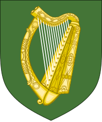
Leinster had a population of 2,630,720 according to the preliminary results of the 2016 census, making it the most populous province in the country.[2] The traditional flag of Leinster features a golden harp on a green background.
History
Early history

The Gaelic Kingdom of Leinster before 1171, considerably smaller than the present-day province, usually did not include certain territories such as Meath, Osraige or the Viking cities of Wexford and Dublin. The first part of the name Leinster derives from Laigin, the name of a major tribe that once inhabited the area.[5] The latter part of the name derives either from the Irish tír or from the Old Norse staðr, both of which translate as "land" or "territory".
Úgaine Mór (Hugony the Great), who supposedly built the hill-fort of Dún Ailinne, near Kilcullen in County Kildare, united the tribes of Leinster. He is a likely, but uncertain, candidate as the first historical king of Laigin (Leinster) in the 7th century BC. Circa 175/185 AD, following a period of civil wars in Ireland, the legendary Cathair Mor re-founded the kingdom of Laigin. The legendary Finn Mac Cool, or Fionn mac Cumhaill, reputedly built a stronghold at the Hill of Allen, on the edge of the Bog of Allen, in what was then Leinster.
In the 4th and 5th centuries AD, after Magnus Maximus had left Britain in 383 AD with his legions, leaving a power vacuum, colonists from Laigin settled in North Wales, specifically in Anglesey, Carnarvonshire and Denbighshire.[6] In Wales some of the Leinster-Irish colonists left their name on the Llŷn Peninsula (in Gwynedd), which derives its name from Laigin.[7] In the 5th century, the emerging Uí Néill dynasties from Connacht conquered areas of Westmeath, Meath and Offaly from the Uí Enechglaiss and Uí Failge of the Laigin.[8] Uí Néill Ard Righ attempted to exact the Boroimhe Laighean (cattle-tribute) from the Laigin from that time, in the process becoming their traditional enemies.
By the 8th century the rulers of Laigin had split into two dynasties:[9]
- Northern Leinster dynasty: Murchad mac Brain (d. 727), King of Uí Dúnlainge, and joint leader of the Laigin
- Southern Leinster dynasty: Áed mac Colggen (d. 738), King of Uí Cheinnselaig, and joint leader of the Laigin
After the death of the last Kildare-based King of Laigin, Murchad Mac Dunlainge in 1042,[10] the kingship of Leinster reverted to the Uí Cheinnselaig sept based in the southeast in present-day County Wexford.[11] This southern dynasty provided all the later Kings of Leinster.
Kingdom of Ireland period
Leinster represents the extended "English Pale", counties controlled directly from Dublin, at the beginning of the 1600s. The other three Provinces had their own regional Presidency systems, based on a Welsh model of administration, in theory if not in fact, from the 1570s and 1580s up to the 1670s, and were considered separate entities. Gradually "Leinster" subsumed the term of "The Pale", as the kingdom was pacified and the difference between the old Pale area and the wider province, now also under English administration, grew less distinct.
The expansion of the province took in the territory of the ancient Kingdom of Mide encompassing much of present-day counties Meath, Westmeath and Longford with five west County Offaly baronies.[12] Local lordships were incorporated during the Tudor conquest of Ireland and subsequent plantation schemes.
Other boundary changes included County Louth, officially removed from Ulster in 1596, the baronies of Ballybritt and Clonlisk (formerly Éile Uí Chearbhaill in the county palatine of Tipperary) in Munster becoming part of Leinster in 1606, and the 'Lands of Ballymascanlon' transferred from Armagh to Louth circa 1630. The provincial borders were redrawn by Cromwell for administration and military reasons, and the Offaly parishes of Annally and Lusmagh, formerly part of Connacht, were transferred in 1660.
The last major boundary changes within Leinster occurred with the formation of County Wicklow (1603–1606),[13] from lands in the north of Carlow (which previously extended to the sea) and most of southern Dublin.[14] Later minor changes dealt with "islands" of one county in another. By the late 1700s, Leinster looked as shown in the above map of 1784.
Counties and Counties Corporate
Following the abolition of County Dublin, three successor counties were created that cover the same area. They are Dún Laoghaire–Rathdown,[15] Fingal and South Dublin. To these may be added the historic County Corporate of the city of Dublin, which, under the terms of the Local Government (Ireland) Act 1898 was abolished to be succeeded by the County borough of Dublin. This was in turn abolished under the terms of the Local Government Act 2001 and the area is now under the jurisdiction of Dublin City Council. The remaining counties of the province are Kildare, Offaly, Laois, Wexford, Carlow, Wicklow, Louth, Meath, Westmeath, Longford and Kilkenny. While Kilkenny city was once a county corporate, by the terms of the 1898 Act it became part of the administrative county,[16] although it retains the privilege of calling itself a city.
Culture
Language
As is the norm for language in Ireland, English is the primary spoken language, but there is an active Irish-speaking minority in the province. According to the Census of Ireland of 2011, there were 18,947 daily speakers of Irish in Leinster outside the education system,[17] including 1,299 native speakers in the small Gaeltacht of Ráth Chairn. As of 2011, there were 19,348 students attending the 66 Gaelscoils (Irish-language primary schools) and 15 Gaelcholáistí (Irish-language secondary schools) in the province, primarily in the Dublin area.[18]
Sport
A number of sporting and cultural organisations organise themselves on provincial lines, including Leinster Rugby, Leinster Cricket Union, Leinster Hockey Association and Leinster GAA.
While Leinster GAA is made-up primarily of the traditional counties of the province, GAA teams from Galway, Kerry and Antrim have played in the Leinster Senior Hurling Championship, as has a team from London; Galway won the title in 2012. Participation of these counties is based on their performances in the Christy Ring Cup.
Large settlements
As of the 2016 census, the larger settlements in Leinster included:
| # | Settlement | County | Municipal District Pop. | Settlement Pop. | Former Legal Town Pop. |
|---|---|---|---|---|---|
| 1 | Dublin City[19] | County Dublin | 1,347,359 | 1,173,179 | 554,554 |
| 2 | Dundalk | County Louth | 55,806[20] | 39,004[21] | 32,520[22] |
| 3 | Kilkenny | County Kilkenny | 52,172[23] | 26,512[24] | 9,842[25] |
| 4 | Drogheda | County Louth | 44,052[26] | 40,956[27] | 31,785[28] |
| 5 | Swords | County Dublin | 42,738 | 39,248[29] | 36,924 |
| 6 | Bray | County Wicklow | 35,531 | 32,600[30] | 27,709 |
| 7 | Navan | County Meath | 34,931 | 30,173[31] | 30,097 |
| 8 | Carlow | County Carlow | 34,846 | 24,272[32] | 14,425 |
See also
References
- "ISO 3166-2 Newsletter II-1" (PDF). Iso.org. 19 February 2010. Retrieved 20 October 2016.
which gives Leinster as the official English name of the Province and Laighin as the official Irish name of the Province and cites "Ordnance Survey Office, Dublin 1993"
- "Population and Actual and Percentage Change 2011 to 2016 by Sex, Province County or City". Central Statistics Office. 2016.
- John Koch (2006). Celtic Culture: A Historical Encyclopedia. 1. ABC-CLIO.
Brigit (Goddess)
- Census of Ireland 2016
- Sean J Connolly (2007). The Oxford Companion to Irish History. Oxford University Press. p. 308. ISBN 9780199234837.
- R F Foster (1992). The Oxford History of Ireland. Oxford & New York: Oxford University Press. p. 6. ISBN 0-19-285271-X.
(References to Irish colony in North Wales, Lleyn Peninsula)
- "Kings of Laigin / Leinster (Gaels of Ireland)". HistoryFiles.co.uk. Retrieved 17 February 2018.
- Mark Clinton (2000). Alfred P. Smyth (ed.). "Settlement patterns in the early historic kingdom of Leinster (seventh-mid twelfth centuries)". Seanchas:Studies in Early and Medieval Irish Archaeology, History and Literature in Honour of Francis John Byrne. Dublin: Four Courts Press: 275–298.
- Seán Duffy (2005). Medieval Ireland: An Encyclopedia. Routledge. pp. 426, 449. ISBN 9781135948245.
- Alfred P. Smyth (1982). "Celtic Leinster: towards an historical geography of early Irish civilization, A.D. 500–1600". Irish Academic Press. p. 81. ISBN 9780716500971.
Murchad, that Ui Dunlainge king who founded an unbroken rotational line of Leinster kings which lasted from 715 to 1042
- Edel Bhreathnach (2000). Alfred P. Smyth (ed.). "Kings, the kingship of Leinster, and the regnal poems of "laidshenchas Laigen":a reflection of dynastic politics in Leinster, 650–1150". Seanchas: Studies in Early and Medieval Irish Archaeology, History and Literature in Honour of Francis J. Byrne. Dublin: Four Courts Press: 299–312.
- Paul Walsh (2003). "1 (Early Leinster and Meath, province and diocese )". Irish Leaders and Learning Through the Ages. Four Courts Press. p. 33. ISBN 9781851825431.
- Emmett O'Byrne (2003). War, politics and the Irish of Leinster, 1156–1606. Four Courts Press. ISBN 1851826904.
Leinster from the death of Toirdhealbhach O’Connor in 1156 to the establishment, in 1606, of County Wicklow – the last Irish and Leinster county to be created
- Alfred P. Smyth (1994). Ken Hannigan; William F. Nolan (eds.). "Kings, Saints and Sagas". Wicklow History & Society. Geography Publications: 41–111. ISBN 9780906602300.
- "Welcome to dlr | Dún Laoghaire-Rathdown County Council". Dlrcoco.ie. Retrieved 9 October 2016.
- "A handbook of local government in Ireland : containing an explanatory introduction to the Local Government (Ireland) Act, 1898 : together with the text of the act, the orders in Council, and the rules made thereunder relating to county council, rural district council, and guardian's elections : with an index". Ia341031.us.archive.org. Retrieved 20 October 2016.
- "Table 32A Irish speakers aged 3 years and over in each Province, County and City, classified by frequency of speaking Irish" (PDF). Census 2006 – Volume 9 – Irish Language. CSO. Retrieved 20 December 2017.
- "Statisticí – Oideachas Trí Mheán na Gaeilge in Éirinn sa Ghalltacht 2010–2011" (PDF) (in Irish). Gaelscoileanna.ie. 2011. Retrieved 20 December 2017.
- "Census 2016 Sapmap Area: Settlements Dublin City And Suburbs". census.cso.ie. Retrieved 14 April 2018.
- "Census 2016 Sapmap Area: Municipal District Dundalk". census.cso.ie. Retrieved 14 April 2018.
- "Census 2016 Sapmap Area: Settlements Dundalk". census.cso.ie. Retrieved 14 April 2018.
- "Census 2016 Sapmap Area: Former Legal Town Dundalk Legal Town". census.cso.ie. Retrieved 14 April 2018.
- "Census 2016 Sapmap Area: Municipal District Kilkenny City East". census.cso.ie. Retrieved 14 April 2018.
- "Census 2016 Sapmap Area: Settlements Kilkenny". census.cso.ie. Retrieved 14 April 2018.
- "Census 2016 Sapmap Area: Former Legal Town Kilkenny Legal Town". census.cso.ie. Retrieved 14 April 2018.
- "Census 2016 Sapmap Area: Municipal District Drogheda". census.cso.ie. Retrieved 14 April 2018.
- "Census 2016 Sapmap Area: Settlements Drogheda". census.cso.ie. Retrieved 14 April 2018.
- "Census 2016 Sapmap Area: Former Legal Town Drogheda Legal Town". census.cso.ie. Retrieved 14 April 2018.
- "Census 2016 Sapmap Area: Settlements Swords". census.cso.ie. Retrieved 14 April 2018.
- "Census 2016 Sapmap Area: Settlements Bray". census.cso.ie. Retrieved 14 April 2018.
- "Census 2016 Sapmap Area: Settlements An Uaimh (Navan)". census.cso.ie. Retrieved 14 April 2018.
- "Census 2016 Sapmap Area: Settlements Carlow". census.cso.ie. Retrieved 14 April 2018.
External links
- . Encyclopædia Britannica. 16 (11th ed.). 1911.
- CSO Irish Regional Income/GDP 2004 Report
The counties are listed per province | ||
 | ||
| ||
| Authority control |
|---|