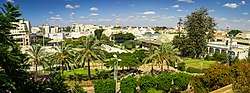
Kfar Saba
Kfar Saba (Hebrew: כְּפַר סָבָא), officially Kefar Sava, is a city in the Sharon region, of the Central District of Israel. In 2019 it had a population of 110,456.
Kfar Sava
| |
|---|---|
| Hebrew transcription(s) | |
| • ISO 259 | Kfar Sava |
| • Translit. | Kfar Sava |
 | |
 Flag  | |
 Kfar Sava 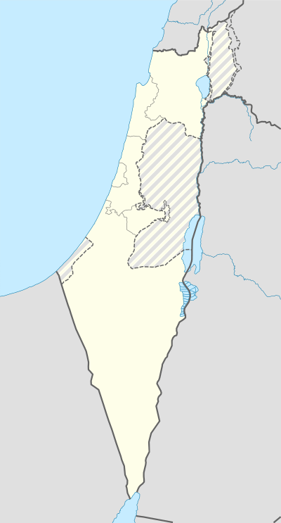 Kfar Sava | |
| Coordinates: 32°10′17″N 34°54′30″E | |
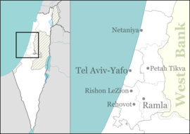
| Country | |
| District | Central |
| Founded | 1903 |
| Government | |
| • Type | City (from 1962) |
| • Mayor | Rafi Saar |
| Area | |
| • Total | 14,169 dunams (14.169 km2 or 5.471 sq mi) |
| Population (2019) | |
| • Total | 110,456 |
| • Density | 7,800/km2 (20,000/sq mi) |
| Website | www.kfar-saba.muni.il (in Hebrew) |
History
The origins of the name are not known - in Hebrew and Aramaic it means 'grandfather village'.
Antiquity
Kfar Saba (ancient Capharsaba) was an important settlement during the Second Temple period in ancient Judea,[1][2] and is mentioned for the first time in the writings of Josephus, in his account of the attempt of Alexander Jannaeus to halt an invasion from the North led by Antiochus (Antiquities, book 13, chapter 15). Kfar Saba appears in the Talmud in connection to corn tithing and the Capharsaba sycamore fig tree.[1] Kfar Saba is mentioned in the Mosaic of Rehob, the oldest known Talmudic text, which dates from around the 3rd century C.E.
Excavations on the site have revealed the remains of a large Roman bathhouse. In the Byzantine periods the ruins of the bathhouse were first converted into fish pools, and later into some form of industrial installation.[3]
Medieval era
Following the Muslim conquest of the Levant in the 7th century, the Palestinian village of Kafr Saba was established in the area. Around 985 C.E. Al-Muqaddasi described it as a village with a large mosque on the road to Damascus.[4] In 1047, Nasir-i-Khusraw described it as a town on the road to Ramla rich in fig and olive trees.
Ottoman era
In 1898, the Jewish town of Kfar Saba was established as a moshava on 7,500 dunams of land purchased from the Arab village.[5] Despite attractive advertisements in Jerusalem and London, attempts to sell plots to private individuals were unsuccessful, as the land was located in a desolate, neglected area far from any other Jewish settlement.[2] The Ottoman pasha of Nablus, to whose governorate the land belonged, refused to give building permits, therefore the first settlers lived in huts made of clay and straw. They earned their living by growing almonds, grapes and olives. A well was dug in 1906. Most of the manual laborers on the land were peasants from Qalqilya.[2] In 1910, an Arab guard employed by the landowners shot at a group of almond thieves from Qalqilya, killing one. An Arab mob then descended on Kfar Saba, beating residents, breaking and looting equipment, and taking two Jewish guards prisoner.[6][7] The situation was defused when reinforcements from Petah Tikva arrived, and a peace was negotiated. This attack drew widespread public attention among Jews in Palestine and around the world, and it was subsequently decided to turn Kfar Saba into a permanent settlement, even without building permits. In 1912, the construction of twelve single-story permanent houses began along a route that is now Herzl Street. The houses were camouflaged due to the lack of building permits. Construction was finished in 1913.[8]
When World War I broke out in 1914, the Ottoman authorities harassed the residents, confiscating work animals and crops. The 1915 Palestine locust infestation destroyed vegetation in the area. Before Kfar Saba had fully recovered, about a thousand Jewish refugees of the Tel Aviv and Jaffa deportation who were seeking shelter arrived. The town's few houses could not accommodate the large number of refugees, and many died due to the harsh sanitary conditions.[8]
In the Palestine Campaign of the war, Kfar Saba was on the front line between General Edmund Allenby's British Army and the Ottoman Army for almost a year, and by the time of the British victory in September 1918, it had been destroyed.[8]
British Mandate

Following Kfar Saba's destruction in World War I, residents began rebuilding the town. During the 1921 Jaffa riots, Kfar Saba, then a small and isolated town, was evacuated on orders of the Haganah. It was attacked during the riots. In May 1921 the original residents returned and found their homes had been looted and burned. They began to rebuild the town for a third time, and it slowly recovered. In 1924 additional settlers joined Kfar Saba. In this period the moshava began to redevelop as cultivation of citrus fruit began, replacing almonds. The first elections for the local council were held.[9]
In August 1947, a Jewish man was found shot to death outside the town.[10] In December 1947, as the Civil War in Palestine between the Arab and Jewish communities got underway, Arab and Jewish leaders in the area pledged to keep the peace between the local communities.[11] In the following months, Kfar Saba was attacked by local Arab militia from nearby Kafr Saba. The Arab Liberation Army (ALA), an army consisting of volunteers from several neighboring Arab countries, sent troops to aid in these attacks.[12] Kfar Saba was also subjected to Arab attacks from other Arab villages in the area. Jewish workers were attacked on their way to work in the fields, and attempts were made to cut its transport links.
On May 13, 1948, one day before Israeli independence was declared, Jewish forces captured the Arab village of Kafr Saba. The Arab population fled ahead of the Jewish forces.
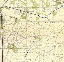 Kfar Saba 1942 1:20,000
 Kfar Saba 1945 1:250,000
State of Israel
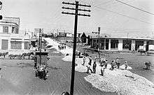
In May 1948, when Israeli independence was declared, Kfar Saba had a population of approximately 5,500. Following the war, it rapidly expanded as many Jewish immigrants from Arab and Muslim countries settled there, and new housing projects were built to accommodate them. The town expanded over the deserted Arab village of Kafr Saba, the site of which is today located in the Shikun Kaplan area of the city. As it became obvious that agriculture alone could not support the economy, an industrial zone was established. In 1953, the population was about 15,000. Meir Hospital was opened in 1956. The rapid growth of the town meant that its status as a moshava was outdated, and it was granted city status in 1962, with head of the local council, Mordechai Surkis, becoming its first mayor.[13] The city had a population of 19,000 at the time. After receiving its city status, a court, a police branch, and offices of the National Insurance Institute and the Israel Tax Authority were established in Kfar Saba. Agriculture also continued to decline in importance in the city's economy as new factories were built. Despite this, the city still had thousands of acres of orchards in the late 1960s.
During the Six-Day War in 1967, two neighborhoods in Kfar Saba were shelled by Jordanian artillery, and an attack on a factory by Jordanian warplanes killed four workers. Following the war, the population increased as many people moved to Kfar Saba from the Gush Dan area, and during Soviet-Jewish immigration to Israel in the early 1970s, the city took in many Soviet immigrants and established an immigrant absorption center. In 1977, Kfar Saba had a population of 35,000.
Kfar Saba is located just across the Green Line from the Palestinian city of Qalqilya. During times of relative peace, residents of Kfar Saba would shop in Qalqilya: this practice ended at the start of the First Intifada in 1987. In the following years, Kfar Saba became been a frequent target of terrorist attacks. In May 2001, a Palestinian Arab suicide bomber wearing an explosive belt killed a doctor and wounded 50 at a bus stop in Kfar Saba.[14] In March 2002, a Palestinian terrorist opened fire on passersby at a major intersection, killing an Israeli girl and wounding 16 before being shot dead.[15] In April 2003, a Palestinian suicide bomber blew himself up at the Kfar Saba train station during the morning rush hour, killing a security guard and wounding 10 bystanders.[16]
Demographics
The 1922 census of Palestine listed the population of Kfar Saba as 14 Jews.[17] By the 1931 census it had grown to 1,405 inhabitants, all Jews, in 395 houses.[18]
In the 1945 statistics, the town had a population of 4,320 Jews.[19][20]
According to the Israel Central Bureau of Statistics (CBS), in 2001, the ethnic makeup of the city was 99.9% Jewish and 0.1% Others. Additionally, there were 523 immigrant residents. Also according to the CBS, there were 37,000 males and 39,600 females in 2001. The population of the city was spread out with 31.1% 19 years of age or younger, 16.3% between 20 and 29, 17.7% between 30 and 44, 20.2% from 45 to 59, 3.5% from 60 to 64, and 11.3% 65 years of age or older. The population growth rate was 2.0% for that year.
The city is ranked high on the socio-economic scale (8 out of 10).[21] Kfar Saba has a listed population surpassing 110,000 as of 2019.
Economy
According to CBS, there were 31,528 salaried workers and 2,648 self-employed in Kfar Saba in 2000. The mean monthly wage in 2000 for a salaried worker was ILS 7,120, a real change of 10.1% over the course of 2000. Salaried males had a mean monthly wage of ILS 9,343 (a real change of 9.9%) versus ILS 5,033 for females (a real change of 9.7%). The mean income for the self-employed was 8,980. 1,015 people received unemployment benefits and 1,682 people received an income guarantee.
In May 2004 the exploration company Givot Olam said that the Meged-4 oil well, located northeast of Kfar Saba, has exceeded original predictions and contains an extremely valuable deposit of oil.[22]
Schools and religious institutions
In 2010, Kfar Saba had 12 secular elementary schools, 3 religious elementary schools, 8 secular high schools and 3 religious high schools. The city is served by 105 synagogues.[23]
Health care
Meir Hospital is located in Kfar Saba.[24] Meir Hospital is a major medical center named for Josef Meir, the first head of the General Sick Fund and the first director of the Israeli Ministry of Health.[25] The hospital accepts all patients, Jews and Arabs, including patients from cities within the jurisdiction of the Palestinian Authority, such as Qalqilyah.[26]
Environmental issues
Kfar Saba has won multiple awards for environment protection efforts. Kfar Saba is also the site of Israel's first biofilter project.[27]
Landmarks
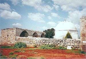
Nabi Yamin
A Mamluk caravanserai complex, including the mausoleum of Nabi Yamin, is located by the Kfar Saba – Qalqilyah road. The site contains an inscription dated to the 14th century.[28] The site has been associated with the tomb of Benjamin, son of Jacob.[29] North of this complex is a smaller tomb whose cupola has been painted green and is being maintained by local Palestinian Muslims, who consider it the "real" tomb. Jews and Muslims venerate Benjamin. Kfar Saba is in the heart of Dan's tribal area, but there are traditions that explain why Benjamin's tomb is located in the land of the tribe of Dan. The traditional burial place of Simeon, son of Jacob, lies close to Kfar Saba. It is a small domed structure that sits in a field not far from kibbutz Eyal. According to Meron Benvenisti, the site was until 1948 only holy to Muslims, and Jews ascribed no holiness to it.[30] Today the dedicated inscriptions from the Mamluk period remain engraved on the stone walls of the tomb but the cloths embroidered with verses from the Qur´an, with which the gravestones were draped, have been replaced by draperies bearing verses from the Hebrew Bible.[31]
First well
The modern development of Kfar Saba started when water was discovered in the early 1920s. The first well was excavated at this time, followed by many others over the next two decades. The Kfar Saba Water Plant was founded to centralize the water supply system. The city's first well is located in the courtyard of Kfar Saba City Hall.[32]
Amrami's dairy farm
The site of the dairy farm of Baruch Amrami, who transferred the administration of the Kfar Saba settlement from Petah Tikva to a local committee and founded the water company and the first bank of the village in the 1920s, is on the corner of Amrami and Rothschild Streets. The cowshed and Amrami's "office" are still standing.[33]
Nordenstein house
Due to the lack of security during World War I, the settlement was abandoned. In 1922, the Nordenstein family returned and built the first defensible stone house. It took another two years for other families to return (mostly from Petah Tikva). The Nordenstein House is still standing on HaEmek Street, near the central bus station.
Kibbutz HaKovesh dining hall
A stone house on Tel Hai Street designed for defense (outlooks and sharp-shooting parapets) served as the communal dining room of Kibbutz HaKovesh. The pioneers themselves lived in tents. In 1948, the kibbutz moved north to secure the Kalkiliya front. The building now houses the Kfar Saba Civil Guard.
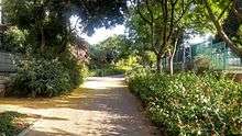
City's Park
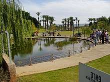
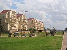
Kfar Saba's Park is one of the biggest parks in the Sharon area. It has an area of 250,000 m2. The park includes kids playgrounds, water fountains, roller skate arena, fitness facilities, and shaded dining areas. The park is open daily between 6:30 am and 11:00 pm. There is free parking for city residents in different locations around the park.
Eva Fischer Fund
The Kfar Saba's Municipality Center contains the Eva Fischer's Fund, where you can see the artworks about the Shoah that the Italian painter gave to the city. (Eva Fischer - 1920-2015)
Archaeology
Remnants of an ancient Israelite village were discovered east of the city, and are believed to be the ruins of biblical Capharsaba. The Kfar Saba Archaeology Museum exhibits artifacts found in the region.
Industry

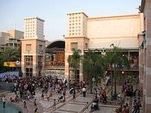
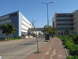
Kfar Saba has one large industrial zone in the east of the city. It contains hi-tech offices and industrial plants, including Teva Pharmaceuticals' plant.
In popular culture
Kfar Saba was the primary filming location of FX's 2014-16 drama series Tyrant, which takes place in the fictional Arab country of Baladi.[34]
Twin towns – sister cities
Kfar Saba is twinned with:[35][36]


Notable residents
- Oz Almog (born 1956), Israeli-Austrian artist
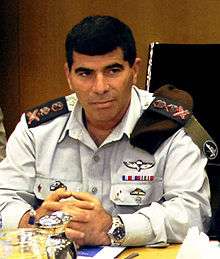
- Gabi Ashkenazi (born 1954), former IDF Chief
- Miki Berkovich (born 1954), basketball player
- Matti Caspi (born 1949), musician
- Galit Chait (born 1975), Olympic ice skater
- Nili Cohen (born 1947), professor and legal expert
- Yarden Gerbi (born 1989), judoka and Olympic bronze medalist
- Nina Pekerman (born 1977), athlete
- Sharren Haskel (born 1984), Member of Knesset
- Hanoch Kalai, Irgun Commander in Chief
- Moti Kirschenbaum, media personality
- David Klein, governor of the Bank of Israel
- Amos Lapidot (1934–2019), fighter pilot, 10th Commander of the Israeli Air Force, and President of Technion – Israel Institute of Technology
- Reshef Levi, writer and director
- Noam Mills (born 1986), female Olympic fencer
- Idan Raichel (born 1977), musician
- Nakdimon Rogel, journalist and author of the Nakdi Report[37]
- Pinchas Sapir, politician
- Yuval Segal (born 1971), actor and comedian
- Keren Siebner (born 1990), Olympic swimmer
- Gil Simkovitch (born 1982), Olympic sport shooter
- Harel Skaat (born 1981), singer
- Yaara Tal (born 1955), pianist
- Maor Tiyouri (born 1990), Olympic long distance runner
- Shelly Yachimovich, journalist and politician
- Israel Yinon, conductor
- Tomer Yosef, musician
- Yehoshua Zettler, Lehi commander

References
- The Origin of the Name Capharsaba Kfar Sava Municipal Council
- Vilnai, Ze'ev (1976). "Kefar-Sava". Ariel Encyclopedia (in Hebrew). Volume 4. Israel: Am Oved. pp. 3790–96.
- According to Ayalon, 1982. Cited in Petersen, 2002, p.233
- Strange, le, Guy (1890). Palestine Under the Moslems: A Description of Syria and the Holy Land from A.D. 650 to 1500. Committee of the Palestine Exploration Fund.
- Hoffman, Carl (June 17, 2009). "Pride and preservation". The Jerusalem Post. Retrieved April 26, 2019.
- Kashran, Tzvi (August 12, 1910). מכתב מפתח תקוה [Letter from Petah Tikvah]. Hapoel Hatzair (in Hebrew). Retrieved April 26, 2019.
- Ben-Yishai, Ron (March 21, 1983). לזכרו של ברוך פריבר [Remembering Baruch Freever] (in Hebrew). Retrieved April 26, 2019.
- "היסטוריה".
- History Kfar Saba Municipal Council (in Hebrew)
- Haganah Kills 11 in Palestine Hunt for Arab Gunmen NY Times, August 16, 1947
- 6 Dead, 26 Injured in Haifa Fighting NY Times, December 25, 1947
- Morris, Benny (2008). 1948: A History of the First Arab-Israeli War. New Haven, Connecticut: Yale University Press. p. 164. ISBN 9780300126969.
- Mordechai Surkis: Public Activities Knesset website
- Jessica Steinberg (2001-05-04). "Israeli yuppie town of Kfar Saba now finding itself on the front line of the battle with the Palesti". JWeekly.com. Jewish Telegraphic Agency. Retrieved April 26, 2019.
- "security: Suicide attacks in Kfar Saba and Jerusalem kill one Israeli". israelinsider. 2002-03-17. Archived from the original on 2010-11-25. Retrieved 2009-05-05.
- "Guard killed and 10 hurt in Israel suicide attack". The Independent. Associated Press. April 24, 2003. Retrieved April 26, 2019.
- Barron, 1923, Table VII, Sub-district of Jaffa, p. 20
- Mills, 1932, p. 14
- Government of Palestine, Department of Statistics, 1945, p. 27
- Government of Palestine, Department of Statistics. Village Statistics, April, 1945. Quoted in Hadawi, 1970, p. 52
- "Local councils and municipalities, by socio-economic index, ranking and cluster membership" (PDF). 2003. Retrieved 2014-02-05.
- Welcome to Givot Olam Oil Archived 2005-12-20 at the Wayback Machine Givot Olam
- "Kfar Saba community guide". Nbn.org.il. Retrieved 2014-02-05.
- Horowitz, Ayala (May 7, 2007). שיבא - בית החולים הגדול בישראל [Sheba - Largest Hospital in Israel]. Makor Rishon (in Hebrew). Retrieved April 26, 2019.
- Meir Medical Center history Archived June 18, 2011, at the Wayback Machine
- Meir Maternity Ward Staff Save 20 Year-Old Arab Mother
- Leader, Avraham; Bar-Lev, Ahuva (May 15, 2011). "Kfar Sava biofilter successfully concludes first winter". The Jerusalem Post. Retrieved April 26, 2019.
- (in Hebrew)Yoav Regev (יואב רגב), ed., The New Israel Guide (מדריך ישראל החדש), vol. 8, p. 94, 2001.
- Vermeulen, Urbain; Steenbergen, J. van (2001). Egypt and Syria in the Fatimid, Ayyubid, and Mamluk Eras III: Proceedings of the 6th, 7th and 8th International Colloquium Organized at the Katholieke Universiteit Leuven in May 1997, 1998, and 1999. Peeters Publishers. pp. 366–. ISBN 9789042909700. Retrieved 18 February 2014.
- Benvenisti, 2002, p. 276
- Benvenisti, 2002, p. 277
- "The Kfar Saba water tower". Water-tower.co.il. 2011-11-29. Archived from the original on 2012-04-26. Retrieved 2014-02-05.
- Deutch, Gloria (2008-01-03). "Streetwise: Rehov Amrami, Kfar Saba". The Jerusalem Post. Archived from the original on 2013-07-06. Retrieved 2009-03-04.
- Press, Viva Sarah (2014-01-23). "FX's New TV Series 'Tyrant' About Syrian Leader is made in Israel". Retrieved 25 April 2014.
- "ערים תאומות". kfar-saba.muni.il (in Hebrew). Kfar Saba. Retrieved 2020-02-24.
- "Kfar Saba/Qalqilya". gnvsistercities.org. Gainesville Sister Cities International. Retrieved 2020-02-24.
- "Veteran journalist and broadcaster Nakdimon Rogel dies". Jerusalem Post. 2011-12-08. Retrieved 2011-12-12.
Bibliography
- Barron, J.B., ed. (1923). Palestine: Report and General Abstracts of the Census of 1922. Government of Palestine.
- Government of Palestine, Department of Statistics (1945). Village Statistics, April, 1945.
- Hadawi, S. (1970). Village Statistics of 1945: A Classification of Land and Area ownership in Palestine. Palestine Liberation Organization Research Center. Archived from the original on 2018-12-08. Retrieved 2009-07-03.
- Mills, E., ed. (1932). Census of Palestine 1931. Population of Villages, Towns and Administrative Areas. Jerusalem: Government of Palestine.
External links
| Wikimedia Commons has media related to Kfar Saba. |
Official website (in Hebrew)
- Kfar Saba Museum (in Hebrew)
- Kfar Saba Portal (in Hebrew)
- Haaretz article - Lean and green
| Authority control |
|
|---|