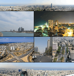
Gush Dan
Gush Dan (Hebrew: גּוּשׁ דָּן, lit. "Dan bloc") is a conurbation in Israel, located along the country's Mediterranean coastline. It includes areas from both the Tel Aviv and the Central District, or sometimes the whole Metropolitan Area of Tel Aviv[2] (Hebrew: מֶטְרוֹפּוֹלִין תֵּל אָבִיב), which includes a small part of the Southern District as well. Gush Dan is the largest conurbation and metropolitan area in Israel, with the metropolitan area having an estimated population of 4,054,570 residents, 95% of whom are Israeli Jews. Despite making up less than 8% of Israel's total land area, it houses about 45% of the country's total population.
Gush Dan | |
|---|---|
 | |
| Nickname(s): Dan Bloc (Gush Dan in Hebrew) | |
| Country | |
| Metropolitan Area | Gush Dan |
| Area | |
| • Total | 1,516 km2 (585 sq mi) |
| Population | |
| • Total | 4,054,570. 44.7% of Israel's Population |
| • Metro density | 2,291/km2 (5,930/sq mi) |
| Israeli Jews: 95.1% Israeli Arabs: 4.9% | |
| Time zone | UTC+2 (IST) |
| • Summer (DST) | UTC+3 (IDT) |
| Postal code | 61999 |
| Area code | +972 (Israel) 3 (City) |
Cities in Gush Dan
Population in cities as of the end of 2018:[3]
- Over 400,000
- Tel Aviv-Yafo 451,523
- Over 200,000
- Rishon LeZion 251,719
- Petah Tikva 244,275
- Ashdod 224,628
- Netanya 217,244
- Over 100,000
- Over 50,000
- Herzliya 95,142
- Modi'in-Maccabim-Re'ut 92,406
- Ramla 75,538
- Lod 75,726
- Ra'anana 73,999
- Givatayim 60,212
- Hod HaSharon 61,102
- Rosh HaAyin 50,453
- Over 10,000
- Ness Ziona 49,108
- Ramat HaSharon 46,019
- El'ad 46.896
- Yavne 45,453
- Kiryat Ono,
- Yehud-Monosson,
- Tira,
- Giv'at Shmuel,
- Kafr Qasim,
- Qalansawe,
- Be'er Ya'akov,
- Even Yehuda,
- Gan Yavne,
- Ganei Tikva,
- Gedera,
- Giv'at Shmuel,
- Jaljulia,
- Kfar Yona,
- Kiryat Ekron,
- Kokhav Ya'ir,
- Mazkeret Batya,
- Shoham,
- Tel Mond,
- Tzoran-Kadima
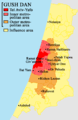 Map of the Gush Dan
 Map of inner metropolitan area
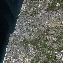 Satellite Image of the Inner Ring of the Gush Dan
.jpg) NASA photo of Tel Aviv area at night
NASA photo of Tel Aviv area at night

 Tel Aviv beach
Metropolitan rings
Israel Central Bureau of Statistics divides the Tel Aviv metropolitan area into four:
| Metropolitan ring | Localities | Population (EOY 2018 estimate) | Population density (per km²) |
Annual Population growth rate | |||
|---|---|---|---|---|---|---|---|
| Total | Jews and others1 | Thereof: Jews | Arabs | ||||
| Core2 | 1 | 451,500 | 431,100 | 407,200 | 20,400 | 8,718.6 | 1.7% |
| Inner Ring3 | 13 | 975,600 | 973,700 | 911,900 | 2,000 | 8,097 | 1.4% |
| Northern Section | 4 | 144,300 | 144,100 | 138,800 | 200 | 3,327.4 | 1.3% |
| Eastern Section | 5 | 495,100 | 494,400 | 479,600 | 700 | 12,394.3 | 1.9% |
| Southern Section | 4 | 336,300 | 335,200 | 293,500 | 1,100 | 9,042.2 | 0.6% |
| Middle Ring4 | 31 | 1,219,800 | 1,177,300 | 1,108,100 | 42,500 | 4,157.4 | 1.6% |
| Northern Section | 6 | 239,500 | 239,200 | 232,300 | 300 | 4,567.4 | 1.3% |
| Eastern Section | 8 | 325,700 | 325,300 | 304,400 | 400 | 4,558.6 | 1.7% |
| Southern Section | 17 | 654,500 | 612,800 | 571,500 | 41,800 | 3,861.5 | 1.7% |
| Outer Ring5 | 258 | 1,338,000 | 1,200,200 | 1,140,700 | 137,800 | 1,052.9 | 2% |
| Northern Section | 97 | 497,100 | 397,300 | 375,100 | 99,800 | 1,284.9 | 1.3% |
| Eastern Section | 47 | 294,700 | 258,000 | 254,200 | 36,700 | 1,056.4 | 3.3% |
| Southern Section | 91 | 453,300 | 452,600 | 424,200 | 700 | 877.3 | 1.4% |
| Judea And Samaria Section | 23 | 93,000 | 92,300 | 87,200 | 600 | - | 4.3% |
| Total | 303 | 3,984,900 | 3,782,300 | 3,567,900 | 202,700 | 2,361.4 | 1.7% |
Notes
- 1 The population of "Jews and others" includes Israeli Jews, non-Arab Christians and those not classified by religion.
- 2 The core area includes the city of Tel Aviv.
- 3 The inner ring includes the cities Bat Yam, Holon, Ramat HaSharon, Ramat Gan, Giv'atayim, Bnei Brak, Herzliya, Or Yehuda, Giv'at Shmuel and Kiryat Ono, as well as a multitude of smaller towns (local councils).
- 4 The middle ring includes the cities Petah Tikva, Ra'anana, Rishon LeZion, Hod HaSharon, Kfar Saba, Yehud, Ramla, Lod, Rosh HaAyin, Ness Ziona and Rehovot, as well as many smaller towns (local councils).
- 5 The outer ring includes the cities Tayibe, Netanya, Modi'in-Maccabim-Re'ut, Ashdod, as well as many smaller towns (local councils).
History
| Historical population | ||
|---|---|---|
| Year | Pop. | ±% |
| 1946 | 343,000 | — |
| 1956 | 845,000 | +146.4% |
| 1966 | 1,291,000 | +52.8% |
| 1976 | 1,661,000 | +28.7% |
| 1986 | 2,036,000 | +22.6% |
| 1996 | 2,547,000 | +25.1% |
| 2006 | 3,098,000 | +21.6% |
| 2016 | 3,854,000 | +24.4% |
| Source: [5][6][7] | ||
The name Gush Dan means "Dan Bloc", and is so named because the area was the territory of the tribe of Dan in the ancient Kingdom of Israel. According to the biblical narrative, the tribe had originally tried to settle in the central coastal area of Canaan, but due to enmity with the Philistines who had already settled there, were only able to camp in the hill country overlooking the Sorek Valley. The camp location became known as Mahaneh Dan ("Camps of Dan"). The region they attempted to settle included the area as far north as Joppa and as far south as Shephelah in the area of Timnah. As a result of the pressure from the Philistines, the tribe abandoned hopes of settling near the central coast, instead migrating to the north of the country. After conquering Laish, the tribe refounded it as their capital and renamed it Dan. In remembrance of the original territory assignments, this coastal region is referred to as Gush Dan.
The modern city of Tel Aviv was founded in 1909 as a suburb of the Arab majority coastal city of Jaffa.[8] The city grew rapidly in the ensuing decades thanks to Jewish immigration from Europe, with the population reaching 150,000 in 1934, and 230,000 14 years later when Israel gained its independence. Before the establishment of the state, other towns in the Gush Dan were founded as well, such as Petah Tikva in 1878, Rishon LeZion in 1882, Ness Ziona in 1883, Rehovot in 1890, and the majority of other Gush Dan cities were established before 1948.
In 1947, the Jewish population of the Gush Dan was nearly 400,000, comprising the majority of the Jewish population of Mandate Palestine. As such almost all of it was included in the Jewish state proposed by the 1947 United Nations Partition Plan for Palestine. After the 1948 Arab–Israeli War the Arab population of the region, which had been nearly 150,000 before the war,[8] was reduced to around 10,000. They were quickly replaced by a larger number of Jews fleeing from postwar Europe and persecution in Arab countries. However, at this time many new immigrants did not come to Tel Aviv. In the 1950s towns were built on the edges of the Gush Dan, including Ashdod, Rosh HaAyin and Yavne. The nation's sole port at the time was located in the northern city of Haifa and its evolving metropolitan area making that city at least as important as Tel Aviv. At the same time the new government was trying to disperse the nation's population to the periphery, discouraging settlement in the already populated Gush Dan. This slowed the growth of the Gush Dan, but the area still more than doubled in population within 20 years of the establishment of the state. The opening of the Port of Ashdod in the southern Gush Dan also increased the area's importance, with Haifa's importance diminishing, and Tel Aviv's increasing due to its proximity to the Port of Ashdod. Tel Aviv itself witnessed population decreases in the 1970s, and 80s with outer regions of the Gush Dan with lower costs of living absorbing many people who left Tel Aviv. Only in the 1990s with the immigration of more than 1 million Jews from former Soviet Republics, 40,000 Ethiopian Jews, and many others to Israel, as well as a boom in the religious population, did Tel Aviv begin to grow again. The demand for housing increased dramatically, with new cities such as Modiin, El'ad being built, and cities like Ashdod more than doubling in population, from 83,000 in 1990, to 175,000 in 2000. In the 2000s the area continued to grow, attracting many immigrants from the Haifa metropolitan area. In 2010 the Gush Dan is home to 3,200,000 people and is the commercial, economical, cultural, and industrial center of Israel. Despite some successes in ongoing attempts by the Israeli government to encourage migration to the Galilee and the Negev, the Gush Dan retains its position as the heart of the State of Israel.
Economy
The Gush Dan is the economic center of the state of Israel. It is responsible for a large proportion of the nation's economy and contains numerous commercial centers.
Major business and commercial districts

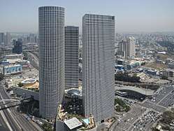


- Diamond Exchange District – Ramat Gan – The Diamond Exchange District is in the city of Ramat Gan. Bordering the Ayalon Highway, the road dividing Ramat Gan and Tel Aviv, the district is home to Israel's diamond industry as well as being a major commercial center. The Diamond Exchange itself contains four buildings connected by bridges; the Maccabi Tower, Shimshon Tower, Noam Tower, and Diamond Tower which contains the world's largest diamond trading floor and is the head-building of the Diamond Exchange. Also in the district are a number of other buildings of importance. The Moshe Aviv Tower is Israel's tallest building at 244 meters. Opposite it, the Elite Tower is currently under construction, set to be equal or greater in height. The Sheraton City Tower is a hotel in the district, whilst other notable buildings are the Ayalon Tower and Gibor Sport House.
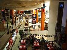
- Dizengoff Square – Tel Aviv – Dizengoff Center (Hebrew: דיזנגוף סנטר) is a shopping mall in central Tel Aviv, host to about 140,000 visitors weekly. Lying south of Dizengoff Square, it is named for Meir Dizengoff, the first mayor of Tel Aviv. The first mall in Tel Aviv, the center opened in 1983. It is divided into two parts and straddles both sides of Dizengoff Street with the two parts linked by a pair of skywalks. The mall is bordered by Dizengoff Street, King George Street and the smaller Tchernichovsky street.
- Port of Ashdod – Ashdod – The Port of Ashdod is one of Israel's two main cargo ports. The port is located in Ashdod, about 40 kilometers south of Tel Aviv, adjoining the mouth of the Lachish River. Its establishment doubled the country's port capacity.
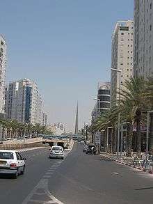
- Rothschild Boulevard – Tel Aviv – Rothschild Boulevard (Hebrew: שְׂדֵרוֹת רוטשילד, Sderot Rothschild) is a street in Tel Aviv beginning in Neve Tzedek at its southwestern edge and running north to Habima Theatre. It is one of the busiest and most expensive streets in the Gush Dan, being one of the city's main tourist attractions.[9]
- Azrieli Center – Tel Aviv – Azrieli Center is a complex of skyscrapers in Tel Aviv. At the base of the center lies a large shopping mall. The center was originally designed by Israeli-American architect Eli Attia, and after he fell out with the developer of the center David Azrieli (after whom it is named), completion of the design was passed on to the Tel Aviv firm of Moore Yaski Sivan Architects.
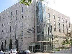
- Tel Aviv Stock Exchange – Tel Aviv – The Tel Aviv Stock Exchange (TASE; Hebrew: הבורסה לניירות ערך בתל אביב; colloquially known as the Boursa) is Israel's only stock exchange. The TASE is the only public market for trading securities in Israel. It plays a major role in the Israeli economy. TASE lists some 622 companies, about 60 of which are also listed on stock exchanges in other countries. TASE also lists some 180 exchange-traded funds (ETFs), 60 government bonds, 500 corporate bonds, and more than 1000 mutual funds. There are 29 members that make up TASE. The list of members indicates that one of the members is a candidate.
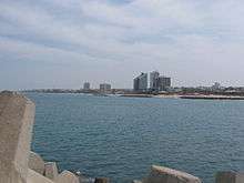
- Tel Aviv Promenade – Tel Aviv – The Tel Aviv promenade is running along its beaches, and is an integral part of the city's lifestyle, as well as a major tourist attraction. Most of the city's bathing beaches and hiking paths are concentrated in the central part of its 14 kilometers of Mediterranean shore. It contains numerous hotels, and commercial buildings.
- Kiryat Atidim – Tel Aviv – high tech center in eastern Ramat HaHayal. The district is known for its ultra modern architecture.
- Bat Yam coastal strip – Bat Yam - southward extension of the Tel Aviv Promenade
- Herzliya Pituah coastal strip and industrial area – Herzliya – northward extension of the Tel Aviv Promenade
- Kiryat Aryeh, Kiryat Matalon, and Segula Industrial Zones – (These three form the second largest industrial zone in the country after Haifa) – Petah Tikva
- Ben Gurion Airport Industrial Zone – Lod
- Eastern Industrial Sector – Holon
- Eastern Industrial Zones – Netanya
- Poleg industrial area – Netanya
Institutes of higher education

- Universities
- Tel Aviv University (TAU) (Tel Aviv) – 30,000 Students
- Bar-Ilan University (BIU) (Ramat Gan) – 27,000 Students
- Open University of Israel (OPENU) (Ra'anana) – 40,000 Students
- Weizmann Institute of Science (WIS) (Rehovot) – 700 Students
- Hebrew University of Jerusalem – Based in Jerusalem Maintains a campus in Rehovot which includes The Faculty of Agriculture[10] and the School of Veterinary Medicine.
- Colleges
- Academic Center of Law and Business, Ramat Gan
- Academic College of Tel Aviv–Yaffo, Tel Aviv
- Bezalel Academy of Art and Design
- College of Management (COLMAN), Rishon LeZion
- Holon Institute of Technology
- Interdisciplinary Center (IDC), Herzliya
- Jerusalem College of Technology
- Netanya Academic College
- Netanya Academic College of Law
- Ono Academic College
- The Center for Academic Studies in Or Yehuda
- Shenkar College of Engineering and Design
- College of Technology Education, Tel Aviv
- Kibbutzim College of Education, Tel Aviv
- Levinsky College of Education, Tel Aviv
- Mofet, Consortium of Colleges of Education
- Moreshet Yaakov Religious College of Education, Rehovot
- Ort College for Teachers of Technology, Tel Aviv
- Talpiot College of Education, Tel Aviv
Shopping centers
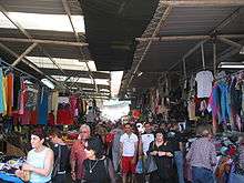

- Carmel Market
- Ramat Aviv Mall
- Azrieli Center
- Dizengoff Center
- Tel Aviv Central Bus Station
- Gan Ha'ir
- Opera Tower
- Wolfson Mall
- Tagore Mall
- London Ministores Mall
- Weizmann Center
- Mikado Center
- Drugstore Center
- Givatayim Mall
- Arena Mall
- The Outlet
- Seven Stars Mall (Shivat Hakokhavim)
- Ayalon Mall
- Marom Mall
- Dan Design Center
- Bialik Mall
- Cinema City Mall
- Holon Mall
- Kan-Or
- Rothschild Center
- Kanyon Hazahav (Gold Mall)
- Shaar Rishon
- Arei Hof Mall
- G Cinema City
- Sharon Mall
- Power Center
- Hadarim Mall
- Irusim Mall
- Savyonim Mall
- Bat Yamon
- Bat Yam Mall
- Ovnat Mall
- Sirkin Mall
- Em Hamoshavot Mall
- American City
- Merkaz HaIr Mall
- Rehovot Mall
- Renanim Mall
- Park Mall
- Arim Mall
- G Kfar Saba
- Green Kfar Saba Mall
- B Center
- Oshiland Center
- Ramla Center
- Lod Center Mall
Transportation
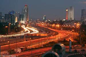
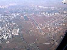
The Dan Bus Company is primarily focused on serving the Gush Dan, although it is being replaced by the Kavim company in many of the Gush Dan's cities. Much of Israel's national highway network feeds into the area, such as Highway 1, Highway 2, Highway 4, and Highway 5. Gush Dan is also served by the local Ayalon Highway. Israel Railways, the state owned, national rail network provider, also feeds most traffic into or within the Gush Dan region. The Tel Aviv Light Rail, currently under construction, will also be a major feature in the regions future transport, as will the high speed service to Jerusalem. Two airports are located in the Gush Dan; Sde Dov Airport located in Tel Aviv which sees an average of 700,000 passenger movements a year, is located north of the Yarkon River hosts flights to Rosh Pina, and Haifa in the north as well as to Ein Yahav, Ovda International Airport, and Eilat in the south as well as to nearby Cyprus, Rhodes in Greece, and Aqaba in Jordan. Meanwhile, Ben Gurion International Airport in Lod which is Israel's largest airport handles over 22 million passengers a year and offers flights to destinations in Europe, Africa, Asia, and The Americas.
Major highways
Some of the major freeways/expressways carrying commuter traffic in and out of the Tel Aviv Metropolitan Area are:
- Highway 20 (also called Ayalon Freeway) – a major intracity freeway in Gush Dan, which runs along Tel Aviv's center eastern border from north to south.
- Highway 1 – connects Tel Aviv with Jerusalem.
- Highway 2 (also called The Coastal Highway) – stretches from Tel Aviv to Haifa. It is one of the busiest highways in Israel.
- Highway 4 (also called Geha Highway, or First President Road) – a major north–south highway connecting Ra'anana and Kfar Saba in the North to Petah Tiqva and Ramat Gan in the center and Ashdod in the South.
- Highway 5 – connects the Mediterranean coast immediately north of Tel Aviv with the central Sharon plain and Ariel and other Israeli settlements in the northern West Bank.
- Highway 44 – connects Tel Aviv with Ramla, Lod and the Shefela.
- Highway 6 – a new north–south tollway running east of Gush Dan from Galilee in the north to Beer Sheva in the south.
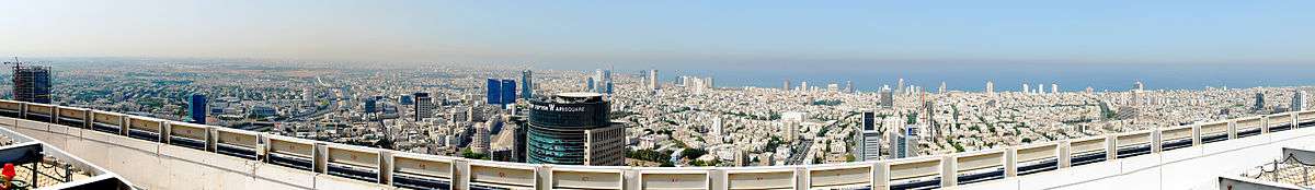
Panoramas

.jpg)


See also
References
| Wikimedia Commons has media related to Gush Dan. |
- "לוח 3.- אוכלוסייה( 1), ביישובים שמנו מעל 2,000 תושבים( 2) ושאר אוכלוסייה כפרית POPULATION(1) OF LOCALITIES NUMBERING ABOVE 2,000 RESIDENTS(2) AND OTHER RURAL POPULATION". Retrieved 2013-11-06. Cite journal requires
|journal=(help) - "Localities, Population, and Density" (PDF). Archived from the original (PDF) on 2016-04-15. Retrieved 2010-01-24.
- "Population in the Localities 2018" (XLS). Israel Central Bureau of Statistics. 25 August 2019. Retrieved 26 August 2019.
- "Localities, Population and Density Per sq. km., by Metropolitan Area and Selected Localities" (PDF). Israel Central Bureau of Statistics. September 26, 2019. Retrieved October 10, 2019.
- "Population of Israel on the Eve of 2018 - 8.8 Million". Press Release. Israel Central Bureau of Statistics. 31 December 2017. Retrieved 2 January 2018.
- "Population, by Population Group". Statistical Abstract of Israel. Israel Central Bureau of Statistics. 11 September 2012. Retrieved 5 April 2013.
- "Monthly Bulletin of Statistics for Population". Israel Central Bureau of Statistics. 7 August 2013. Retrieved 24 August 2013.
- "Archived copy". Archived from the original on 2014-09-13. Retrieved 2016-02-06.CS1 maint: archived copy as title (link)
- Mirovsky, Arik. "For a prestigious address, nothing beats Rothschild". Haaretz. Retrieved 2006-10-08.
- Faculty of Agricultural, Food and Environmental Quality Sciences