Kafr Bara
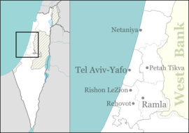
Kafr Bara or Kfar Bara (Arabic: كفر برا; Hebrew: כַּפְר בַּרָא) is an Israeli-Arab local council in Israel's Central District. The small town, located near the Green Line, is often considered a part of the Little Triangle along with Kafr Qasim and Jaljulia. In 2018 its population was 3,594.[1]
Kafr Bara
| |
|---|---|
| Hebrew transcription(s) | |
| • ISO 259 | Káper Báraˀ |
| • Also spelled | Kafar Bara (official) Kfar Bara (unofficial) |
 Mosque in Kafr Bara, 2010 | |
 Kafr Bara | |
| Coordinates: 32°7′50″N 34°58′19″E | |
| Grid position | 147/170 PAL |
| District | Central |
| Government | |
| • Type | Local council |
| Area | |
| • Total | 9,387 dunams (9.387 km2 or 3.624 sq mi) |
| Population (2018)[1] | |
| • Total | 3,594 |
| • Density | 380/km2 (990/sq mi) |
| Name meaning | Khirbet Kafr Bara, "The ruin of the village of Bara"[2] |
History
Pottery and glass dating from the Roman period (second century CE) and early Byzantine period (fourth century and beginning of fifth century CE), have been found in a burial cave at Kafr Bara.[3] Various agricultural installations, including a winepress, dating from Byzantine era has also been excavated.[4] Archaeological excavations have revealed remains, apparently from a rural settlement from the Byzantine and Early Islamic periods (sixth–ninth centuries CE).[5]
Ottoman era
In 1517, the village was included in the Ottoman Empire with the rest of Palestine, and in the 1596 tax-records it appeared located in the Nahiya of Jabal Qubal, part of Nablus Sanjak. It had a population of 20 Muslim households, who paid a fixed tax-rate of 33,3 % on agricultural products, including wheat, barley, summer crops, and goats and/or beehives; a total of 2,920 akçe. 5/6 of the revenue went to a Waqf.[6]
British Mandate era
At the 1931 census of Palestine, conducted by the British Mandate Kafr Bara had 95 inhabitants, all Muslims, in a total of 19 houses.[7]
In the 1945 statistics the population of Kafr Bara was 150, all Muslims,[8] who owned 3,959 dunams of land according to an official land and population survey.[9] Of this, 10 dunams were for citrus and bananas, 12 were plantations and irrigable land, 1,841 used for cereals,[10] while 14 dunams were built-up (urban) land.[11]
1948, and aftermath
After 1948, Kafr Bara has been part of Israel.
Demographics
Kafr Bara had a population of 3,274 in the 2014 census.[12]
See also
References
- "Population in the Localities 2018" (XLS). Israel Central Bureau of Statistics. 25 August 2019. Retrieved 26 August 2019.
- Palmer, 1881, p. 234
- Masarwa, 2008, Kafr Bara Final Report
- Eshed, 2017, Kafr Bara Final Report
- Abu Fana, 2010, Kafr Bara Final Report
- Hütteroth and Abdulfattah, 1977, p. 131
- Mills, 1932, p. 59
- Government of Palestine, Department of Statistics, 1945, p. 21
- Government of Palestine, Department of Statistics. Village Statistics, April, 1945. Quoted in Hadawi, 1970, p. 75
- Government of Palestine, Department of Statistics. Village Statistics, April, 1945. Quoted in Hadawi, 1970, p. 126
- Government of Palestine, Department of Statistics. Village Statistics, April, 1945. Quoted in Hadawi, 1970, p. 176
- "לוח 3.- אוכלוסייה( 1), ביישובים שמנו מעל 2,000 תושבים( 2) ושאר אוכלוסייה כפרית Population (1) of localities numbering above 2,000 Residents (2) and other rural population". Archived from the original on 3 October 2015. Retrieved 2 October 2015. Cite journal requires
|journal=(help)
Bibliography
- Abu Fana, Mohammed (2010-02-11). "Kafr Bara Final Report" (122). Hadashot Arkheologiyot – Excavations and Surveys in Israel. Cite journal requires
|journal=(help) - Eshed, Vered (2017-08-06). "Kafr Bara Final Report" (129). Hadashot Arkheologiyot – Excavations and Surveys in Israel. Cite journal requires
|journal=(help) - Government of Palestine, Department of Statistics (1945). Village Statistics, April, 1945.
- Hadawi, S. (1970). Village Statistics of 1945: A Classification of Land and Area ownership in Palestine. Palestine Liberation Organization Research Center.
- Hütteroth, Wolf-Dieter; Abdulfattah, Kamal (1977). Historical Geography of Palestine, Transjordan and Southern Syria in the Late 16th Century. Erlanger Geographische Arbeiten, Sonderband 5. Erlangen, Germany: Vorstand der Fränkischen Geographischen Gesellschaft. ISBN 3-920405-41-2.
- Masarwa, Marwan (2008-02-11). "Kafr Bara Final Report" (120). Hadashot Arkheologiyot – Excavations and Surveys in Israel. Cite journal requires
|journal=(help) - Mills, E., ed. (1932). Census of Palestine 1931. Population of Villages, Towns and Administrative Areas. Jerusalem: Government of Palestine.
- Palmer, E.H. (1881). The Survey of Western Palestine: Arabic and English Name Lists Collected During the Survey by Lieutenants Conder and Kitchener, R. E. Transliterated and Explained by E.H. Palmer. Committee of the Palestine Exploration Fund.
External links
- Welcome To Kafr Bara
- Survey of Western Palestine, Map 14: IAA, Wikimedia commons