Li County, Sichuan
Li County or Lixian (simplified Chinese: 理县; traditional Chinese: 理縣; pinyin: Lǐ Xiàn; Tibetan: ལིས་རྫོང་།, Wylie: lis rdzong, ZYPY: Li Zong ; Qiang: pauɕuq) is a county in Ngawa Tibetan and Qiang Autonomous Prefecture, Sichuan, China. China National Highway G317 and the Zagunao River run through the whole territory.[1]
Li County 理县 · ལིས་རྫོང་། | |
|---|---|
County | |
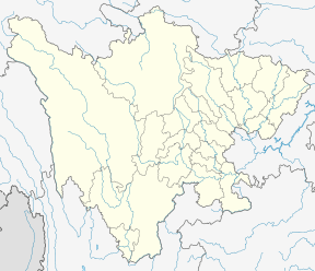
.png) Li County (red) in Ngawa Prefecture (yellow) and Sichuan province | |
 Lixian Location of the seat in Sichuan | |
| Coordinates: 31°25′N 103°10′E | |
| Country | People's Republic of China |
| Province | Sichuan |
| Autonomous prefecture | Ngawa |
| Area | |
| • Total | 4,318 km2 (1,667 sq mi) |
| Population (1999) | |
| • Total | 42,494 |
| • Density | 9.8/km2 (25/sq mi) |
| • Major nationalities | Tibetan - 47.99% Qiang - 31.95% Han - 19.49% |
| Time zone | UTC+8 (China Standard) |
On May 12, 2008, the area was affected by the 2008 Sichuan earthquake.
Transport
Geography
Li County is located from 30°54′43″N 102°32′46″E (30.911944°, 102.546111°) to 31°12′12″N 103°30′30″E (31.203333°, 103.508333°).[1]
Demographics
The county had a population of 42,494 in 1999.[2]
Climate
| Climate data for Lixian (1981−2010) | |||||||||||||
|---|---|---|---|---|---|---|---|---|---|---|---|---|---|
| Month | Jan | Feb | Mar | Apr | May | Jun | Jul | Aug | Sep | Oct | Nov | Dec | Year |
| Record high °C (°F) | 20.9 (69.6) |
30.4 (86.7) |
31.7 (89.1) |
32.0 (89.6) |
33.4 (92.1) |
34.6 (94.3) |
35.8 (96.4) |
34.4 (93.9) |
33.6 (92.5) |
27.6 (81.7) |
24.4 (75.9) |
19.5 (67.1) |
35.8 (96.4) |
| Average high °C (°F) | 7.0 (44.6) |
10.1 (50.2) |
14.7 (58.5) |
19.9 (67.8) |
22.9 (73.2) |
24.5 (76.1) |
26.9 (80.4) |
26.8 (80.2) |
22.7 (72.9) |
17.9 (64.2) |
13.4 (56.1) |
8.4 (47.1) |
17.9 (64.3) |
| Daily mean °C (°F) | 1.0 (33.8) |
3.6 (38.5) |
7.6 (45.7) |
12.2 (54.0) |
15.6 (60.1) |
18.0 (64.4) |
20.3 (68.5) |
20.1 (68.2) |
16.7 (62.1) |
12.0 (53.6) |
7.0 (44.6) |
2.2 (36.0) |
11.4 (52.5) |
| Average low °C (°F) | −3.1 (26.4) |
−0.8 (30.6) |
2.8 (37.0) |
7.0 (44.6) |
10.6 (51.1) |
13.6 (56.5) |
15.8 (60.4) |
15.6 (60.1) |
12.9 (55.2) |
8.5 (47.3) |
2.9 (37.2) |
−2.0 (28.4) |
7.0 (44.6) |
| Record low °C (°F) | −11.0 (12.2) |
−10.9 (12.4) |
−7.9 (17.8) |
−0.5 (31.1) |
3.2 (37.8) |
7.2 (45.0) |
9.3 (48.7) |
7.4 (45.3) |
5.2 (41.4) |
−0.2 (31.6) |
−5.3 (22.5) |
−12.1 (10.2) |
−12.1 (10.2) |
| Average precipitation mm (inches) | 8.2 (0.32) |
13.4 (0.53) |
33.5 (1.32) |
61.4 (2.42) |
88.1 (3.47) |
105.9 (4.17) |
79.0 (3.11) |
74.4 (2.93) |
80.1 (3.15) |
54.7 (2.15) |
16.4 (0.65) |
4.2 (0.17) |
619.3 (24.39) |
| Average relative humidity (%) | 63 | 63 | 63 | 64 | 68 | 74 | 73 | 72 | 74 | 74 | 68 | 63 | 68 |
| Source: China Meteorological Data Service Center[3] | |||||||||||||
Notes
- abazhou.gov.cn Archived 2008-05-01 at the Wayback Machine
- (in English) National Population Statistics Materials by County and City - 1999 Period, in China County & City Population 1999, Harvard China Historical GIS
- 中国地面气候标准值月值(1981-2010) (in Chinese). China Meteorological Data Service Center. Retrieved 20 October 2018.
External links
- (in Chinese) Government site - Google translation
- (in Chinese) 理县 Li County ⊙雷康/编 - Google translation
| Authority control |
|
|---|
This article is issued from Wikipedia. The text is licensed under Creative Commons - Attribution - Sharealike. Additional terms may apply for the media files.