Pidu District
Pidu District formerly known as Pi County or Pixian[lower-alpha 1] is one of 11 urban districts of the prefecture-level city of Chengdu, the capital of Sichuan Province, Southwest China. It was approved from the former Pi County by the State Council on November 24, 2016.[4]
Pidu 郫都区 | |||||||||||||||||||||||||||||||||||||||||||||||||||||||||||||||
|---|---|---|---|---|---|---|---|---|---|---|---|---|---|---|---|---|---|---|---|---|---|---|---|---|---|---|---|---|---|---|---|---|---|---|---|---|---|---|---|---|---|---|---|---|---|---|---|---|---|---|---|---|---|---|---|---|---|---|---|---|---|---|---|
District | |||||||||||||||||||||||||||||||||||||||||||||||||||||||||||||||
 | |||||||||||||||||||||||||||||||||||||||||||||||||||||||||||||||
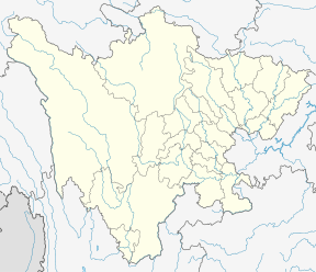 Pidu Location in Sichuan | |||||||||||||||||||||||||||||||||||||||||||||||||||||||||||||||
| Coordinates: 30.805°N 103.881°E[1] | |||||||||||||||||||||||||||||||||||||||||||||||||||||||||||||||
| Country | People's Republic of China | ||||||||||||||||||||||||||||||||||||||||||||||||||||||||||||||
| Province | Sichuan | ||||||||||||||||||||||||||||||||||||||||||||||||||||||||||||||
| Sub-provincial city | Chengdu | ||||||||||||||||||||||||||||||||||||||||||||||||||||||||||||||
| Area | |||||||||||||||||||||||||||||||||||||||||||||||||||||||||||||||
| • Total | 437.5 km2 (168.9 sq mi) | ||||||||||||||||||||||||||||||||||||||||||||||||||||||||||||||
| Population (2010)[2] | |||||||||||||||||||||||||||||||||||||||||||||||||||||||||||||||
| • Total | 756,047 | ||||||||||||||||||||||||||||||||||||||||||||||||||||||||||||||
| • Density | 1,726/km2 (4,470/sq mi) | ||||||||||||||||||||||||||||||||||||||||||||||||||||||||||||||
| Time zone | UTC+8 (China Standard) | ||||||||||||||||||||||||||||||||||||||||||||||||||||||||||||||
| Postal code | 6117XX | ||||||||||||||||||||||||||||||||||||||||||||||||||||||||||||||
| Chengdu district map |
| ||||||||||||||||||||||||||||||||||||||||||||||||||||||||||||||
| Website | pixian | ||||||||||||||||||||||||||||||||||||||||||||||||||||||||||||||
| Pidu District | |||||||
|---|---|---|---|---|---|---|---|
| Chinese | 郫都 | ||||||
| |||||||
| Alternative Chinese name | |||||||
| Traditional Chinese | 郫縣 | ||||||
| Simplified Chinese | 郫县 | ||||||
| |||||||
An urbanizing district organized as part of Chengdu, the capital of the province of Sichuan, China. It presently covers an area of 437.5 square kilometers (168.9 sq mi), with a total population of 756,047 during the 2010 census. It was formerly known as the source of the best tobacco in Sichuan and is now well known for its doubanjiang, a type of spicy fermented bean sauce.
Geography
Pitong, the seat of Pidu, is located 10 kilometers (6.2 mi) from downtown Chengdu. It covers an area of 437.5 square kilometers (168.9 sq mi).[5]
History
During the Warring States period, the area of the present Pidu belonged to the state of Shu. In 314 BC, it was conquered by Qin, which organized Pi County two years later in 312 BC.
In the 19th century, the area was famed for the quality of its tobacco, reckoned the best in Sichuan.[3]
It is now seeking to attract electronics and IT corporations and, in 2015, applied for elevation to urban district status.
Administration
The district seat is Pitong (郫筒镇; Pítǒng zhèn). There are 13 other towns in the district:[6]
- Xipu (犀浦镇)
- Hongguang (红光镇)
- Anjing (安靖镇)
- Tuanjie (团结镇)
- Tangchang (唐昌镇)
- Sandaoyan (三道堰)
- Xinminchang (新民场)
- Huayuan (花园镇)
- Ande (安德镇)
- Tangyuan (唐元镇)
- Deyuan (德源镇)
- Gucheng (古城镇)
- You`ai (友爱镇)
Climate
| Climate data for Pidu (1981−2010) | |||||||||||||
|---|---|---|---|---|---|---|---|---|---|---|---|---|---|
| Month | Jan | Feb | Mar | Apr | May | Jun | Jul | Aug | Sep | Oct | Nov | Dec | Year |
| Record high °C (°F) | 18.5 (65.3) |
23.6 (74.5) |
30.9 (87.6) |
32.4 (90.3) |
34.6 (94.3) |
35.9 (96.6) |
36.4 (97.5) |
36.2 (97.2) |
35.4 (95.7) |
29.3 (84.7) |
25.5 (77.9) |
18.2 (64.8) |
36.4 (97.5) |
| Average high °C (°F) | 9.1 (48.4) |
11.3 (52.3) |
15.8 (60.4) |
21.4 (70.5) |
25.9 (78.6) |
27.7 (81.9) |
29.5 (85.1) |
29.2 (84.6) |
25.3 (77.5) |
20.3 (68.5) |
15.8 (60.4) |
10.3 (50.5) |
20.1 (68.2) |
| Daily mean °C (°F) | 5.4 (41.7) |
7.6 (45.7) |
11.3 (52.3) |
16.3 (61.3) |
20.8 (69.4) |
23.5 (74.3) |
25.2 (77.4) |
24.6 (76.3) |
21.3 (70.3) |
16.8 (62.2) |
12.0 (53.6) |
6.7 (44.1) |
16.0 (60.7) |
| Average low °C (°F) | 2.6 (36.7) |
4.7 (40.5) |
7.8 (46.0) |
12.4 (54.3) |
16.8 (62.2) |
20.2 (68.4) |
21.8 (71.2) |
21.2 (70.2) |
18.6 (65.5) |
14.3 (57.7) |
9.3 (48.7) |
4.0 (39.2) |
12.8 (55.1) |
| Record low °C (°F) | −4.1 (24.6) |
−3.9 (25.0) |
−1.8 (28.8) |
3.3 (37.9) |
6.3 (43.3) |
13.7 (56.7) |
16.2 (61.2) |
15.7 (60.3) |
11.8 (53.2) |
2.7 (36.9) |
−0.4 (31.3) |
−4.5 (23.9) |
−4.5 (23.9) |
| Average precipitation mm (inches) | 9.0 (0.35) |
12.3 (0.48) |
23.7 (0.93) |
48.0 (1.89) |
72.3 (2.85) |
104.4 (4.11) |
207.4 (8.17) |
211.2 (8.31) |
130.0 (5.12) |
42.7 (1.68) |
16.5 (0.65) |
5.7 (0.22) |
883.2 (34.76) |
| Average relative humidity (%) | 83 | 82 | 81 | 80 | 76 | 81 | 85 | 86 | 86 | 86 | 84 | 84 | 83 |
| Source: China Meteorological Data Service Center[7] | |||||||||||||
References
- Google (2014-07-02). "Pixian" (Map). Google Maps. Google. Retrieved 2014-07-02.
- 我市2010年第六次全国人口普查数据公报 (in Chinese). Government of Chengdu. 2011-05-13. Retrieved 2011-08-04.
- Encyclopædia Britannica, 9th ed. (1878), Vol. V, "China".
- 郫都区历史沿革 (in Chinese). xzqh.org. 2016-12-02. Retrieved 2019-07-19.
- "Pixian China". Pixian County Government. 2007. Archived from the original on 2016-03-03. Retrieved 2008-01-14.
- http://baike.baidu.com/view/244256.htm
- 中国地面气候标准值月值(1981-2010) (in Chinese). China Meteorological Data Service Center. Retrieved 20 October 2018.