Gusau
Gusau is a city and Local Government Area located in northwestern Nigeria. It is the capital of Zamfara State.
Gusau | |
|---|---|
 Gusau Location in Nigeria | |
| Coordinates: 12°09′N 6°40′E | |
| Country | |
| State | Zamfara State |
| Area | |
| • Total | 3,364 km2 (1,299 sq mi) |
| Time zone | UTC+1 (WAT) |
| 3-digit postal code prefix | 880 |
| ISO 3166 code | NG.ZA.GS |
| Climate | Aw |
The LGA has an area of 3,364 km² and a population of 383,162 at the 2006 census.
The postal code of the area is 880.[1]
Geography
Gusau sits just north of a line drawn from Kebbe to Kano, and has an estimated population of 147,404.[2]
Its population is mostly Hausa with some Fulani, Yoruba, Igbo, Igala, Nupe etc.
Government
Sharia practice was first declared in the city in 1999 by the governor Ahmed Sani (Yariman Bakura) and is still in force.
Climate
Gusau has a tropical savanna climate (Köppen climate classification Aw).
| Climate data for Gusau | |||||||||||||
|---|---|---|---|---|---|---|---|---|---|---|---|---|---|
| Month | Jan | Feb | Mar | Apr | May | Jun | Jul | Aug | Sep | Oct | Nov | Dec | Year |
| Record high °C (°F) | 39.0 (102.2) |
40.0 (104.0) |
41.5 (106.7) |
41.5 (106.7) |
41.0 (105.8) |
38.5 (101.3) |
33.0 (91.4) |
32.0 (89.6) |
33.5 (92.3) |
36.5 (97.7) |
38.0 (100.4) |
38.0 (100.4) |
41.5 (106.7) |
| Average high °C (°F) | 32.2 (90.0) |
34.8 (94.6) |
38.1 (100.6) |
38.4 (101.1) |
36.0 (96.8) |
32.6 (90.7) |
29.6 (85.3) |
28.6 (83.5) |
30.3 (86.5) |
33.4 (92.1) |
34.8 (94.6) |
32.4 (90.3) |
33.4 (92.1) |
| Daily mean °C (°F) | 23.3 (73.9) |
25.8 (78.4) |
29.6 (85.3) |
31.0 (87.8) |
29.8 (85.6) |
27.2 (81.0) |
25.2 (77.4) |
24.6 (76.3) |
25.4 (77.7) |
26.3 (79.3) |
25.2 (77.4) |
24.4 (75.9) |
26.5 (79.7) |
| Average low °C (°F) | 14.4 (57.9) |
16.8 (62.2) |
21.1 (70.0) |
23.5 (74.3) |
23.5 (74.3) |
21.8 (71.2) |
20.9 (69.6) |
20.6 (69.1) |
20.5 (68.9) |
19.2 (66.6) |
15.6 (60.1) |
14.4 (57.9) |
19.4 (66.9) |
| Record low °C (°F) | 6.5 (43.7) |
10.5 (50.9) |
13.5 (56.3) |
17.0 (62.6) |
17.5 (63.5) |
16.5 (61.7) |
17.0 (62.6) |
17.5 (63.5) |
17.5 (63.5) |
13.0 (55.4) |
10.0 (50.0) |
8.0 (46.4) |
6.5 (43.7) |
| Average precipitation mm (inches) | 0.5 (0.02) |
1.0 (0.04) |
1.0 (0.04) |
8.0 (0.31) |
100.0 (3.94) |
145.0 (5.71) |
253.0 (9.96) |
332.0 (13.07) |
208.0 (8.19) |
20.0 (0.79) |
1.0 (0.04) |
2.0 (0.08) |
1,071 (42.17) |
| Average precipitation days (≥ 0.3 mm) | 0 | 0 | 0 | 2 | 8 | 11 | 16 | 19 | 16 | 2 | 0 | 0 | 74 |
| Average relative humidity (%) | 28 | 24 | 26 | 45 | 61 | 74 | 83 | 87 | 86 | 74 | 47 | 33 | 56 |
| Source: Deutscher Wetterdienst[3] | |||||||||||||
References
- "Post Offices- with map of LGA". NIPOST. Archived from the original on 2012-11-26. Retrieved 2009-10-20.
- "The World Gazetteer". Archived from the original on 2011-05-22. Retrieved 2010-02-20.
- "Klimatafel von Gusau / Nigeria" (PDF). Baseline climate means (1961-1990) from stations all over the world (in German). Deutscher Wetterdienst. Retrieved 10 August 2016.
State capital: Gusau | ||
| Local Government Areas | 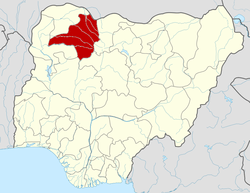 | |
This article is issued from Wikipedia. The text is licensed under Creative Commons - Attribution - Sharealike. Additional terms may apply for the media files.