Zurmi
Zurmi is a Local Government Area in Zamfara State, Nigeria. Its headquarters are in the town of Zurmi at12°46′00″N 6°47′10″E.
Zurmi | |
|---|---|
LGA and town | |
 Zurmi Location in Nigeria | |
| Coordinates: 12°51′N 6°44′E | |
| Country | |
| State | Zamfara State |
| Area | |
| • Total | 2,834 km2 (1,094 sq mi) |
| Population (2006 census) | |
| • Total | 293,837 |
| Time zone | UTC+1 (WAT) |
| 3-digit postal code prefix | 882 |
| ISO 3166 code | NG.ZA.ZU |
It has an area of 2,834 km² and a population of 293,837 at the 2006 census.
The postal code of the area is 882.[1] it shares border with Niger republic from the North and Katsina state from East its end stop at the most populated village Gurbin Bore under Kwashabawa ward after Crossed the inter-state Bridge constructed in the early 1990, 4 years after the establishment of the Whole state in 1996.
References
- "Post Offices- with map of LGA". NIPOST. Archived from the original on October 7, 2009. Retrieved 2009-10-20.
State capital: Gusau | ||
| Local Government Areas | 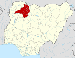 | |
This article is issued from Wikipedia. The text is licensed under Creative Commons - Attribution - Sharealike. Additional terms may apply for the media files.