Gummi, Nigeria
Gummi is a Local Government Area in Zamfara State, Nigeria. Its headquarters are in the town of Gummi at12°08′30″N 5°07′30″E .
Gummi | |
|---|---|
LGA and town | |
 Gummi Location in Nigeria | |
| Coordinates: 12°03′N 5°10′E | |
| Country | |
| State | Zamfara State |
| Area | |
| • Total | 2,610 km2 (1,010 sq mi) |
| Population (2006 census) | |
| • Total | 204,539 |
| Time zone | UTC+1 (WAT) |
| 3-digit postal code prefix | 891 |
| ISO 3166 code | NG.ZA.GM |
It has an area of 2,610 km2 and a population of 204,539 at the 2006 census.
The postal code of the area is 891.[1]
Gummi was carved out of the former larger Sokoto state, which included the present Zamfara and Kebbi states. Gummi has a long history of relative peace and security.
The great majority of the people of the area are Hausa Fulani and Muslims and are predominantly farmers; the principal crop is calabash.
References
- "Post Offices- with map of LGA". NIPOST. Archived from the original on 2012-11-26. Retrieved 2009-10-20.
State capital: Gusau | ||
| Local Government Areas | 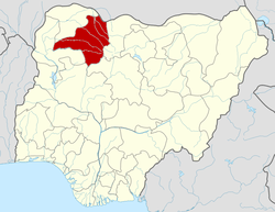 | |
In Gummi local government there is also a tribe called Zamfarawa whose are the origin and founding fathers of Gummi, Anka and Talata Mafara which makes Zamfara as a state. Also Gummi local government divided into two state house of assembly constituencies, Gummi east and Gummi west, because of its population.