Mokwa
Mokwa is a Local Government Area in Niger State, Nigeria. Its headquarters are in the town of Mokwa on the A1 highway in the west of the area.
Mokwa | |
|---|---|
LGA and town | |
 Mokwa Location in Nigeria | |
| Coordinates: 9°12′N 5°20′E | |
| Country | |
| State | Niger State |
| Council Chairman | Feb 11 2016 |
| Government | |
| • Local Government Chairman and the Head of the Local Government Council | Abubakar Yahaya Sheti |
| Area | |
| • Total | 4,338 km2 (1,675 sq mi) |
| Population (2006 census) | |
| • Total | 244,937 |
| • Density | 56/km2 (150/sq mi) |
| Time zone | UTC+1 (WAT) |
| 3-digit postal code prefix | 912 |
| ISO 3166 code | NG.NI.MO |
Mokwa is a town in Niger state with an estimated population of 244,937 (2006). The long southern border of the LGA is formed by the Niger River from Lake Jebba in the west beyond the confluence of the Kaduna River in the east. Kwara State and Kogi State are across the Niger from the LGA. The A1 highway crosses the Niger at Gana to Jebba in Kwara State.
Mokwa is a Nupe kingdom led by the Ndalile (presently Lile Shaba Aliyu) and consisting of sub-districts such as Muwo, Bokani, Kudu, Kpaki, Jebba, Rabba, Ja'agi and others. The leadership style of Mokwa town is emirship, and the head of the town is addressed as Ndalile.
The town is known for it production of tradition crafts, notably hoes, cutlass and melon processing. Mokwa is also known for it sallah festival.
Mokwa is occupied by vast tribes like the Yoruba, Hausa, Igbo, Gbagi and others.
It has an area of 4,338 km² and a population of 244,937 at the 2006 census.
The postal code of the area is 912.[1]
References
- "Post Offices- with map of LGA". NIPOST. Archived from the original on 2012-11-26. Retrieved 2009-10-20.
State capital: Minna | ||
| Local Government Areas | 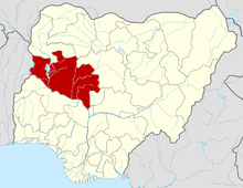 | |