Makurdi
Makurdi[2] is the capital of Benue state[3], Nigeria. The city is located in the Middle Belt along the Benue River and holds the base for the Nigerian Air Force's MiG 21 and SEPECAT Jaguar aircraft squadrons. In 2007, Makurdi had an estimated population of 500,797.[1]
Makurdi | |
|---|---|
.jpg) Makurdi | |
| Motto(s): Food Basket of the Nation | |
 Makurdi Location in Nigeria | |
| Coordinates: 7°43′50″N 8°32′10″E | |
| Country | |
| State | Benue State |
| Government | |
| • Local Government Chairman and the Head of the Local Government Council | Juliana Audu |
| Population (2007)[1] | |
| • Total | 500,797 |
| Climate | Aw |
Demographics
The major ethnic groups are the Tiv, Idoma, Igede, Jukun, Wurkum,Agatu, Etulo,Alagbo,Hausa,Fulani and Nupe.
Education
Makurdi is home to Benue State University, University of Agriculture Makurdi and Nigeria Army School Of Military Engineering, Makurdi.
It is also home to Government Secondary School, North Bank.
Climate
| Climate data for Makurdi (1961–1990) | |||||||||||||
|---|---|---|---|---|---|---|---|---|---|---|---|---|---|
| Month | Jan | Feb | Mar | Apr | May | Jun | Jul | Aug | Sep | Oct | Nov | Dec | Year |
| Record high °C (°F) | 38.5 (101.3) |
39.0 (102.2) |
39.5 (103.1) |
39.0 (102.2) |
37.0 (98.6) |
34.0 (93.2) |
33.0 (91.4) |
32.0 (89.6) |
33.0 (91.4) |
34.0 (93.2) |
35.0 (95.0) |
36.0 (96.8) |
39.5 (103.1) |
| Average high °C (°F) | 34.8 (94.6) |
36.9 (98.4) |
37.0 (98.6) |
35.0 (95.0) |
32.6 (90.7) |
31.2 (88.2) |
30.0 (86.0) |
30.0 (86.0) |
30.7 (87.3) |
31.7 (89.1) |
33.5 (92.3) |
34.2 (93.6) |
33.1 (91.6) |
| Daily mean °C (°F) | 26.4 (79.5) |
28.5 (83.3) |
30.0 (86.0) |
29.2 (84.6) |
27.6 (81.7) |
26.4 (79.5) |
25.9 (78.6) |
25.8 (78.4) |
26.0 (78.8) |
26.4 (79.5) |
26.8 (80.2) |
25.2 (77.4) |
27.1 (80.8) |
| Average low °C (°F) | 18.4 (65.1) |
22.0 (71.6) |
24.7 (76.5) |
25.0 (77.0) |
23.6 (74.5) |
22.9 (73.2) |
22.5 (72.5) |
22.6 (72.7) |
22.3 (72.1) |
22.5 (72.5) |
20.3 (68.5) |
17.6 (63.7) |
22.0 (71.6) |
| Record low °C (°F) | 10.0 (50.0) |
12.0 (53.6) |
15.5 (59.9) |
20.0 (68.0) |
18.0 (64.4) |
18.5 (65.3) |
19.5 (67.1) |
19.5 (67.1) |
18.5 (65.3) |
19.5 (67.1) |
13.0 (55.4) |
8.5 (47.3) |
8.5 (47.3) |
| Average precipitation mm (inches) | 3.7 (0.15) |
2.0 (0.08) |
30.7 (1.21) |
91.3 (3.59) |
166.2 (6.54) |
182.9 (7.20) |
212.4 (8.36) |
217.8 (8.57) |
218.1 (8.59) |
109.1 (4.30) |
1.8 (0.07) |
1.0 (0.04) |
1,237 (48.70) |
| Average precipitation days (≥ 1.0 mm) | 0.3 | 0.3 | 1.7 | 5.6 | 8.9 | 10.3 | 12.9 | 13.3 | 13.3 | 7.8 | 0.5 | 0.2 | 75.1 |
| Average relative humidity (%) (at 15:00 LST) | 26.3 | 26.8 | 37.0 | 50.3 | 61.5 | 66.6 | 69.9 | 71.3 | 68.6 | 63.3 | 45.1 | 31.9 | 51.5 |
| Mean monthly sunshine hours | 217.0 | 212.8 | 210.8 | 210.0 | 213.9 | 183.0 | 151.9 | 145.7 | 162.0 | 201.5 | 240.0 | 232.5 | 2,381.1 |
| Mean daily sunshine hours | 7.0 | 7.6 | 6.8 | 7.0 | 6.9 | 6.1 | 4.9 | 4.7 | 5.4 | 6.5 | 8.0 | 7.5 | 6.5 |
| Source 1: NOAA[4] | |||||||||||||
| Source 2: Deutscher Wetterdienst (extremes and mean temperature)[5] | |||||||||||||
Transport
Makurdi is located on the banks of Benue River, a major tributary of the Niger River. It is on the main narrow gauge railway line running north from Port Harcourt. There are regular bus services linking Makurdi to neighbouring towns.
Until a road rail bridge was built in 1932, a train ferry was used to cross the Benue river.
Agriculture
Benue State is predominantly an agricultural area specialising in cash crops and subsistence crops.
References
- "The World Gazetteer". Archived from the original on 9 February 2013. Retrieved 6 April 2007.
- "Makurdi | Location, Facts, & Population". Encyclopedia Britannica. Retrieved 2020-05-26.
- "Government of Benue State". Government of Benue State. Retrieved 2020-05-26.
- "Makurdi Climate Normals 1961–1990". National Oceanic and Atmospheric Administration. Retrieved 10 August 2016.
- "Klimatafel von Makurdi / Nigeria" (PDF). Baseline climate means (1961-1990) from stations all over the world (in German). Deutscher Wetterdienst. Retrieved 10 August 2016.
State capital: Makurdi | ||
| Local Government Areas | 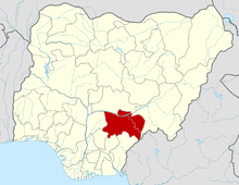 | |
| Settlements | ||