El Peñón de Guatapé
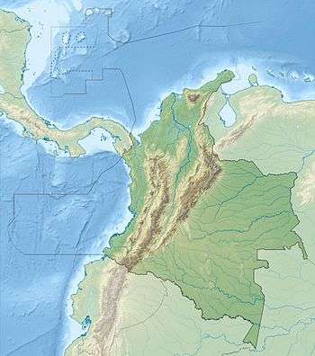
The Rock of Guatape (Spanish: El Peñón de Guatapé), or simply La Piedra or El Peñol,[1] is a landmark inselberg also known as The Stone of El Peñol (Spanish: La Piedra del Peñol),[2] in Colombia. It is located in the town and municipality of Guatapé, Antioquia.[3] The town of El Peñol, which borders Guatapé, has also historically claimed the rock as their own and thus has led to different names for the site.
| El Peñón de Guatapé | |
|---|---|
_2017-04-10.jpg) The Rock of Guatapé. | |
| Highest point | |
| Elevation | 2,135 m (7,005 ft) |
| Coordinates | 6°13′12″N 75°10′46″W |
| Geography | |
 El Peñón de Guatapé | |
| Country | Colombia |
| State | Antioquia |
| Parent range | Central Ranges, Andes |
| Geology | |
| Mountain type | Granite dome |
| Climbing | |
| First ascent | Prehistoric |
The landform is a granitic rock remnant that has resisted weathering and erosion, likely as result of being less fractured than the surrounding bedrock. Peñón de Guatapé is an outcrop of the Antioquia Batholith[3] and towers up to 200 meters (656 feet) above its base. Visitors can scale the rock via a staircase built into one side, a path that includes more than 649 steps to the top.
Near the base of the Rock, there are food and market stalls for shopping. About halfway up the stairs, there is a shrine to the Virgin Mary. The summit contains a three-story viewpoint tower, a convenience store, and a seating area.
History
The indigenous Tahamí, former inhabitants of this region, worshiped the rock and called it in their language mojarrá or mujará (meaning "rock" or "stone").
The rock was first climbed officially in July 1954, when Luis Villegas, Pedro Nel Ramirez, and Ramón Díaz climbed the rock in a five-day endeavor, using sticks that were fixed against the rock's wall.[4]
A new species of plant, named Pitcairnia heterophylla by a German scientist, was found on the top of the rock.
A viewing spot was built on top of the rock, where it is possible to acquire handicrafts, postcards, and other local goods. It is possible to see the 500 km shore-perimeter dam. There are 740 steps to the uppermost step atop the building at the summit, a fact reinforced by yellow numbers also seen in the climb up the stairs.
In the 1940s, the Colombian government declared it a National Monument.[5]
Graffiti
On the western face of the stone there are painted large white letters "G" and an incomplete "U" (only the single vertical stroke was completed, resembling an "I"). The towns of Guatapé and El Peñol had long disputed ownership of the rock, and the residents of Guatapé decided to settle the matter by painting the town's name on the rock in huge white letters. It did not take long for the residents of El Peñol to notice the work, and a large mob was assembled to stop it. Only the "G" and part of the "U" were completed.
Properties
The rock rises from the bottom of the hydroelectric dam of Peñol-Guatapé. This monolith was spotted as a border landmark between country farms and the two cities.
At its highest part, on the rear (southeast side), it has an elevation of 2,135 metres (7,005 ft) above sea level, with an average temperature of 18 °C (64 °F). The "Peñol" is 285 metres (935 ft) long and 110 metres (360 ft) wide. It has some rock breaks, one of which was used for the construction of 650 steps of the stairway[6] that can be used to go to the top.
The Stone of Peñol is composed of quartz, feldspar and mica.
Gallery
 View of Peñón de Guatapé from the road
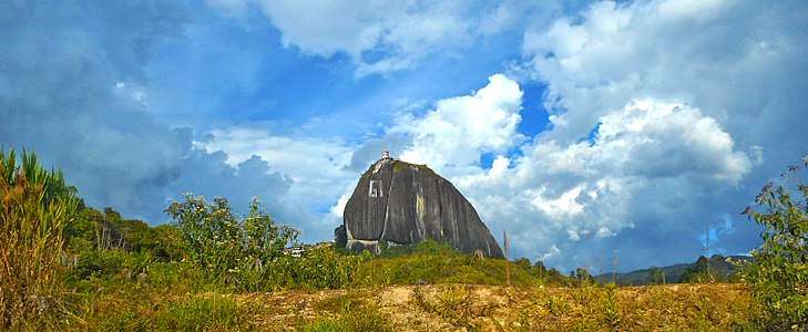 Peñón de Guatapé rising from the countryside
See also
References
- Jens Porup; Kevin Raub; Robert Reid (6 June 2009). Colombia 5. Lonely Planet. p. 216. ISBN 978-1-74104-827-8. Retrieved 18 December 2012.
- Official Guatapé Site http://www.guatape-antioquia.gov.co%5B%5D
- García, Carolina; Hermelin, Michel (2016). "Inselbergs Near Medellín". In Hermelin, Michel (ed.). Landscapes and Landforms of Colombia. Springer. p. 219. ISBN 978-3-319-11800-0.
- Álvaro Idarraga (2006). "El Zócalo", Guatapé: Museo Histórico de Guatapé.
- Guatapé's Major Office
- La Guía Verde Colombia: Actualizada Práctica Completa Para todos los viajeros. MICHELIN. 1 January 2011. p. 258. ISBN 978-2-06-716548-9. Retrieved 18 December 2012.
External links
https://www.municipiodeguatape.gov.co/
Capital: Medellín | |||||||||||||||||||
| Regions and municipalities |
| ||||||||||||||||||
| Related topics | |||||||||||||||||||
Treasures of Colombia | |||||||||||||||||||||||||||||
|---|---|---|---|---|---|---|---|---|---|---|---|---|---|---|---|---|---|---|---|---|---|---|---|---|---|---|---|---|---|
| |||||||||||||||||||||||||||||
| |||||||||||||||||||||||||||||
| |||||||||||||||||||||||||||||
| |||||||||||||||||||||||||||||
Source: Wills, Fernando et al. 2001. Nuestro patrimonio - 100 tesoros de Colombia - Our heritage - 100 treasures of Colombia, 1–311. El Tiempo.ISBN 958-8089-16-6 | |||||||||||||||||||||||||||||