Chocó Department
Chocó Department (Spanish pronunciation: [tʃoˈko], Spanish: Departamento del Chocó) is a department of Colombia known for its large Afro-Colombian population. It is in the west of the country, and is the only Colombian department to have coastlines on both the Pacific Ocean and the Atlantic Ocean. It contains all of Colombia's border with Panama. Its capital is Quibdó.
Department of Chocó Departamento del Chocó | |
|---|---|
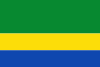 Flag  Coat of arms | |
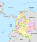
.svg.png) Chocó shown in red | |
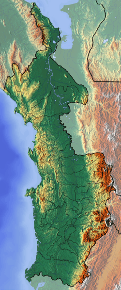 Topography of the department | |
| Coordinates: 5°42′N 76°40′W | |
| Country | |
| Region | Pacific/Chocó Region |
| Established | November 3, 1947 |
| Capital | Quibdó |
| Government | |
| • Governor | Jhoany Carlos Alberto Palacios Mosquera(2016-2019) |
| Area | |
| • Total | 46,530 km2 (17,970 sq mi) |
| Area rank | 9th |
| Population (2018)[3] | |
| • Total | 534,826 |
| • Rank | 23rd |
| • Density | 11/km2 (30/sq mi) |
| Time zone | UTC-05 |
| ISO 3166 code | CO-CHO |
| Municipalities | 30 |
| HDI (2017) | 0.673[4] medium · 30th |
Chocó has a diverse geography, unique ecosystems and unexploited natural resources. However, its population has one of the lowest standards of living of all departments in Colombia. In March 2007, Colombian media reported that some 50 children starved in less than three months, creating awareness of the grave condition Chocó inhabitants are facing. Infrastructure problems were also revealed. For example, despite its status as the world's rainiest lowland, with close to 400 inches (10,000 mm) of annual precipitation,[5] Quibdó lacks sanitary drinking water.[6]

History
The department was created in 1944.[6] Its low population, mountainous and inhospitable topography, and distance from Bogotá resulted in Chocó receiving little attention from the Colombian government. During the reign of military dictator Gustavo Rojas Pinilla, his administration proposed to eliminate Chocó and divide its territory between the departments of Antioquia and Valle del Cauca. But the 1957 coup d'état of General Gabriel París Gordillo overthrew Pinilla's government and ended such plans.
Geography
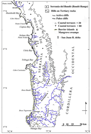
The Chocó Department makes up most of the ecoregion known as El Chocó that extends from Panama to Ecuador.
The municipality of Lloró holds the Highest Average Annual Precipitation record measured at 523.6 inches (13,300 mm) which makes it the wettest place in the world.[7] Three large rivers drain the Chocó Department, the Atrato (which runs north, with tributaries that also flow north), the San Juan, and the Baudó. Each has many tributaries. The Baudó Mountains on the coast and the inland Cordillera Occidental are cut by low valleys, with an altitude less than 1,000 meters, that form most of the territory. Most of the Chocó is thick rainforest. Much of the wood for Colombia's internal consumption is harvested from the Chocó, with a small percentage harvested for export. Chocó Department produces the majority of Colombia's significant platinum output (28,359 ounces of platinum in 2011). Chocó is also Colombia's top gold-producing region (653,625 ounces in 2011). In the late 19th century, it attracted a variety of miners from many countries seeking to make their fortunes in gold.
Demographics
| Historical population | ||
|---|---|---|
| Year | Pop. | ±% |
| 1973 | 203,635 | — |
| 1985 | 313,567 | +54.0% |
| 1993 | 406,199 | +29.5% |
| 2005 | 440,123 | +8.4% |
| 2018 | 534,826 | +21.5% |
| Source:[8] | ||
Chocó is inhabited predominantly by Afro-Colombians, descendants of enslaved Africans imported and brought to this area by the Spanish colonizers after conquering the Americas. The second largest race/ethnic group are the Emberá, a Native American people. More than half of their total population in Colombia lives in Chocó, some 35,500. They practice hunting and artisan fishing and live near rivers.[9]
The total population as of 2005 was less than half a million, with more than half living in the Quibdó valley. According to a 2005 census[10] the ethnic composition of the department is:
- Afro-Colombians (82.1%)
- Amerindians or Indigenous (12.7)
- Whites and Mestizos (5.2%)
Towns and municipalities
Quibdó is the largest city, with a population of almost 100,000. Other important cities and towns include Istmina, Condoto, Nóvita and El Carmen in the interior, Acandí on the Caribbean Coast, and Solano on the Pacific Coast.
Resorts include Capurganá on the Caribbean Coast, and Jurado, Nuquí, and Bahía Solano on the West Coast.
Municipalities
- Acandí
- Alto Baudó
- Atrato
- Bagado
- Bahía Solano
- Bajo Baudó
- Belen de Bajira
- Bojayá
- Cértegui
- Condoto
- El Cantón de San Pablo
- El Carmen de Atrato
- El Carmen del Darién
- Istmina
- Juradó
- Litoral del San Juan
- Lloró
- Medio Atrato
- Medio Baudó
- Medio San Juan
- Nóvita
- Nuquí
- Quibdó
- Río Iró
- Río Quito
- Riosucio
- San José del Palmar
- Sipí
- Tadó
- Unguía
- Unión Panamericana
See also
Notes
- Meyer, Irina Marún; et al. (2012). Chocó: La dimensión territorial y el logro de los ODM (PDF). Fondo para el Logro de los Objetivos del Milenio, United Nations Development Programme. p. 11. Archived from the original (PDF) on 2013-02-22. Retrieved 2013-02-22.
- Kline, Harvey F. (2012). "Chocó, Department of". Historical Dictionary of Colombia. Lanham, Maryland: Scarecrow Press. p. 109. ISBN 978-0-8108-7813-6.
- "DANE". Archived from the original on November 13, 2009. Retrieved February 13, 2013.
- "Sub-national HDI - Area Database - Global Data Lab". hdi.globaldatalab.org. Retrieved 2018-09-13.
- Parsons, James J. (November 1978), "Review of Slavery on the Spanish Frontier: The Colombian Chocó, 1680-1810 by William Frederick Sharp", The Hispanic American Historical Review, Duke University Press, 58 (4): 717–718, JSTOR 2513352
- "¿Se debe acabar Chocó?". Semana (in Spanish). Bogotá: Semana.com. 31 March 2007. Retrieved 7 February 2010.
- NOAA Satellite and Information Service Global Measured Extremes of Temperature and Precipitation
- "Reloj de Población". DANE. Departamento Administrativo Nacional de Estadísitica. Retrieved 6 July 2017.
- "86 tribus subsisten en Colombia". El País (in Spanish). Cali, Colombia: elpais.com. 23 March 2007. Archived from the original on September 27, 2007. Retrieved 7 February 2010.
- "La visibilización estadística de los grupos étnicos colombianos" (PDF) (in Spanish).
References
- (in Spanish) todacolombia.com – Chocó Department
External links
- VisitChoco.com Choco Department Tourism and Trip Planning website (English and Spanish)
- Mosquera-Machados, Silvia del Carmen (2002) "Cadre général du département du Choco" in Analyse multi-aléas et risques naturels dans le département du Chocó (nord-ouest de la Colombie) Université de Genève, Geneva in French
- "Mision de Observacion a la Situación de las Comunidades Afrodescendientes en Colombia: Anexo 1" in Spanish;
- Choco 7 dias - local newspaper founded by Elacio Murillo, former member of the Choco state assembly who was assassinated by gunmen on January 12, 2007.
- Alternative Development, Economic Interests and Paramilitaries in Uraba, TNI Drug Policy Briefing No 27, September 2008 by Moritz Tenthoff
 | ||