Guainía Department
Guainía (Spanish pronunciation: [ɡwajˈni.a]; Yuri language: "Land of many waters") is a department of Colombia. It is in the east of the country, bordering Venezuela and Brazil. Its capital is Inírida. In 1963 Guainía was split off from Vaupés department. The northern part and the Inírida River are included in the Orinoco basin; the rest is part of the Amazon basin. The Guaviare River is the main area of colonization; many colonos come from the Colombian Andean zone, most of them from Boyacá. They are followed by the llaneros, people from the Eastern plains (Los Llanos). The population is mainly composed of Amerindians, and the largest ethnic groups are the Puinaves (from the makú-puinave family) and the curripacos (from the Arawak family). There are a total of 24 ethnic groups in the department; many of them speak four Indigenous languages besides Spanish and Portuguese.
Department of Guainía Departamento de Guainía | |
|---|---|
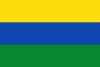 Flag 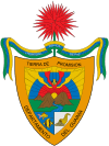 Coat of arms | |
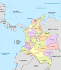
.svg.png) Guainía shown in red | |
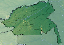 Topography of the department | |
| Coordinates: 3°51′55″N 67°55′26″W | |
| Country | |
| Region | Amazon Region |
| Capital | Inírida |
| Government | |
| • Governor | Javier Eliecer Zapata Parrado (2016-2019) |
| Area | |
| • Total | 72,238 km2 (27,891 sq mi) |
| Area rank | 5th |
| Population (2018)[1] | |
| • Total | 48,114 |
| • Rank | 33rd |
| • Density | 0.67/km2 (1.7/sq mi) |
| Time zone | UTC-05 |
| ISO 3166 code | CO-GUA |
| HDI (2017) | 0.652[2] medium · 32nd |
| Historical population | ||
|---|---|---|
| Year | Pop. | ±% |
| 1964 | 3,602 | — |
| 1973 | 6,637 | +84.3% |
| 1985 | 12,345 | +86.0% |
| 1993 | 28,478 | +130.7% |
| 2005 | 35,230 | +23.7% |
| 2018 | 48,114 | +36.6% |
| Source:[3] | ||
Municipalities
There is only one municipality in Guainía: Inírida, its capital. The rest of the territory is subdivided in corregimientos departamentales, a pending figure due to public disorder.[4] This case happens only in Amazonas, Vaupés and Vichada. Barranco Minas is the second biggest population and its main corregimiento; it is located on the Guaviare River.
The Guainía corregimientos are:
References
- "DANE". Archived from the original on November 13, 2009. Retrieved February 13, 2013.
- "Sub-national HDI - Area Database - Global Data Lab". hdi.globaldatalab.org. Retrieved 2018-09-13.
- "Reloj de Población". DANE. Departamento Administrativo Nacional de Estadísitica. Retrieved 6 July 2017.
- "Sentencia C-141/01" (in Spanish). Retrieved 2008-07-27.
External links
- (in Spanish) Guainía Secretary of Education
- Territorial-Environmental Information System of Colombian Amazon SIAT-AC website
 | ||