Clarksburg, Maryland
Clarksburg is a census-designated place and an unincorporated area in northern Montgomery County, Maryland, United States. It is located at the northern end of the Interstate 270 technology corridor, approximately four miles north of Germantown. As of 2016, Clarksburg had an estimated population of 20,441.[2]
Clarksburg, Maryland | |
|---|---|
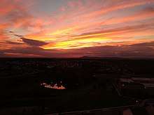
 An aerial view of Clarksburg, Maryland in January 2007. | |
 Flag | |
 Location of Clarksburg, Maryland | |
| Coordinates: 39°13′10″N 77°17′17″W | |
| Country | |
| State | |
| County | |
| Founded | 1752[1] |
| Area | |
| • Total | 8.3 sq mi (21.3 km2) |
| • Land | 8.2 sq mi (21.2 km2) |
| • Water | 0.1 sq mi (0.1 km2) |
| Elevation | 663 ft (202 m) |
| Population (2016) | |
| • Total | 20,441 |
| • Density | 4,319.9/sq mi (1,667.9/km2) |
| Time zone | UTC−5 (Eastern (EST)) |
| • Summer (DST) | UTC−4 (EDT) |
| ZIP code | 20871 |
| Area code(s) | 301 |
| FIPS code | 24-17350 |
| GNIS feature ID | 0583799 |
Geography
As an unincorporated area, Clarksburg's boundaries are not officially defined. Clarksburg is, however, recognized by the United States Census Bureau as a census-designated place, and by the United States Geological Survey as a populated place.
According to the United States Census Bureau, it has a total area of 8.3 square miles (21 km2), of which 8.2 square miles (21 km2) is land and 0.1 square miles (0.26 km2) (1.82%) is water.
Demographics
As of the 2010 census,[3] there were 13,766 people and 4,352 households residing in the area. The population density was 1,667.9 people per square mile (51.2/km²). The population is roughly 44.1% White, 14.7% African-American, 0.1% American Indian or Alaska Native, 33.6% Asian, 0.1% Native Hawaiian or Pacific Islander, including 9.8% of the population Hispanic or Latino origin of any race.
In 2000 there were 604 households, out of which 42.1% had children under the age of 18 living with them, 72.0% were married couples living together, 6.6% had a female householder with no husband present, and 17.5% were non-families. 13.9% of all households were made up of individuals and 4.6% had someone living alone who was 65 years of age or older. The average household size was 3.04 and the average family size was 3.34.
In the area, the population was spread out with 29.3% under the age of 18, 4.8% from 18 to 24, 29.7% from 25 to 44, 27.4% from 45 to 64, and 8.8% who were 65 years of age or older. The median age was 38 years. For every 100 females, there were 100.2 males. For every 100 females age 18 and over, there were 103.6 males.
The median income for a household in the CDP was $88,419, and the median income for a family was $91,216. Males had a median income of $63,125 versus $42,283 for females. The per capita income for the area was $33,174. About 3.4% of families and 4.6% of the population were below the poverty line, including 6.3% of those under age 18 and 6.8% of those age 65 or over.
History
Clarksburg is named for trader John Clarke,[4] and was established at the intersection of the main road between Georgetown and Frederick and an old Seneca trail. One of its earliest white inhabitants was a man named Michael Ashford Dowden, who in 1752 received a patent for 40 acres (160,000 m2) from the colonial government called "Hammer Hill", and two years later permission to build an inn. The inn itself is a footnote in history, hosting the army of General Edward Braddock during the French and Indian War, serving as a meeting place for local Sons of Liberty in the years before the American Revolution, and possibly serving dinner to President Andrew Jackson on his way to his inauguration. Jamie, grandson of the trader, built a general store in the area around 1770, and over the next thirty years enough people moved to the area that Clark was appointed postmaster for the community. By 1875, Clarksburg was a major town in the northern part of the county, but the construction of the Baltimore and Ohio Railroad undermined its economy.
_from_the_overpass_for_Maryland_State_Route_121_(Clarksburg_Road)_in_Clarksburg%2C_Montgomery_County%2C_Maryland.jpg)
In 1964, the Montgomery County planning commission decided that Clarksburg would be the last community along Interstate 270 that would have large-scale development.[5] The Montgomery County Council adopted a master plan for Clarksburg in 1968, which rezoned land for a mix of townhouses and single-family houses.[6] Another master plan was adopted in 1994.[5] A retail area was planned to be built in Clarksburg, but retail development had not broken ground by 2010, to the dismay of some residents.[7] A Harris Teeter-anchored shopping center opened in 2013, and a large outlet mall called Clarksburg Premium Outlets opened in October 2016. The shopping complex has over 90 stores and provides jobs for the region.[8]
In June 2015, the Clarksburg Chamber of Commerce selected the town's flag designed by Shaneea Peek as the official flag of Clarksburg. The inspiration of the flag was derived from Dowden's Ordinary which is a historic landmark of Clarksburg.[9]
Development

Since 2000, there has been major growth in the area of Clarksburg. A new town center is being built in the heart of Clarksburg, near the historic center. 2010 Census data showed that over 13,677 residents and 4,352 households resided in Clarksburg, which consisted of a diverse population with a high level of education attainment. Several public parks[10] and schools have been built to help accommodate the growth.
During the boom growth period it was discovered that some of the new houses were built closer together than the minimum distance required by zoning laws, with roads built too narrow for firetrucks to pass, and homes and community facilities built without adequate permits or approvals by local authorities.[11] This was found to be the fault of inadequate county oversight and lax enforcement of building codes and laws combined with a building boom in the early 2000s.[12]:161–173
In April 2014, the Montgomery County Council set additional limits on development projects in order to protect the quality of nearby Tenmile Creek, a drinking water source and emergency water supply for the metropolitan Washington, D.C. area.[12]:173–175 [13][14] Later that year, developers filed suit against the county, claiming that the county "illegally limited construction on its property." [15] The U.S. District Court in Maryland dismissed the suit in August 2017.[16] The district court's dismissal was affirmed by the Fourth Circuit Court of Appeals on November 29, 2018.[17]
Parks and Recreation
Clarksburg has a park and children's playground named Park Daniel. There are multiple parks in the area including Little Bennett Campgrounds, Black Hill Regional Park and Ridge Road Dog Park. There are also multiple farms, private and public, that serve production and tourism purposes.
School enrollment
| School Name | Capacity | Actual Student Enrollment
2017–2018 school year |
Projected Student Enrollment
2018–2019 school year |
Percent Change
|
Percent of Capacity
2011–2012 school year |
|---|---|---|---|---|---|
| Clarksburg Elementary School[18] | 589 | 312 | 410 | +76.09% | 69.60% |
| Wilson Wims Elementary | 1,399 | 752 | 1,220 | +61.63% | 53.75% |
| Little Bennett Elementary School[19] | 685 | 624 | 614 | -1.61% | 91.09% |
| Snowden Farm Elementary | |||||
| Rocky Hill Middle School[20] | 956 | 1,020 | 809 | -20.69% | 106.69% |
| Clarksburg High School[21] | 1,629 | 2,034 | 2,334 | +14.74% | 124.86% |
The two newest schools, Little Bennett Elementary School and Clarksburg High School, have the largest increase of students, with Little Bennett at 71.4% above building capacity in the projections of 2011-2012. This has led to a moratorium in issuance of permits for new projects, but not issuance of permits in existing projects, for new homes in the Clarksburg area.[22] The majority of planned housing units will be built in existing projects. All four of the largest neighborhoods are exempt from the moratorium.
Businesses and Organizations
References
- Brocker, Jim (January 7, 2012). "Clarksburg, a work in progress". The Washington Post. p. E4. ProQuest 914465801.
- Bureau, U.S. Census. "U.S. Census website". United States Census Bureau. Retrieved 2018-11-14.
- "U.S. Census website". United States Census Bureau. Retrieved 2008-01-31.
- "Old Location, New Store in Clarksburg". The Washington Post. December 21, 2006. p. T3. ProQuest 410144087.
- Aguilar, Louis (February 17, 1994). "Clarksburg Gets Ready to Meet Its Master Plan; County Preparing a Big Future for Rural Hamlet". The Washington Post. p. M1. ProQuest 307721919.
- Bensinger, Gail (July 24, 1968). "Clarksburg Master Plan Voted". The Washington Post. p. B9. ProQuest 143329444.
- Spivack, Miranda S. (January 12, 2010). "Clarksburg at the 10-year mark: Turmoil comes to town and stays; Montgomery development struggles to deliver what was promised". The Washington Post. p. B1. ProQuest 410373354.
- "About Clarksburg Premium Outlets". Simon Property Group. Retrieved 2018-03-14.
- "Clarksburg Reveals its New Flag on Heritage Day". Patch. Retrieved 2015-10-05.
- "Ovid Hazen Wells Recreational Park". Silver Spring, MD: Montgomery County Department of Parks. 2019-05-13.
- Singer-Bart, Susan (2010-02-24). "County fire officials restricting upcounty street parking". The Gazette. Gaithersburg, MD. Archived from the original on 2016-04-08.
- Hanson, Royce (2017). "Chapter 7. Errors in Corridor City Planning". Suburb: Planning Politics and the Public Interest. Ithaca, NY: Cornell University Press. ISBN 1501708082.
- "Approval of Planning Board Draft 10 Mile Creek Area Limited Amendment to the Clarksburg Master Plan and Hyattstown Special Study Area" (PDF). Rockville, MD: Montgomery County Council. 2014-04-01. Resolution No. 17-1048.
- Turque, Bill (2014-04-02). "Montgomery council brings official end to battle over Clarksburg's Ten Mile Creek". Washington Post.
- Turque, Bill (2014-11-14). "Clarksburg builders file suit, charging that MoCo improperly limited home construction". Washington Post.
- Pulte Home Corp. and Shiloh Farm Investments v. Montgomery County, Maryland (D. Md. 2017-08-25). Text Case No. GJH-14-3955.
- Pulte Home Corp. and Shiloh Farm Investments v. Montgomery County, Maryland (4th Cir. 2018-11-29). Text. Docket no. 17-2112.
- "Clarksburg ES at a Glance (PDF)" (PDF).
- "Little Bennett ES at a Glance (PDF)" (PDF).
- "Rocky Hill MS at a Glance (PDF)" (PDF).
- "Clarksburg HS at a Glance (PDF)" (PDF).
- "County puts hold on new projects". Archived from the original on 2009-04-16. Retrieved 2007-11-23.
External links
| Wikimedia Commons has media related to Clarksburg, Maryland. |
- Clarksburg - Montgomery County Planning Department
Places adjacent to Clarksburg, Maryland | |
|---|---|
.svg.png)
Municipalities and communities of Montgomery County, Maryland, United States | ||
|---|---|---|
| Cities | 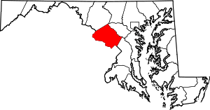 | |
| Towns | ||
| Villages & Special Tax Districts | ||
| CDPs |
| |
| Unincorporated communities | ||
| Footnotes | ‡This populated place also has portions in an adjacent county or counties | |
| Authority control |
|
|---|