Severn, Maryland
Severn is a census-designated place (CDP) in Anne Arundel County, Maryland, United States. The population was 44,231 at the 2010 census,[1] a 26% increase from its population of 35,076 in 2000. The zip code is 21144.
Severn, Maryland | |
|---|---|
.jpg) 2014 aerial photo of Severn | |
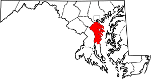
 Location of Severn, Maryland | |
| Coordinates: 39°7′58″N 76°41′38″W | |
| Country | |
| State | |
| County | |
| Area | |
| • Total | 17.7 sq mi (45.9 km2) |
| • Land | 17.7 sq mi (45.9 km2) |
| • Water | 0.0 sq mi (0.0 km2) |
| Elevation | 161 ft (49 m) |
| Population (2010) | |
| • Total | 44,231 |
| • Density | 2,497/sq mi (964.1/km2) |
| Time zone | UTC−5 (Eastern (EST)) |
| • Summer (DST) | UTC−4 (EDT) |
| ZIP code | 21144 |
| Area code(s) | 410 |
| FIPS code | 24-71150 |
| GNIS feature ID | 0591249 |
Geography
Severn is located at 39°7′58″N 76°41′38″W (39.132841, −76.694002)[2] in northwestern Anne Arundel County. It is bordered by Hanover to the north, Glen Burnie to the east, Odenton and Millersville to the south, and Fort George G. Meade to the west. The Baltimore–Washington Parkway (Maryland Route 295) forms the northwestern edge of the CDP, Maryland Route 176 (Dorsey Road) forms the northern edge, and Interstate 97 forms the eastern edge. Part of the southern boundary of the CDP is formed by the non-tidal portion of the Severn River. The Maryland Route 100 freeway runs through the northern part of the CDP, connecting the B-W Parkway and I-97.
According to the United States Census Bureau, the CDP has a total area of 17.7 square miles (45.9 km2), all of it land.[1]
Demographics
At the 2000 census there were 35,076 people, 12,003 households, and 9,506 families living in the CDP. The population density was 2,511.3 people per square mile (969.4/km²). There were 12,362 housing units at an average density of 885.1 per square mile (341.7/km²). The racial makeup of the CDP was 56.25% White, 34.56% Black, 0.42% Native American, 4.29% Asian, 0.10% Pacific Islander, 1.36% from other races, and 3.02% from two or more races. Hispanic or Latino of any race were 3.96%.[3]
Of the 12,003 households 43.4% had children under the age of 18 living with them, 59.8% were married couples living together, 14.7% had a female householder with no husband present, and 20.8% were non-families. 15.3% of households were one person and 2.5% were one person aged 65 or older. The average household size was 2.91 and the average family size was 3.24.
The age distribution was 30.3% under the age of 18, 7.8% from 18 to 24, 35.7% from 25 to 44, 21.1% from 45 to 64, and 5.2% 65 or older. The median age was 33 years. For every 100 females, there were 94.7 males. For every 100 females age 18 and over, there were 91.9 males.
The median household income was $66,204 and the median family income was $68,424 (these figures had risen to $84,864 and $99,583 respectively as of a 2007 estimate[4]). Males had a median income of $42,933 versus $31,751 for females. The per capita income for the CDP was $24,640. About 5.4% of families and 6.5% of the population were below the poverty line, including 10.7% of those under age 18 and 7.1% of those age 65 or over.
Education
Public schools
Students may attend public school within the Anne Arundel County Public Schools district.
- Arundel Middle School – 6th through 8th grade
- Arundel High School – 9th through 12th grade
- Center of Applied Technology North – vocational education classes for 9th through 12th grade
- Severn Elementary School – kindergarten through 5th grade
- Ridgeway Elementary School – kindergarten through 5th grade
- Van Bokkelen Elementary School – pre-kindergarten through 5th grade
- Quarterfield Elementary School – pre-kindergarten through 5th grade
- Meade Heights Elementary School – kindergarten through 5th grade
- Meade Senior High School – 9th through 12th grade
- Corkran Middle School – 6th through 8th grade
- Glen Burnie High School – 9th through 12th grade
- Old Mill Middle School South and North – 6th through 8th grade
- Old Mill High School – 9th through 12th grade
Private schools
Notable residents
- The Braxtons (Toni, Traci, Towanda, Trina and Tamar, along with their brother Michael), singers and stars of Braxton Family Values
- Steve Dannenmann, accountant who gained fame as the 2005 World Series of Poker runner-up
- Doud Eisenhower, son of President Dwight D. Eisenhower, died at Fort Meade
- C. Edward Middlebrooks, politician
- Marina Harrison, Miss Maryland 2003 and Miss Maryland USA 2005
- Jessica Benson, singer
- Erin O'Donnell, singer
- A. J. Francis, former NFL defensive tackle
References
| Wikimedia Commons has media related to Severn, Maryland. |
- "Geographic Identifiers: 2010 Demographic Profile Data (G001): Severn CDP, Maryland". U.S. Census Bureau, American Factfinder. Archived from the original on February 12, 2020. Retrieved June 3, 2013.
- "US Gazetteer files: 2010, 2000, and 1990". United States Census Bureau. 2011-02-12. Retrieved 2011-04-23.
- "U.S. Census website". United States Census Bureau. Retrieved 2008-01-31.
- "Archived copy". Archived from the original on 2020-02-13. Retrieved 2009-04-05.CS1 maint: archived copy as title (link)