Kent County, Maryland
Kent County is a county located in the U.S. state of Maryland. As of the 2010 census, its population was 20,197,[1] making it the least populous county in Maryland. Its county seat is Chestertown.[2] The county was named for the county of Kent in England.[3] The county is located on Maryland's Eastern Shore.
Kent County | |
|---|---|
 Kent County Courthouse in Chestertown | |
 Flag  Seal | |
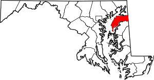 Location within the U.S. state of Maryland | |
 Maryland's location within the U.S. | |
| Coordinates: 39°14′N 76°06′W | |
| Country | |
| State | |
| Founded | December 30, 1642 |
| Named for | Kent |
| Seat | Chestertown |
| Largest town | Chestertown |
| Area | |
| • Total | 413 sq mi (1,070 km2) |
| • Land | 277 sq mi (720 km2) |
| • Water | 136 sq mi (350 km2) 33%% |
| Population (2010) | |
| • Total | 20,197 |
| • Estimate (2019) | 19,422 |
| • Density | 49/sq mi (19/km2) |
| Time zone | UTC−5 (Eastern) |
| • Summer (DST) | UTC−4 (EDT) |
| Congressional district | 1st |
| Website | www |
History
In 1608, Captain John Smith explored and mapped a portion of what is now Kent County.
In 1642, the governor and council appointed commissioners for the Isle and County of Kent. This act appears to have led to the establishment of Kent County. In 1675, the first county seat was New Yarmouth. The seat was briefly moved upriver to Quaker Neck, and then to the site of modern Chestertown. Before the American Revolution New Town on Chester, now Chestertown, was a port entry for the counties of Cecil, Kent, and Queen Anne's.[4]
The county has a number of properties which are listed on the National Register of Historic Places.[5]
Kent County was the mean center of US population in the census of 1790.
In 1793, the county had its first newspaper, called Apollo, or Chestertown Spy. It was succeeded by local papers such as the Chestertown Gazette.
Washington College, the oldest college in Maryland, is located in Kent County. First college charted in the nation after the Declaration of Independence. It was founded by William Smith in 1782. George Washington authorized use of his name. He gave the largest gift of 50 guineas and served on the Board of Visitors and Governors for five years.
The college has been host to four United States Presidents. George Washington. Harry S. Truman, Dwight Eisenhower, and Franklin Roosevelt. All were awarded honorary degrees from the college.
Government and politics
Kent County was granted home rule in 1970 under a state code.
In the early post-Civil War era Kent County, having been heavily Confederate-leaning, tended towards the Democratic Party.[6] William McKinley was the only Republican to carry the county between 1876 and 1924. After that, although carried by Franklin Roosevelt and Harry Truman during the five consecutive Democratic victories between 1932 and 1948, the county trended Republican especially relative to national voting. Currently, Kent County is along with Somerset County further south the most politically competitive county on Maryland's Eastern Shore. In 2004, Republican George W. Bush won it with 52 percent of the vote to Democrat John Kerry’s 46%. In the 2008 United States Presidential Election, Barack Obama won Kent County by 48 votes more than John McCain.[7] In 2012 Republican Mitt Romney won Kent County by 28 votes over Democrat Barack Obama.
| Year | Republican | Democratic | Third parties |
|---|---|---|---|
| 2016 | 48.7% 4,876 | 45.7% 4,575 | 5.7% 570 |
| 2012 | 49.2% 4,870 | 48.9% 4,842 | 1.9% 192 |
| 2008 | 49.0% 4,905 | 49.4% 4,953 | 1.6% 162 |
| 2004 | 52.8% 4,900 | 46.1% 4,278 | 1.2% 107 |
| 2000 | 51.4% 4,155 | 44.9% 3,627 | 3.8% 303 |
| 1996 | 43.7% 3,055 | 45.8% 3,207 | 10.5% 736 |
| 1992 | 40.6% 3,094 | 40.6% 3,093 | 18.9% 1,441 |
| 1988 | 55.9% 3,761 | 43.5% 2,925 | 0.7% 46 |
| 1984 | 61.6% 3,897 | 37.8% 2,390 | 0.6% 36 |
| 1980 | 45.8% 2,889 | 47.4% 2,986 | 6.8% 429 |
| 1976 | 46.8% 2,821 | 53.2% 3,211 | |
| 1972 | 64.4% 4,036 | 34.6% 2,168 | 1.1% 67 |
| 1968 | 46.5% 2,946 | 35.4% 2,243 | 18.1% 1,146 |
| 1964 | 32.8% 2,008 | 67.2% 4,113 | |
| 1960 | 51.5% 3,264 | 48.5% 3,079 | |
| 1956 | 61.2% 3,747 | 38.8% 2,378 | |
| 1952 | 59.2% 3,656 | 40.6% 2,504 | 0.2% 11 |
| 1948 | 49.3% 2,489 | 50.0% 2,524 | 0.7% 35 |
| 1944 | 48.9% 2,351 | 51.1% 2,454 | |
| 1940 | 46.5% 2,639 | 53.1% 3,014 | 0.5% 28 |
| 1936 | 46.2% 2,543 | 53.2% 2,931 | 0.6% 33 |
| 1932 | 38.1% 1,468 | 61.5% 2,370 | 0.4% 16 |
| 1928 | 52.8% 2,777 | 46.6% 2,450 | 0.6% 30 |
| 1924 | 42.5% 2,019 | 55.3% 2,628 | 2.2% 102 |
| 1920 | 48.2% 2,838 | 51.6% 3,034 | 0.2% 14 |
| 1916 | 46.4% 1,673 | 52.3% 1,886 | 1.3% 48 |
| 1912 | 30.2% 1,021 | 53.7% 1,816 | 16.1% 543 |
| 1908 | 47.0% 1,753 | 52.0% 1,939 | 1.1% 39 |
| 1904 | 47.9% 1,841 | 50.9% 1,956 | 1.2% 46 |
| 1900 | 53.1% 2,426 | 45.4% 2,076 | 1.6% 71 |
The Sheriff of Kent County is John Price IV.
The commissioners of Kent County are - P. Thomas Mason (R) President, Robert N. Jacobs Jr. (R) and Ronald H. Fithian (D)
Geography
According to the U.S. Census Bureau, the county has a total area of 413 square miles (1,070 km2), of which 277 square miles (720 km2) is land and 136 square miles (350 km2) (33%) is water.[9]
According to the Maryland Geological Survey, the highest point in Kent County is 102 ft above sea level, approximately 2.25 mi west of Coleman's Corner (shown on maps as "Coleman"), just northeast of the mouth of Still Pond Creek.[10]
Kent County has a 209-mile shoreline, including Eastern Neck Island. The Chesapeake Bay is on the west, Sassafras River on the north, and the Chester River on the south. The eastern border with Delaware is part of the Mason–Dixon line.
Adjacent counties
- Cecil County (north)
- New Castle County, Delaware (northeast)
- Harford County (northwest)
- Queen Anne's County (south)
- Kent County, Delaware (southeast)
- Anne Arundel County (southwest)
- Baltimore County (west)
National protected area
Demographics
| Historical population | |||
|---|---|---|---|
| Census | Pop. | %± | |
| 1790 | 12,836 | — | |
| 1800 | 11,771 | −8.3% | |
| 1810 | 11,450 | −2.7% | |
| 1820 | 11,453 | 0.0% | |
| 1830 | 10,501 | −8.3% | |
| 1840 | 10,842 | 3.2% | |
| 1850 | 11,386 | 5.0% | |
| 1860 | 13,267 | 16.5% | |
| 1870 | 17,102 | 28.9% | |
| 1880 | 17,605 | 2.9% | |
| 1890 | 17,471 | −0.8% | |
| 1900 | 18,786 | 7.5% | |
| 1910 | 16,957 | −9.7% | |
| 1920 | 15,026 | −11.4% | |
| 1930 | 14,242 | −5.2% | |
| 1940 | 13,465 | −5.5% | |
| 1950 | 13,677 | 1.6% | |
| 1960 | 15,481 | 13.2% | |
| 1970 | 16,146 | 4.3% | |
| 1980 | 16,695 | 3.4% | |
| 1990 | 17,842 | 6.9% | |
| 2000 | 19,197 | 7.6% | |
| 2010 | 20,197 | 5.2% | |
| Est. 2019 | 19,422 | [11] | −3.8% |
| U.S. Decennial Census[12] 1790-1960[13] 1900-1990[14] 1990-2000[15] 2010–2018[1] | |||

2000 census
As of the census of 2000, there were 19,197 people, 7,666 households, and 5,136 families living in the county. The population density was 69 people per square mile (27/km²). There were 9,410 housing units at an average density of 34 per square mile (13/km²). The racial makeup of the county was 79.64% White, 17.41% Black or African American, 0.15% Native American, 0.54% Asian, 0.05% Pacific Islander, 1.04% from other races, and 1.18% from two or more races. 2.84% of the population were Hispanic or Latino of any race. 15.7% were of English, 14.2% German, 12.4% Irish and 11.3% American ancestry.
There were 7,666 households out of which 26.30% had children under the age of 18 living with them, 51.70% were married couples living together, 11.10% had a female householder with no husband present, and 33.00% were non-families. 27.80% of all households were made up of individuals and 13.70% had someone living alone who was 65 years of age or older. The average household size was 2.33 and the average family size was 2.81.
In the county, the population was spread out with 20.80% under the age of 18, 10.90% from 18 to 24, 23.70% from 25 to 44, 25.30% from 45 to 64, and 19.30% who were 65 years of age or older. The median age was 41 years. For every 100 females there were 91.90 males. For every 100 females age 18 and over, there were 88.90 males.
The median income for a household in the county was $39,869, and the median income for a family was $46,708. Males had a median income of $31,899 versus $24,513 for females. The per capita income for the county was $21,573. About 9.30% of families and 13.00% of the population were below the poverty line, including 17.00% of those under age 18 and 8.50% of those age 65 or over.
2010 census
As of the 2010 United States Census, there were 20,197 people, 8,165 households, and 5,272 families living in the county.[16] The population density was 72.9 inhabitants per square mile (28.1/km2). There were 10,549 housing units at an average density of 38.1 per square mile (14.7/km2).[17] The racial makeup of the county was 80.1% white, 15.1% black or African American, 0.8% Asian, 0.2% American Indian, 1.9% from other races, and 1.8% from two or more races. Those of Hispanic or Latino origin made up 4.5% of the population.[16] In terms of ancestry, 18.7% were English, 18.7% were German, 15.5% were Irish, 7.9% were American, and 5.8% were Italian.[18]
Of the 8,165 households, 24.4% had children under the age of 18 living with them, 49.2% were married couples living together, 10.9% had a female householder with no husband present, 35.4% were non-families, and 29.6% of all households were made up of individuals. The average household size was 2.29 and the average family size was 2.78. The median age was 45.6 years.[16]
The median income for a household in the county was $50,141 and the median income for a family was $63,507. Males had a median income of $41,046 versus $35,161 for females. The per capita income for the county was $29,536. About 5.1% of families and 12.2% of the population were below the poverty line, including 14.9% of those under age 18 and 7.8% of those age 65 or over.[19]
Education
- Kent County High School
- Kent County Middle School
- Galena Elementary School
- Judy Center (Pre-school)
- Henry Highland Garnet Elementary School
- Rock Hall Elementary School
- Kent School
- Chestertown Christian Academy
- Echo Hill Outdoor School
- Radcliffe Creek School
- Washington College
- Chesapeake College (supported in part by the county government, but located in Wye Mills, Md.)
Annual & Holiday Events
- Chestertown Tea Party Festival
- National Music Festival
- Chestertown's "Music in the Park" Summer Concert Series
- Legacy Day
- Chestertown Jazz Festival
- Sultana Downrigging
- A Dickens of a Christmas Weekend
Communities
This county contains the following incorporated municipalities:
Towns
- Betterton
- Chestertown (county seat)
- Galena
- Millington (partly in Queen Anne's County)
- Rock Hall
Census-designated places
The United States Census Bureau recognizes the following Census-designated places in Kent County:
Unincorporated communities
Other unincorporated places not listed as Census-Designated Places but known in the area include:
Museums & Theatres
- Sumner Hall Honors the service of African American Civil War veterans of the Charles Summer Post # 25, Grand Army of the Republic
- Church Hill Theatre
- The Mainstay
- The Garfield Center for the Arts
- Betterton Heritage Museum located in the Betterton Community Hall . Hand carved decoys are on display
- Massey Air Museum a living airport museum reminiscent of rural airports of bygone era. See a collection of vintage aircraft and artifacts.
- Waterman's Museum. On display are a fishing shanty and artifacts from the early days of oystering, crabbing and fishing
- Eastern Neck. A National Wildlife Refuge Located at the mouth of the Chester River. The 2,285 acre island provides a natural habitat for many species of migratory birds
- African American Schoolhouse, Worton. Interpretive panel and exterior viewing only of a one room schoolhouse originally built as a church in 1890
- Kent Museum, Kennedyville. Local agriculture and domestic life is represented here.
Notable people
- John Cadwalader (1742-1786), Quaker commander during the American Revolutionary War. Served at Princeton, Brandywine, Germantown and Monmouth.
- Captain Lambert Wickes- One of the senior officers of the Continental Navy in the opening years of the Revolution. Noted for his daring raids on British shipping. He took Benjamin Franklin to France in 1776.
- Tyshawn Johnson, better known by his stage name Yvng Swag, is an American trap recording artist, dancer and internet personality
- R. Clayton Mitchell Jr. (1936 – 2019), Speaker of the Maryland House of Delegates, 1986–1993. President of the Kent County Commissioners, 1966–1970. Member of the Maryland House of Delegates, 1970–1993.
- John Needles (1786 – 1878), Quaker abolitionist and a master craftsman of fine furniture
Miscellaneous
- The newspaper of record is the Kent County News.
- Kent County Public Schools were some of the last in the country to fully integrate. The federal government stepped up pressure and required a formal plan of integration, which was adopted in 1966.[20] In 1967, there was full and complete integration in Kent County. Construction plans delayed the opening the desegregated high school [20] which opened in the fall of 1971. In 1971, all pupils, regardless of race, reported to the modern high school in Worton. All grades in the Kent County system were integrated before the opening of the centrally located high school.
- Kent County, Maryland, is one of the few counties in the United States to border its namesake in another state—in this case, Kent County, Delaware.
- In 1790 Kent County contained the centre of population of the United States, according to the US Census Bureau. It is on the edge of a cornfield at 39.16.30 N 76.11.12 W.
- Tolchester Beach Amusement Park founded in 1877 by the Tolchester Steamboat Company. As many as 20,000 people visited the resort on summer weekends. It was served by 6 steamers and a ferry. There games of skill and chance and harness racing on a track within the park borders. Included on the grounds were a hotel, pavilion and bathing beach It grew from 10 acres to 155. It was closed in 1962.
- The Kent County Railroad Company was formed in 1856. The line was bought by the Pennsylvania Railroad in 1903. The railroads’ s primary importance was a means to ship local product to t eastern markets. The railroad continued to operate until early 1970.
- Chestertown - Fountain Park - the fountain in the park was manufactured by Robert Wood & Company of Philadelphia. It was purchased by the Ladies Improvement Society in 1899 and installed in the Park. The figure of Hebe, goddess of youth and beauty stands atop the fountain.
References
- "State & County QuickFacts". United States Census Bureau. Archived from the original on June 6, 2011. Retrieved August 24, 2013.
- "Find a County". National Association of Counties. Archived from the original on May 31, 2011. Retrieved June 7, 2011.
- Gannett, Henry (1905). The Origin of Certain Place Names in the United States. Govt. Print. Off. pp. 173.
- Clark, Charles; Robert Swain, Jr. (1950). The Eastern Shore of Maryland and Virginia. New York: Lewis Historical Publishing Company. pp. 917–938.
- "National Register Information System". National Register of Historic Places. National Park Service. April 15, 2008.
- Levine, Mark V.; ‘Standing Political Decisions and Critical Realignment: The Pattern of Maryland Politics, 1872-1948’; The Journal of Politics, volume 38, no. 2 (May, 1976), pp. 292-325
- "CNN Maryland Results 2008 election". Cable News Network.
- Leip, David. "Dave Leip's Atlas of U.S. Presidential Elections". uselectionatlas.org. Retrieved 2018-06-11.
- "2010 Census Gazetteer Files". United States Census Bureau. August 22, 2012. Archived from the original on September 13, 2014. Retrieved September 12, 2014.
- "Maryland Geological Survey". Maryland Department of Natural Resources. Retrieved 2011-07-21.
- "Population and Housing Unit Estimates". Retrieved April 26, 2019.
- "U.S. Decennial Census". United States Census Bureau. Retrieved September 12, 2014.
- "Historical Census Browser". University of Virginia Library. Retrieved September 12, 2014.
- "Population of Counties by Decennial Census: 1900 to 1990". United States Census Bureau. Retrieved September 12, 2014.
- "Census 2000 PHC-T-4. Ranking Tables for Counties: 1990 and 2000" (PDF). United States Census Bureau. Retrieved September 12, 2014.
- "DP-1 Profile of General Population and Housing Characteristics: 2010 Demographic Profile Data". United States Census Bureau. Archived from the original on 2020-02-13. Retrieved 2016-01-22.
- "Population, Housing Units, Area, and Density: 2010 - County". United States Census Bureau. Archived from the original on 2020-02-13. Retrieved 2016-01-22.
- "DP02 SELECTED SOCIAL CHARACTERISTICS IN THE UNITED STATES – 2006-2010 American Community Survey 5-Year Estimates". United States Census Bureau. Archived from the original on 2020-02-13. Retrieved 2016-01-22.
- "DP03 SELECTED ECONOMIC CHARACTERISTICS – 2006-2010 American Community Survey 5-Year Estimates". United States Census Bureau. Archived from the original on 2020-02-13. Retrieved 2016-01-22.
- "Report on School Desegregation in 14 Eastern shore and southern Maryland Counties" (PDF). February 1966. Retrieved June 3, 2020.
External links
Places adjacent to Kent County, Maryland | ||||||||||
|---|---|---|---|---|---|---|---|---|---|---|
| ||||||||||
Municipalities and communities of Kent County, Maryland, United States | ||
|---|---|---|
| Towns | | |
| CDPs | ||
| Unincorporated communities | ||
| Footnotes | ‡This populated place also has portions in an adjacent county or counties | |
.svg.png)
| Authority control |
|
|---|