Aspen Hill, Maryland
Aspen Hill is a census-designated place and an unincorporated area in Montgomery County, Maryland, United States.
Aspen Hill, Maryland | |
|---|---|
 Location of Aspen Hill, Maryland | |
| Coordinates: 39°5′19″N 77°4′49″W | |
| Country | |
| State | |
| County | |
| Area | |
| • Total | 10.5 sq mi (27.3 km2) |
| • Land | 10.5 sq mi (27.1 km2) |
| • Water | 0.1 sq mi (0.2 km2) |
| Elevation | 328 ft (100 m) |
| Population (2010) | |
| • Total | 48,759 |
| • Density | 4,799.2/sq mi (1,853.0/km2) |
| Time zone | UTC−5 (Eastern (EST)) |
| • Summer (DST) | UTC−4 (EDT) |
| ZIP codes | 20853, 20906, 20916 |
| Area code(s) | 301 |
| FIPS code | 24-02825 |
| GNIS feature ID | 0589663 |
Etymology
The community name is derived from aspen trees that once were found near the first post office in the area. The post office was located in a general store on what was then known as the Washington-Brookeville Pike (now the intersection of Connecticut and Georgia Avenues) and opened circa 1864.
History
In the 1920s and 1930s, Aspen Hill was known as being the location of Aspin Hill Memorial Park, one of three pet cemeteries then operating on the East Coast of the United States.[1][2][3] Burials at Aspen Hill Cemetery included dogs that had served the during World War I as well as the pets of area residents.[4] Memorial ceremonies honoring pets were often held there on World Day for Animals.[4][5][6]
In July 1950, Louis M. Denit sold 517 acres (2.1 km2) of land in Aspen Hill to Gelman Construction Company for approximately $300,000.[7] Denit was a well-known attorney who specialized in banking and trust law.[8] Gelman Construction Company bought the land in order to build 2,450 three-bedroom ramblers, a shopping center, schools, playgrounds, and churches.[7] The homes were priced at less $10,000 each.[7]
In January 1955, Minnie Goodman sold 268 acres (1.1 km2) of land in Aspen Hill to Metropolitan Homes, Inc.[9] At the time, the land was the last vacant tract of land of its size between Rockville and Wheaton.[9] Metropolitan Homes planned to build 12,000 homes, schools, shopping centers, and churches on the land.[9] Prices for the homes started at $15,000 each.[9]
On August 14, 1958, a brush fire broke out in the Redland Neighborhood of Avery. The winds were blowing to the southeast, so the fire threatened the entire town of Aspen Hill. At around 10:00 at night, the fire department ordered the evacuation of the northwestern part of the town, and the remaining portions of the town an hour later. The fire, which became known as the Rock Creek fire, destroyed 95% of the buildings in the Redland neighborhood of Avery, and a few neighborhoods of Aspen Hill. The fire burned down the woods north of the town, and made its way south along the Rock Creek and Bel Pre Creek, eventually reaching parts of North Bethesda and Garrett Park, completely encircling the town of Aspen Hill, before being contained on August 18. In total 98 buildings were destroyed, 34 of which were in Aspen Hill. The damage is still visible today, in the young vegetation and the lack of homes in the neighborhood of Avery. Only a few homes in the neighborhood survived, and due to opposition to the granting of rebuilding permits from the residents out of fear of "modernizing" the neighborhood which was full of vintage homes, no permits were granted until 2002. The few buildings that remain in the neighborhood are mostly survivors of the fire. The rest of the neighborhood is woods and abandoned meadows. The damage in Aspen Hill, however, was quickly rebuilt, and most if not all the damaged structures have been rebuilt.[10]
Aspen Hill was one of the locations in which a fatal shooting took place in October 2002 as part of the Beltway sniper attacks.
Geography
As a census-designated place, Aspen Hill's boundaries are defined by the U.S. Census Bureau. The United States Postal Service does not accept “Aspen Hill” as a place name; addresses in the community must use the place names Rockville, Silver Spring, or Wheaton.
Some addresses use Wheaton (20906),[11] notably in the Aspen Hill Shopping Center, while immediately across Aspen Hill Road at the Northgate Plaza Shopping Center, the addresses use Silver Spring (20906).[12] Immediately to the west across Connecticut Avenue, addresses use Rockville (20853).[13] As a result, crime statistics which are reasonably considered as belonging to Aspen Hill are buried in the statistics of three different areas. Aspen Hill straddles a corner where three statistical areas meet in what locals consider the commercial heart of Aspen Hill.
The United States Census Bureau, defines Aspen Hill as a census-designated place located at 39°6' North, 77°5' West. In the 2000 Census Bureau Gazetteer, Aspen Hill was located at 39°5′19″N 77°4′49″W (39.088525, −77.080267).[14]
The United States Geological Survey definition of Aspen Hill is centered at 39°4′46″N 77°4′24″W, somewhat different from either of the Census Bureau's definitions.
Other organizations, such as the Aspen Hill Civic Association, Inc., have their own definitions. The organizational membership bounds of the Civic Association do not include any areas to the east of Georgia Avenue. The community organization, Aspen Hill Group, on the other hand, only represents and consists of homeowners from the neighborhoods of Aspen Hill Road, Parkland, Arctic Avenue, and Frankfort/Mariana. Other local resources such as the Montgomery Gazette and the Washington Post use a more broad definition. Generally speaking, if it is not a part of Manor Country Club or Leisure World, and is south of Norbeck Road and north of Veirs Mill Road, east of Rock Creek and west of Bel Pre Creek or Matthew Henson State Park or Matthew Henson Greenway, the local media consider it to be Aspen Hill.
According to the United States Census Bureau, the community has a total area of 10.5 square miles (27 km2), of which 10.5 square miles (27 km2) is land and 0.1 square miles (0.26 km2) (0.57%) is water.
Demographics
| Historical population | |||
|---|---|---|---|
| Census | Pop. | %± | |
| 1970 | 16,887 | — | |
| 1980 | 47,455 | 181.0% | |
| 1990 | 45,494 | −4.1% | |
| 2000 | 50,228 | 10.4% | |
| 2010 | 48,759 | −2.9% | |
| source:[15] | |||
As of the census[16] of 2010, there were 48,759 people, 16,697 households, and 11,959 families living in the community. The population density was 4,799.2 people per square mile (1,852.3/km²). There were 16,697 housing units at an average density of 1,590.2 per square mile (611.6/km²). The racial makeup of the area was 50.60% White, 21.70% Black or African American, 0.60% Native American, 10.9% Asian, 0.00% Pacific Islander, 11.5% from other races, and 4.6% from two or more races. 27.9% of the population were Hispanic or Latino of any race. 37.2 of the population were non-Hispanic whites and 13.4% were White Latinos. 20.9% were non-Hispanic African-Americans and less than 1% were Afro-Latino.
As of 2010, the Hispanic and Latino community in Aspen Hill was predominantly Central American, especially Salvadoran. 40% of Aspen Hill's Latino community was Salvadoran, 6% Honduran, 6% Guatemalan and 3% Nicaraguan. 8% of Latinos were of Mexican descent. Less than 2% were of Spaniard descent. 22% of Aspen Hill's Latinos were of South American descent, with 8% being Peruvian American, 4% being Colombian American, and 4% being Bolivian American. 3% of Latinos were Puerto Rican, 3% were Dominican American, 2% were Chilean American, 2% were Ecuadorian American, and 1% were Cuban American. Costa Ricans, Panamanians, Argentines, Paraguayans, Uruguayans and Venezuelans each constituted 1% or less of the Latino population.[17]
As of the census[16] of 2000, there were 50,228 people, 18,187 households, and 13,076 families living in the community. The population density was 4,799.2 people per square mile (1,852.3/km²). There were 18,565 housing units at an average density of 1,773.9 per square mile (684.6/km²). The racial makeup of the area was 55.60% White, 20.98% Black or African American, 0.33% Native American, 11.51% Asian, 0.06% Pacific Islander, 7.48% from other races, and 4.04% from two or more races. 15.44% of the population were Hispanic or Latino of any race. 9% of Aspen Hill's residents were Irish, 9% German, 7% English, 4% Central American, 4% Italian, 4% Subsaharan African 3% Chinese, 3% South American, 3% West Indian, 3% Korean, 3% Polish, 3% Salvadoran, 2% Russian, 2% Indian, 2% Scottish and 2% Jamaican. People of Vietnamese, Arab, Mexican, French, Greek, Filipino, Scotch-Irish, Welsh, Brazilian, Ukrainian, Peruvian, Haitian, Dutch, Bolivian, Swedish, Puerto Rican, Thai, Guatemalan, Hungarian, Colombian and French-Canadian descent each comprised 1% of the population.[18]
There were 18,187 households out of which 33.3% had children under the age of 18 living with them, 53.7% were married couples living together, 14.1% had a female householder with no husband present, and 28.1% were non-families. 21.9% of all households were made up of individuals and 7.6% had someone living alone who was 65 years of age or older. The average household size was 2.74 and the average family size was 3.18.
In the area the population was spread out with 24.0% under the age of 18, 7.7% from 18 to 24, 31.8% from 25 to 44, 24.0% from 45 to 64, and 12.5% who were 65 years of age or older. The median age was 37 years. For every 100 females, there were 89.9 males. For every 100 females age 18 and over, there were 85.7 males.
The median income for a household in the area was $63,340, and the median income for a family was $73,736 (these figures had risen to $75,014 and $81,474 respectively as of a 2007 estimate[19]). Males had a median income of $44,341 versus $36,739 for females. The per capita income for the area was $27,905. About 4.6% of families and 6.8% of the population were below the poverty line, including 8.0% of those under age 18 and 6.4% of those age 65 or over.
Education
Aspen Hill is served by Wheaton Woods, Lucy V. Barnsley, Bel Pre, Brookhaven, Flower Valley, Harmony Hills, and Strathmore elementary schools.[20] Older students living in Aspen Hill generally attend Earle B. Wood Middle School, Parkland Middle School, or Argyle Middle School.[20] Rockville High School, Wheaton High School, and Kennedy High School serve Aspen Hill's teenagers.[20]
References
| Wikimedia Commons has media related to Aspen Hill, Maryland. |
- "Pal, Old Dog, Joins Owners in Death". The Washington Post. Aug 16, 1928. p. 1.
- Wooten, Katherine Hinton. "Where Your Pets Lie Sleeping: The Aspin Hill Memorial Park in Washington, Fourth Largest of Its Kind in the Country, Contains the Bodies of Some Two Thousand Dumb Friends—Many Brought From Other Cities—Graves Are Marked With Elaborate Memorial Stones". The Washington Post. October 26, 1930. p. SM6.
- "Hope for Cat: Reward Awaiting Return, Dead or Alive: Spot in Cemetery Reserved". The Washington Post. April 8, 1933. p. 18.
- "Rites Will Honor Pets at Cemetery". The Washington Post. October 3, 1936. p. X26.
- "Today Is World Day for Animals The Washington Post". October 3, 1943. p. M11.
- "Animal Lovers Pay Tribute To Dead Pets". The Washington Post. October 7, 1940. p. 13.
- "Sold Near Wheaton Md." The Washington Post. July 23, 1950. p. R1.
- "Lawyer Left $900,000, Most to Wife". The Washington Post. March 29, 1957. p. B13.
- "Md. Tract Bought for Homesites". The Washington Post. January 30, 1955. p. G1.
- https://www.youtube.com/watch?v=kdAxM2fiKOA&t=219s
- "Maryland Department of Assessments and Taxation website (downloaded August 09, 2008)". Sdatcert3.resiusa.org. 2004-12-29. Archived from the original on May 24, 2011. Retrieved 2009-07-15.
- "Maryland Department of Assessments and Taxation website (downloaded August 09, 2008)". Sdatcert3.resiusa.org. 1983-06-30. Archived from the original on May 24, 2011. Retrieved 2009-07-15.
- "Maryland Department of Assessments and Taxation website (downloaded August 09, 2008)". Sdatcert3.resiusa.org. 1985-10-31. Archived from the original on May 24, 2011. Retrieved 2009-07-15.
- "US Gazetteer files: 2010, 2000, and 1990". United States Census Bureau. 2011-02-12. Retrieved 2011-04-23.
- "CENSUS OF POPULATION AND HOUSING (1790-2000)". U.S. Census Bureau. Retrieved 2010-07-17.
- "U.S. Census website". United States Census Bureau. Retrieved 2008-01-31.
- "Hispanic or Latino by Type: 2010". United States Census Bureau. Retrieved 2017-07-25.
- "Aspen Hill, MD, Ancestry & Family History". Epodunk.com. Retrieved 2017-07-25.
- "Aspen Hill CDP, Maryland - Fact Sheet - American FactFinder". Factfinder.census.gov. Retrieved 2009-07-15.
- "Earl B. Wood MS 2016-2017 Service Area". Montgomery County Public Schools. Retrieved February 5, 2017.
Municipalities and communities of Montgomery County, Maryland, United States | ||
|---|---|---|
| Cities | 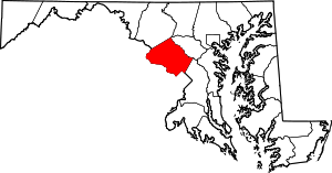 | |
| Towns | ||
| Villages & Special Tax Districts | ||
| CDPs |
| |
| Unincorporated communities | ||
| Footnotes | ‡This populated place also has portions in an adjacent county or counties | |
| Authority control |
|
|---|