Bong Ti
Bong Ti (Thai: บ้องตี้, pronounced [bɔ̂ŋ tîː]) is a village and tambon (subdistrict) of Sai Yok District, in Kanchanaburi Province, Thailand.[2] The tambon contains four villages.
Bong Ti บ้องตี้ | |
|---|---|
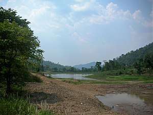
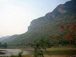 Mountain range and lake in Tambon Bong Ti, Kanchanaburi Province | |
 | |
| Coordinates: 14°4′N 98°59′E[1] | |
| Country | Thailand |
| Province | Kanchanaburi |
| District | Sai Yok |
| Elevation | 300 m (1,000 ft) |
| Population (2005) | |
| • Total | 3,894 |
| Time zone | UTC+7 (ICT) |
Geography
Bong Ti Subdistrict is in the mountainous area of the Tenasserim Hills, close to the border with Myanmar. There is a tarmac road connecting with Sinbyudaing in Myanmar at the western end of the subdistrict. In 2005 the tambon had a population of 3,894 people. Many of the local inhabitants are Karen people.
In 2015, sound from the meteor was reported in three districts of Kanchanaburi Province: Thong Pha Phum, Sai Yok, and Si Sawat.[3] The Governor of Kanchanaburi Province, Wan-chai Osukhonthip, ordered police and Sai Yok National Park rangers to search Wang Krachae and Bong Ti subdistricts in Sai Yok District for meteor debris.[3]
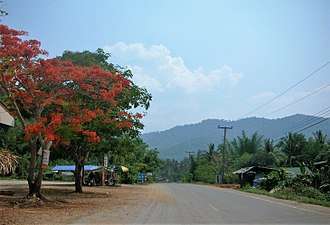 Village, Tambon Bong Ti, Kanchanaburi Province |
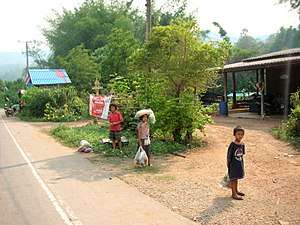 Children in Bong Ti village |
 Near the Myanmar border in Tambon Bong Ti |
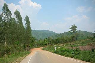 End of the paved road and beginning of the tarmac road leading to Myanmar |
References
- GoogleEarth
- Thaitambon.com, Accessed 11 May 2011 (in Thai)
- "Exploding meteor sends social media into a tizzy". The Nation. 8 September 2015. Archived from the original on 2016-06-04. Retrieved 8 September 2015.
External links

- Pictures of the subdistrict
| India |
| ||||
|---|---|---|---|---|---|
| Thailand |
| ||||