Manghai
Manghai (Chinese: 芒海镇) is a town in Mangshi, Yunnan, China. As of the 2017 census it had a population of 6,777 and an area of 105-square-kilometre (41 sq mi). It is surrounded by Zhefang Town on the northwest, Mengga Town and Dongshan Township on the east, and Myanmar on the south.[1][2]
Manghai Town | |
|---|---|
| Chinese transcription(s) | |
| • Simplified | 芒海镇 |
| • Traditional | 芒海鎮 |
| • Pinyin | Mánghǎi Zhèn |
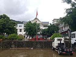 The Government building of Manghai. | |
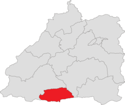 Location of the town region in Mangshi | |
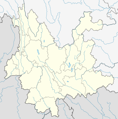 Manghai Town Location in Yunnan | |
| Coordinates: 24.117449°N 98.317746°E | |
| Country | |
| Province | Yunnan |
| Prefecture | Dehong Dai and Jingpo Autonomous Prefecture |
| County-level city | Mangshi |
| Area | |
| • Total | 105 km2 (41 sq mi) |
| Population (2017) | 6,777 |
| Time zone | UTC+8 (China Standard) |
| Postal code | 678401 |
| Area code(s) | 0692 |
Administrative division
As of December 2015, the town is divided into 3 villages:
- Manghai (芒海村)
- Lüyin (吕尹村)
- Lainan (赖南村)
Geography
Climate
The town has a subtropical climate with an annual rainfall of 1,650-millimetre (65 in), a long sunshine time and an annual average temperature of 19.5 °C (67.1 °F). The highest elevation is 2,147-metre (7,044 ft) and the lowest is 870-metre (2,850 ft).
Economy
The economy is supported primarily by farming, ranching and frontier trade. The traditional industries are rice, tea, sugarcane, animal husbandry and straw fruit. The emerging industries are walnut, coffee, macadamia nut and bamboo industry.[1]
Education
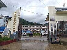
- Manghai Nine-year School
Transportation
The National Highway G320 passes across the town.
References
- 芒海镇基本情况. dhms.gov.cn (in Chinese). 2018-03-26.
- Lai Xinlin (2016-11-22). 芒海镇对面,缅甸一侧山区时有炮火硝烟. thepaper.cn (in Chinese).