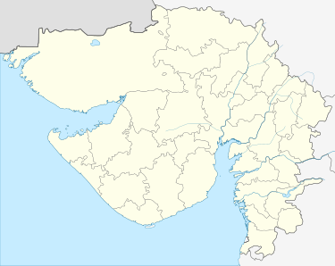
Bhuj
Bhuj (![]()
Bhuj | |
|---|---|
City | |
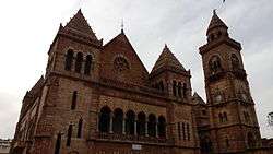 The Prag Mahal | |
 Bhuj | |
| Coordinates: 23.25°N 69.67°E | |
| Country | |
| State | Gujarat |
| District | Kachchh |
| Municipality | Bhuj Municipality |
| Founded by | Rao Hamirji |
| Government | |
| • Type | Elected |
| • Body | Municipality |
| Area | |
| • Total | 56 km2 (22 sq mi) |
| Elevation | 110 m (360 ft) |
| Population (2011)Census 2011 | |
| • Total | 213,514 |
| • Density | 3,800/km2 (9,900/sq mi) |
| Languages | |
| • Official | Kutchi, Gujarati |
| Time zone | UTC+5:30 (IST) |
| PIN | 370001 |
| Telephone code | 2832 |
| Vehicle registration | GJ-12 |
| Sex ratio | 0.97 ♀/♂ |
| Website | http://www.bhujnagarpalika.org |
| source:Census of India[1] | |
Etymology
According to legend, Kutch was ruled by the Nāga chieftains in the past. Sagai, a queen of Sheshapattana, who was married to King Bheria Kumar, rose up against Bhujanga, the last chieftain of Naga. After the battle, Bheria was defeated and Queen Sagai committed sati. The hill where they lived later came to be known as Bhujia Hill and the town at the foothill as Bhuj. Bhujang was later worshiped by the people as snake god, Bhujanga, and a temple was constructed to revere him.[2]
History

Bhuj was founded by Rao Hamir in 1510 and was made the capital of Kutch by Rao Khengarji I in 1549.[3] Its foundation stone as state capital was formally laid on Vikram Samvat 1604 Maagha 5th (approx. 25 January 1548). From 1590 onwards, when Rao was forced to acknowledge the Mughal supremacy, Bhuj came to be known as Suleiman Nagar amongst Muslims. The city's walls were built by Rao Godji I in 1723, and the Bhujiya Fort by Devkaran Seth in Rao Deshalji I's time (1718 - 1741).[4].
Bhuj has been attacked six times. In two instances, the defense was successful and in four other instances, the defense failed. In 1728, an attack by Sarbuland Khan, Mughal Viceroy of Gujarat, was repulsed by Rao Deshalji I, and, in 1765 Mian Ghulam Shah Kalhoro was, by a timely display of the strength of the fortifications, induced to withdraw. During the civil troubles of the reign of the Rao Rayadhan III, Bhuj was thrice taken, by Meghji Seth in 1786, by Hansraj in 1801, and by Fateh Muhammad in 1808. On 26 March 1819, the hill fort of Bhujia was captured by a British detachment under Sir William Keir.[4]
In 1818, Bhuj had a population of 20,000 people. The earthquake on 16 June 1819 destroyed nearly 7000 houses with a loss of an estimated 1140 human lives. About one-third of the buildings that escaped ruin were heavily damaged, and the north face of the town wall was leveled with the ground.
In 1837, Bhuj is said to have had a population of 30,000.[4]
After independence of India in 1947, Cutch State acceded unto the dominion of India and was constituted an independent commissionaire, Kutch State. In 1956, Kutch State was merged with Bombay state, which in 1960 was divided into the new linguistic states of Gujarat and Maharashtra, with Kutch becoming part of Gujarat state as Kutch district. Bhuj is the district headquarters of Kutch District, the largest district in India.
In the 21 July 1956[5] as well as in the 26 January 2001, the city suffered great losses of life and property due to earthquakes. Many parts of Bhuj were demolished due to the extensive damage, whilst others were repaired. There has been great progress in rebuilding the City since the 2001 earthquake, with considerable improvements to roads, transportation, and infrastructure.
Bhuj is home to one of the first Swaminarayan Sampraday temples, built in 1822. Bhuj temple is one of the six original temples built during the earthly presence of the Lord Swaminarayan. The devotees living in Bhuj including Gangaram Mull, Sundarji Suthar and Hirji Suthar requested Lord to construct a temple at Bhuj. Lord instructed Vaishnavanand Swami to construct the temple, and Lord himself installed the murti of Lord NarNarayan Dev in Bhuj on VS 1879 on the 5th day of the bright half of the month of Vaishakh (Friday 15th May 1823 AD). [6]
Geography
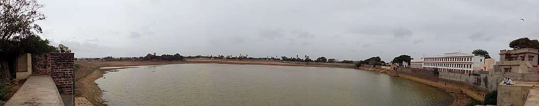
Bhuj has an average elevation of 110 metres (360 feet). On the eastern side of the city is a hill known as Bhujia Hill, on which there is a Bhujia Fort, that separates Bhuj city and Madhapar town ( considered one of the richest villages in Asia ). It has two lakes namely Hamirsar and Deshadsar (દેેેશળસર).
Climate
Bhuj has a borderline hot desert climate (Köppen BWh) just short of a hot semi-arid climate (BSh). Although annual rainfall "averages" around 330 millimetres or 13 inches the variability is among the highest in the world with coefficient of variation of around sixty per cent[7] – among the few comparably variable climates in the world being the Line Islands of Kiribati, the Pilbara coast of Western Australia, the sertão of Northeastern Brazil, and the Cape Verde islands.[8] Recorded annual rainfall has been as low as 21.9 millimetres or 0.86 inches in 1899 – yet in 1926 a total of 1,177.1 millimetres or 46.34 inches fell and in the incomplete year of 1959 rainfall exceeded 1,160 millimetres or 45.67 inches, of which 730.6 millimetres or 28.76 inches fell during Bhuj's wettest-ever month of July 1959.
Apart from the cool mornings of the "winter" season from December to February, temperatures are very warm to sweltering throughout the year, which further reduces the effectiveness of the erratic monsoonal rainfall. During the "hot" season from mid-March to mid-June, temperatures of 40 °C or 104 °F are frequent, whilst during the monsoon season they exceed 34 °C or 93.2 °F with high humidity except during rainy spells accompanied by cooler temperatures but oppressive humidity.
| Climate data for Bhuj (1981–2010) | |||||||||||||
|---|---|---|---|---|---|---|---|---|---|---|---|---|---|
| Month | Jan | Feb | Mar | Apr | May | Jun | Jul | Aug | Sep | Oct | Nov | Dec | Year |
| Record high °C (°F) | 37.0 (98.6) |
38.9 (102.0) |
43.9 (111.0) |
45.6 (114.1) |
47.8 (118.0) |
47.0 (116.6) |
41.3 (106.3) |
41.2 (106.2) |
42.8 (109.0) |
44.0 (111.2) |
39.7 (103.5) |
35.4 (95.7) |
47.8 (118.0) |
| Average high °C (°F) | 27.4 (81.3) |
30.4 (86.7) |
35.4 (95.7) |
38.9 (102.0) |
39.4 (102.9) |
37.6 (99.7) |
34.2 (93.6) |
32.7 (90.9) |
34.9 (94.8) |
36.9 (98.4) |
33.1 (91.6) |
28.7 (83.7) |
34.1 (93.4) |
| Average low °C (°F) | 10.0 (50.0) |
12.8 (55.0) |
18.1 (64.6) |
22.3 (72.1) |
25.5 (77.9) |
27.2 (81.0) |
26.4 (79.5) |
25.3 (77.5) |
24.3 (75.7) |
21.7 (71.1) |
16.0 (60.8) |
11.2 (52.2) |
20.1 (68.2) |
| Record low °C (°F) | −0.2 (31.6) |
0.3 (32.5) |
5.5 (41.9) |
12.7 (54.9) |
16.6 (61.9) |
16.1 (61.0) |
19.4 (66.9) |
20.0 (68.0) |
17.8 (64.0) |
11.1 (52.0) |
6.0 (42.8) |
0.6 (33.1) |
−0.2 (31.6) |
| Average rainfall mm (inches) | 1.3 (0.05) |
0.3 (0.01) |
1.1 (0.04) |
0.2 (0.01) |
1.5 (0.06) |
35.6 (1.40) |
130.9 (5.15) |
99.7 (3.93) |
48.6 (1.91) |
2.3 (0.09) |
1.8 (0.07) |
0.2 (0.01) |
323.5 (12.73) |
| Average rainy days | 0.2 | 0.0 | 0.2 | 0.1 | 0.3 | 1.8 | 5.0 | 3.8 | 2.2 | 0.4 | 0.2 | 0.1 | 14.3 |
| Source: India Meteorological Department (record high and low up to 2010)[9][10] | |||||||||||||
Places of interest
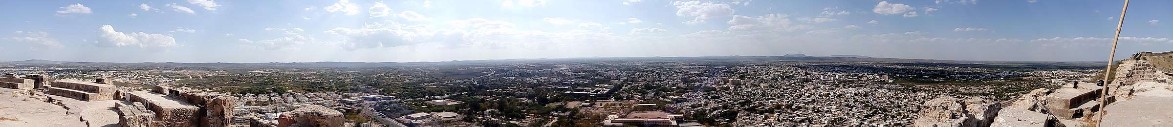
- The Fort: The old city was surrounded by a fort wall with five major gates (Mahadev, Patvadi, Sarpat, Bhid and Vaniyavad) and one small gate known as Chhathi Bari (sixth window). The fort wall is 35 feet high and four feet thick, and during its use was armed with fifty-one guns.[4] Much of the fort wall has either fallen down or been demolished, due to the damage sustained in the 2001 earthquake and the city's redevelopment.
- Hamirsar Lake
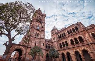
- Prag Mahal
- Aina Mahal
- Sharadbaug Palace
- Chhatardi
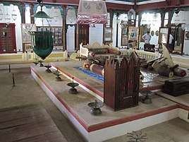
- Kutch Museum
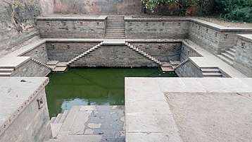
- Ramkund
- Mohammad Pannah Masjid
- Bharatiya Sanskriti Darshan Museum
- Swaminarayan temple
- Bhujia Fort and Smritivan on Bhujia Hill
- Hill Garden
- Tapkeshwari Temple
- Trimandir: Glance at the Trimandir in Bhuj which signifies the Enlightened Vision of Gnani Purush Dada Bhagwan.
- The Bhuj House: A historic, 19th century courtyard estate that is the ancestral home to the Parsi Bhujwala family, which has been redeveloped into a private boutique hotel reflecting a very specific era in Kutch's history when the Parsi community was prominent as close aides to the Rao court and friends to the British garrisons of Kutch in colonial India.[11]
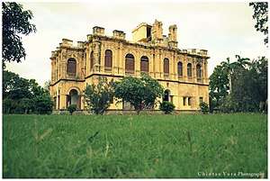 Sharadbaugh Palace
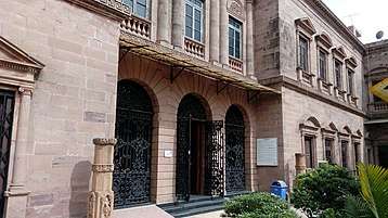
 Ramkund
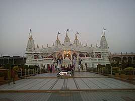 Swaminarayan temple
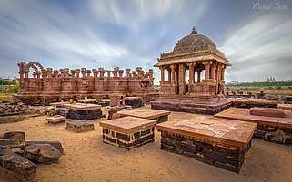 Chhatedi of Bhuj
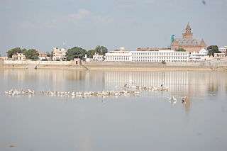
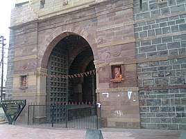 Mahadev Gate near Hamirsar Lake
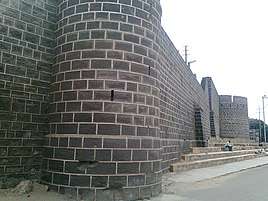 Darbargadh Fort
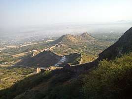
 Tapakeshwari Devi Temple near Bhuj
 Hill Garden
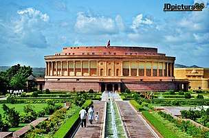 The Vande Mataram Memorial is located at Village - Bhujodi near Bhuj
Demographics
In 2011 the population of Bhuj was 213,514, which consisted of 111,146 males and 102,368 females.[1]
Culture
Bhuj is a famous destination within India for observing the historic craftsmanship of the Kutch region, including the textile crafts of bandhni (tie-dye), embroidery, and leatherwork. Artists of nearby villages bring their artwork for sale in 'Bhuj Haat', which is situated near Jubilee Ground. Locals often visit Hamirsar Lake for relaxation in natural surroundings.
Bhuj is also famous for its regional cuisine, especially Pakvans, chikki, Kutchhi Dabeli (a vegetarian burger made with mashed potato, cooked with masala curry and chutneys), and regional Gujarati sweets.
Media and communications
State-owned All India Radio has a local station in Bhuj which transmits various programmes. Local TV channels and newspapers are the most popular media.
Education

Alfred High School, the first high school of Kutch, established in 1870, is also an architectural heritage of the town.
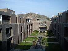
Krantiguru Shyamji Krishna Verma Kachchh University is located in Bhuj. The university has 41 colleges affiliated, nineteen of which are in Bhuj. The university gives degrees in Arts, Science, Commerce, Law Education, Management, Pharmacy, Social Welfare, Medicine and Engineering.[12]
Primary and secondary
- St. Xavier's High School, Bhuj
- Alfred High School
- Army Public School
- V.D High School
- Indira Bai Girls High school•
- Hope Foundation School near Ashapura Nagar
- Shri Swaminarayan Vidhyalay
- Shishukunj International School Shishukunj International School
- White House Public School
- Matrushree R.D. Varsani high school
- Kendriya Vidyalaya No.1,Airforce Station Bhuj
- Kendriya Vidyalaya No.2, Army Cantt. Bhuj
Higher education
Radio Station & Television
Bhuj has its own Radio Station with Studio. Prasar Bharati under Information and Broadcasting Ministry is operating Radio Studio. MW is available on 1314KHz and FM is available on 103.7MHz. There is also terrestrial DD channel available. DD National and DD Girnar available.
Transportation


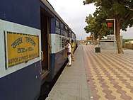
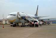
Bhuj is connected to Ahmedabad, Vadodara, Surat Mumbai, Delhi, Kolkata, Pune, Gaziabad, Jaipur, Ajmer, Hapur, Moradabad, Bareilly, Kharagpur, Ujjain and other cities within India by railway. The city has a domestic airport, from which daily flights connect to Mumbai with flights operated by Air India. State Transport buses are available from the ST stand in the middle of the town to various places in Gujarat. Additionally, many private tour operators also run frequent buses to major cities within and outside of the state of Gujarat. Kandla Airport is 53 km from Bhuj. The city may be navigated by the city bus and auto rickshaw.
Trains
| Train no. | Train Name | Runs From | Destination | Departure Days | Arrival Days |
|---|---|---|---|---|---|
| 11091-11092 | Ahimsa Express | Bhuj | Pune | Wednesday | Tuesday |
| 14312-14311 via Ahmedabad & 14322-14321 via Bhildi | Ala Hazrat Express | Bhuj | Bareilly | Tuesday, Thursday & Sunday for 14312. Monday, Wednesday, Friday & Saturday for 14322 | Friday, Saturday, Monday for 14311. Tuesday, Wednesday, Thursday & Sunday for 14321 |
| 22829-22830 | Shalimar - Bhuj Weekly SF Express | Bhuj | Shalimar | Tuesday | Monday |
| 22904-22903 | Bandra Terminus Bhuj AC Superfast Express | Bhuj | Bandra | Monday, Thursday, Saturday | Thursday, Saturday, Monday |
| 12960-12959 | Bhuj Dadar Superfast Express | Bhuj | Dadar | Monday, Thursday | Wednesday, Saturday |
| 19132-19131 | Kutch Express | Bhuj | Bandra | Daily | Daily |
| 19116-19115 | Shayajinagari Express | Bhuj | Dadar | Daily | Daily |
Flight
Bhuj has flights to Mumbai provided by Air India Regional.
| Airline | Departs | Arrives |
|---|---|---|
| Air India Regional | Bhuj | Mumbai |
References
- "Census of India". The Registrar General & Census Commissioner, India, New Delhi, Ministry of Home Affairs, Government of India. 26 June 2007. Retrieved 3 September 2015.
- Ward (1 January 1998). Gujarat–Daman–Diu: A Travel Guide. Orient Longman Limited. pp. 316–317. ISBN 978-81-250-1383-9.
- "History of Bhuj". Bhuj Online. Retrieved 31 October 2018.
- Gazetteer of the Bombay Presidency: Cutch, Palanpur, and Mahi Kantha. Printed at the Government Central Press. 1880. pp. 215–216.
- "Quake rocks Kutch". The Hindu. 24 July 1956. Retrieved 16 December 2013.
- http://www.bhujmandir.org
- Van Etten, Eddie J.B.; ‘Inter-annual Rainfall Variability of Arid Australia: greater than elsewhere?’; Australian Geographer; 40 (2009), pp. 109-120
- Dewar, Robert E. and Wallis, James R; ‘Geographical patterning of interannual rainfall variability in the tropics and near tropics: An L-moments approach’; in Journal of Climate, 12; pp. 3457-3466
- "Bhuj Climatological Table Period: 1981–2010". India Meteorological Department. Retrieved 10 April 2015.
- "Ever recorded Maximum and minimum temperatures up to 2010" (PDF). India Meteorological Department. Archived from the original (PDF) on 16 March 2014. Retrieved 10 April 2015.
- "Introducing The Bhuj House: An Interview with Jehan Bhujwala". Greaves Tours. 2 May 2016.
- "ક્રાંતિગુરુ શ્યામજી કૃષ્ણ વર્મા કચ્છ યુનિવર્સિટી". Kskvku.digitaluniversity.ac. Retrieved 5 August 2012.
- This article incorporates Public Domain text from Gazetteer of the Bombay Presidency: Cutch, Palanpur, and Mahi Kantha. Printed at the Government Central Press. 1880. p. 216.
External links
- Kachchh University
- Bhuj Bole Chhe - Website maintained by the citizens of Bhuj about their city
- Official Facebook page for Bhuj
- Facebook page of Bhuj Bole Chhe - Voice of Bhuj Citizens
Taluka of Bhuj | ||
|---|---|---|
| Capital Town | Bhuj |  |
| Major cities | ||
| Villages of Bhuj taluka | ||
| Topics | Sarpanch · Taluka Head · History · Notable people · Cities and Towns · Education institutes · National parks & Sanctuaries | |
| Topics |  | |
|---|---|---|
| Regions of Gujarat | ||
| Districts | ||
| Major cities | ||
| Ecoregions | ||
| Economy |
| |
| ||
| Authority control |
|
|---|