Amravati division
Amravati division also known as Varhad is an Indian one of the six administrative divisions of Maharashtra state in India. Amravati and Nagpur divisions constitute the ancient Vidarbha region. Amravati Division is bound by Madhya Pradesh state to the north, Nagpur Division to the east, Telangana state to the southeast, Marathwada region (Aurangabad Division) to the south and southwest, and Nashik Division to the west.
- Area: 46,090 km²
- Population (2011 census): 2,888,445
- Districts: Akola, Amravati, Buldhana, Washim, Yavatmal
- Largest City: Amravati
- Literacy: 77.79%
- Area under irrigation: 2,582.02 km²
- Railways: broad gauge 249 km, meter gauge 227 km, narrow gauge 188 km.
Amravati division | |
|---|---|
division | |
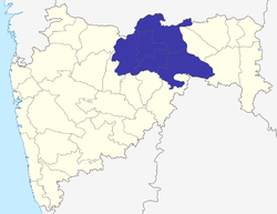 Location of Amravati division in Maharashtra | |
 Amravati division Location of the divisional headquarters in Maharashtra, India | |
| Coordinates: 20°55′00″N 77°45′00″E | |
| Country | |
| State | Maharashtra |
| Area | |
| • Total | 46,090 km2 (17,800 sq mi) |
| Population (2011) | |
| • Total | 2,888,445 |
| • Density | 63/km2 (160/sq mi) |
| Languages | |
| • Official | Marathi |
| Time zone | UTC+5:30 (IST) |
| ISO 3166 code | IN-MH |
History of Amravati Division
Amravati division roughly corresponds to the former province of Berar, which was ruled by the Maratha Maharajas of Nagpur till 1803. In 1853, it was occupied by the British, who decided to administer the province although it remained under the nominal sovereignty of the Nizam of Hyderabad.[1]
In 1903 Berar Province was renamed Berar Division and added to the British-administered Central Provinces, which in 1936 was renamed Central Provinces and Berar.[2] Upon Indian independence, the Central Provinces and Berar were reorganised as the Indian state of Madhya Pradesh. In 1956 the Indian states were reorganised on linguistic grounds, and Amravati and Nagpur divisions were transferred to Bombay State, which was split on linguistic lines into the states Maharashtra and Gujarat in 1960.
Amravati city is the largest city in the division followed by Akola and Yawatmal cities.
Chikhaldara, the only hill station in Vidarbha region, is situated in Amravati District. Also the famous Melghat Tiger Reserve is situated in Amravati and Akola districts.
Administration
A Divisional Commissioner, an IAS officer appointed by the Government of Maharashtra, administers the division. Divisional Commissioners have included:
- Ganesh P. Thakur (2011–2012)[3]
- D. R. Bansod (2013–2014)[4]
- Dnyaneshwar Sadashivrao Dhok Rajurkar (2014– )[5]
The division is subdivided into five districts:
- Akola
- Amravati
- Buldana
- Yavatmal
- Washim
See also
- Make In Maharashtra
- Central Provinces and Berar, Administration
References
- Olson, James S. and Robert Shadle, eds. Historical Dictionary of the British Empire, Vol. 1. Greenwood Publishing Group, UK 1996. P. 227.
- Hunter, William Wilson, Sir, et al. (1908). Imperial Gazetteer of India, Volume 6. 1908-1931; Clarendon Press, Oxford.
- "Divisional Commissionerate, Amravati". Amravati Division. Archived from the original on 10 March 2012.
- "Divisional Commissionerate, Amravati". Amravati Division. Archived from the original on 24 July 2013.
- "Divisional Commissionerate, Amravati". Amravati Division. Archived from the original on 25 March 2016.
External links
| Topics | |||||||||||||
|---|---|---|---|---|---|---|---|---|---|---|---|---|---|
| Regions | |||||||||||||
| Divisions and Districts |
| ||||||||||||
| Million-plus cities in Maharashtra | |||||||||||||
| Other cities with municipal corporations | |||||||||||||
Portal:India | |||||||||||||