Kolhapur district
Kolhapur district is in Maharashtra state. The city of Kolhapur is the district headquarters. As of 2011, the district had population of 3,876,001, of which 33% were urban.
Kolhapur district | |
|---|---|
District of Maharashtra | |
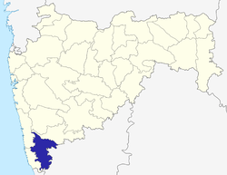 Location of Kolhapur district in Maharashtra | |
| Country | India |
| State | Maharashtra |
| Division | Pune Division |
| Headquarters | Kolhapur |
| Tehsils | 1. Gadhinglaj, 2. Karveer, 3. Bhudargad, 4. Panhala, 5. Kagal, 6. Shirol, 7. Hatkanangale, 8. Ajara, 9. Chandgad, 10. Gaganbawada, 11. Radhanagari, 12. Shahuwadi |
| Government | |
| • Lok Sabha constituencies | 1. Kolhapur, 2. Hatkanangle (shared with Sangli District), based on (Election Commission website) |
| Area | |
| • Total | 7,685 km2 (2,967 sq mi) |
| Population (2011) | |
| • Total | 3,876,001 |
| • Density | 500/km2 (1,300/sq mi) |
| • Urban | 32% |
| Demographics | |
| • Literacy | 89% |
| Time zone | UTC+05:30 (IST) |
| Major highways | NH-4, NH-204 |
| Average annual precipitation | 1035 mm |
| Website | http://kolhapur.nic.in |
Demographics
According to the 2011 census Kolhapur district has a population of 3,876,001. This gives it a ranking of 65th in India (out of a total of 640). The district has a population density of 504 inhabitants per square kilometre (1,310/sq mi). Its population growth over the decade 2001-2011 was 9.96%. Kolhapur has a sex ratio of 953 females for every 1000 males.
At the time of the 2011 Census of India, 90.00% of the population in the district spoke Marathi, 2.60% Hindi, 2.70% Urdu, 2.00% Kannada, 0.46% Sindhi and 0.42% Telugu as their first language.[1]
The district has three centres of tourism, the Mahalaxmi temple and karveer peeth jagadguru shankaracharya math in the city of Kolhapur and Jyotiba temple in Wadi ratnagiri.[2]
| Historical population | ||
|---|---|---|
| Year | Pop. | ±% p.a. |
| 1901 | 872,720 | — |
| 1911 | 792,681 | −0.96% |
| 1921 | 794,673 | +0.03% |
| 1931 | 908,317 | +1.35% |
| 1941 | 1,039,279 | +1.36% |
| 1951 | 1,267,609 | +2.01% |
| 1961 | 1,552,636 | +2.05% |
| 1971 | 2,001,973 | +2.57% |
| 1981 | 2,457,095 | +2.07% |
| 1991 | 2,989,507 | +1.98% |
| 2001 | 3,523,162 | +1.66% |
| 2011 | 3,876,001 | +0.96% |
| source:[3] | ||
Administration and Divisions
| Name of Division (Headquarter) | Sr. No. | Districts | Administration | Sub-Division | Taluka | Source |
|---|---|---|---|---|---|---|
| Pune Division HQ=Pune Districts=5 SubDivisions=31 Talukas=64 |
1. | Kolhapur District | HQ-Kolhapur Sub-Divisions-6 Taluka-12 |
Panhala | District website | |
| Ichalkaranji | ||||||
| Karvir | ||||||
| Radhanagari | ||||||
| Bhudargad | ||||||
| Gadhinglaj | ||||||
See also
References
- 2011 Census of India, Population By Mother Tongue
- "AAI proposal to acquire 11ha land for airport soon: MP - Times of India". The Times of India. Retrieved 2017-09-19.
- Decadal Variation In Population Since 1901
External links
| Wikimedia Commons has media related to Kolhapur district. |
Places adjacent to Kolhapur district | ||||||||||
|---|---|---|---|---|---|---|---|---|---|---|
| ||||||||||
| Topics | |||||||||||||
|---|---|---|---|---|---|---|---|---|---|---|---|---|---|
| Regions | |||||||||||||
| Divisions and Districts |
| ||||||||||||
| Million-plus cities in Maharashtra | |||||||||||||
| Other cities with municipal corporations | |||||||||||||
Portal:India | |||||||||||||
Kolhapur district topics | |||||
|---|---|---|---|---|---|
| History |
| | |||
| Geography | |||||
| Cities and towns | |||||
| Transport |
| ||||
| Visitor's attractions |
| ||||
| Culture | |||||
| Education |
| ||||
| Lok Sabha Constituencies | |||||
| Vidhan Sabha Constituencies |
| ||||
| Taluka/Tehsil | |||||
| Stadiums | |||||
‡ This constituency also has portions in Sangli district
| |||||