Åmli
Åmli is a municipality in Agder county, Norway. It is located in the traditional region of Sørlandet. The main population centre and administrative center is the village of Åmli which lies along the river Nidelva. Other villages in Åmli include Askland, Dølemo, Eppeland, Flaten, Hillestad, Homdrom, Lauveik, Nelaug, Øvre Ramse, Skjeggedal, Tveit, Vehus, and Ytre Ramse.[3]
Åmli kommune | |
|---|---|
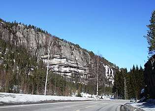
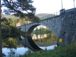 View of the Nidelva river in Åmli | |
 Coat of arms 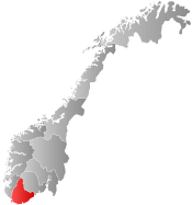 Agder within Norway | |
 Åmli within Agder | |
| Coordinates: 58°47′53″N 08°22′9″E | |
| Country | Norway |
| County | Agder |
| District | Sørlandet |
| Administrative centre | Åmli |
| Government | |
| • Mayor (2011) | Reidar Saga (Labour) |
| Area | |
| • Total | 1,130.61 km2 (436.53 sq mi) |
| • Land | 1,058.42 km2 (408.66 sq mi) |
| • Water | 72.19 km2 (27.87 sq mi) |
| Area rank | 89 in Norway |
| Population (2017) | |
| • Total | 1,856 |
| • Rank | 335 in Norway |
| • Density | 1.8/km2 (5/sq mi) |
| • Change (10 years) | 2.3% |
| Demonym(s) | Åmling[1] |
| Time zone | UTC+01:00 (CET) |
| • Summer (DST) | UTC+02:00 (CEST) |
| ISO 3166 code | NO-4217 |
| Official language form | Nynorsk[2] |
| Website | www |
The 1,131-square-kilometre (437 sq mi) municipality is the 89th largest by area out of the 422 municipalities in Norway. Åmli is the 335th most populous municipality in Norway with a population of 1,856. The municipality's population density is 1.1 inhabitants per square kilometre (2.8/sq mi) and its population has increased by 2.3% over the last decade.[4]
General information

Name
The municipality (originally the prestegjeld) is named after the old Åmli farm (Old Norse Almlíð), since the first Åmli Church was built there. The first element is almr which means "elm" and the last element is líð which means "hillside". The name was historically spelled Omlid and Aamli.[5]
Coat-of-arms
The coat-of-arms is from modern times. The arms were granted in 1987. It shows a silver or white beaver on a blue background. Odd Einar Ufsvatn was the designer. The beaver was chosen because the Åmli area is one of the few remaining beaver habitats in Europe, and beavers from Norway have been used to help re-populate other areas in Europe where the beaver had gone extinct in the wild.[6]
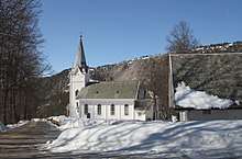
Churches
The Church of Norway has two parishes (sokn) within the municipality of Åmli. It is part of the Aust-Nedenes prosti (deanery) in the Diocese of Agder og Telemark.
| Parish (Sokn) | Church Name | Location of the Church | Year Built |
|---|---|---|---|
| Gjøvdal | Gjøvdal Church | Askland | 1803 |
| Åmli | Tovdal Church | Hillestad | 1820 |
| Åmli Church | Åmli | 1909 |
History
The parish of Omlid was established as a municipality on 1 January 1838 (see formannskapsdistrikt). In 1876, the southwestern district of Åmli (population: 663) was separated from it to become the municipality of Mykland. This left Åmli with 2,564 inhabitants. On 1 January 1908, Åmli was split into three municipalities: the northern area surrounding the river Gjøv (pop: 590) became the municipality of Gjevedal, the southwestern area surrounding the Tovdalselva river (pop: 389) became Lille Topdal, and the remainder of the old municipality (population: 2,024) continued as Åmli municipality.[7]
During the 1960s, there were many municipal mergers across Norway due to the work of the Schei Committee. On 1 January 1960, the neighboring municipality of Gjøvdal (pop: 362) was merged with Åmli to form a new, larger municipality called Åmli. The combined population was 2,309. On 1 January 1962, the Espestølsgrenda area (pop: 7) was transferred from Åmli (and Aust-Agder county) to neighboring Nissedal municipality (in Telemark county). Several uninhabited areas (the Espestøl, Reinefoss, and Espestølstykket farms) were transferred to Nissedal municipality in Telemark county on 1 January 1965. Then on 1 January 1967, the neighboring municipality of Tovdal (pop: 161) was merged back into the municipality of Åmli. Åmli then had a total of 2,211 inhabitants. On 1 January 1968, the Flateland farm (pop: 6) was transferred to the municipality of Froland.[7]
Geography
Åmli is located in northern Aust-Agder county. It is bordered on the north by Fyresdal and Nissedal municipalities (in Telemark county), on the east by Vegårshei municipality, on the south by Froland municipality, and on the west by Bygland municipality.
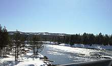
The most densely populated area is around the municipal center of Åmli, which lies on the banks of the river Nidelva. The village has about 682 residents (in 2017). Side valleys which join the main valley include Gjøvdal and Tovdal. The rivers Nidelva and Tovdalselva flow through the valleys.
In the southern part of the municipality the Sørlandsbanen railway line passes through the area, stopping at the Nelaug Station. The largest villages in Åmli include Dølemo, Nelaug, Hillestad, and Askland. The rest of the population is scattered among the valleys.
The Åmli hills are wooded and typically range from 700 to 800 metres (2,300 to 2,600 ft) above sea level. At 930 metres (3,050 ft), the highest point is Trongedalsfjell, which lies between the Tovdal and Gjøvdal valleys. Several lakes are located in Åmli including Måvatn, Nasvatn, and Nelaug.
There are several protected areas, for instance, the Årdalen nature reserve, bordering on the Rukkevatn nature reserve, and the Furubuhei marsh reserve, provide approximately 43 square kilometres (17 sq mi) of nature reserves.
Government
All municipalities in Norway, including Åmli, are responsible for primary education (through 10th grade), outpatient health services, senior citizen services, unemployment and other social services, zoning, economic development, and municipal roads. The municipality is governed by a municipal council of elected representatives, which in turn elect a mayor.
Municipal council
The municipal council (Kommunestyre) of Åmli is made up of 17 representatives that are elected to four year terms. Currently, the party breakdown is as follows:[8]
| Party Name (in Nynorsk) | Number of representatives | |
|---|---|---|
| Labour Party (Arbeidarpartiet) | 7 | |
| Conservative Party (Høgre) | 2 | |
| Christian Democratic Party (Kristeleg Folkeparti) | 2 | |
| Centre Party (Senterpartiet) | 6 | |
| Total number of members: | 17 | |
Economy
Lumbering in Åmli provides for about 12% of the Aust-Agder county's total timber production making it the third most import source of timber in Aust-Adger (after Froland and Birkenes). Agriculture, including sheep husbandry, provides a minor contribution to the economy.
Electrical power is generated by a hydroelectric plant at Flatefoss, which regulates the level of the lake, Nelaug.
The newspaper Åmliavisa has been published in Åmli since 2008.
Transportation
The main road through Åmli is the north-south Norwegian National Road 41. Other roads include Norwegian County Road 412, Norwegian County Road 413, and Norwegian County Road 415. There are also two railway lines running through southern Åmli: the main Sørlandsbanen railway line which stops at Nelaug Station and the branch line Arendalsbanen which terminates at Nelaug Station, but also stops at Flaten Station.
Notable residents
- Engvald Bakkan (1897–1982), an author
- Jonas Alaska (born 1988), a musician
References
- "Navn på steder og personer: Innbyggjarnamn" (in Norwegian). Språkrådet.
- "Forskrift om målvedtak i kommunar og fylkeskommunar" (in Norwegian). Lovdata.no.
- Thorsnæs, Geir, ed. (5 April 2016). "Åmli". Store norske leksikon (in Norwegian). Kunnskapsforlaget. Retrieved 17 December 2017.
- Statistisk sentralbyrå (2017). "Table: 06913: Population 1 January and population changes during the calendar year (M)" (in Norwegian). Retrieved 23 December 2017.
- Rygh, Oluf (1905). Norske gaardnavne: Nedenes amt (in Norwegian) (8 ed.). Kristiania, Norge: W. C. Fabritius & sønners bogtrikkeri. p. 53.
- "Kommunevåpenet" (in Norwegian). 2008. Retrieved 3 October 2008.
- Jukvam, Dag (1999). "Historisk oversikt over endringer i kommune- og fylkesinndelingen" (PDF) (in Norwegian). Statistisk sentralbyrå.
- "Table: 04813: Members of the local councils, by party/electoral list at the Municipal Council election (M)" (in Norwegian). Statistics Norway. 2015.
| Wikimedia Commons has media related to Åmli. |
External links
| Look up Åmli in Wiktionary, the free dictionary. |
- Municipal fact sheet from Statistics Norway (in Norwegian)

- Culture in Åmli on the map
 |  | ||||||||||||||||||||
|
| Authority control |
|
|---|