Wilson Township, Pope County, Arkansas
| Wilson Township | |
|---|---|
| Township | |
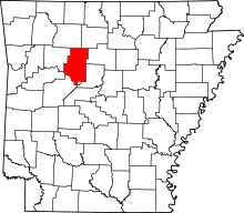
 Wilson Township Location in Arkansas | |
| Coordinates: 35°13′30″N 92°55′01″W / 35.22500°N 92.91694°WCoordinates: 35°13′30″N 92°55′01″W / 35.22500°N 92.91694°W | |
| Country |
|
| State |
|
| County | Pope |
| Established | 1854 |
| Area | |
| • Total | 59.35 sq mi (153.7 km2) |
| • Land | 56.32 sq mi (145.9 km2) |
| • Water | 3.03 sq mi (7.8 km2) |
| Elevation | 335 ft (102 m) |
| Population (2010) | |
| • Total | 4,774 |
| • Density | 84.8/sq mi (32.7/km2) |
| Time zone | UTC-6 (CST) |
| • Summer (DST) | UTC-5 (CDT) |
| Area code(s) | 479 |
| GNIS feature ID | 69715 |
Wilson Township is one of nineteen current townships in Pope County, Arkansas, USA.[1] As of the 2010 census, its unincorporated population was 4,774. It now contains the former township of Lee.
Geography
According to the United States Census Bureau, Wilson Township covers an area of 59.35 square miles (153.7 km2), with 56.32 square miles (145.9 km2) of land and 3.03 square miles (7.8 km2) of water.
Cities, towns, and villages
References
- United States Census Bureau 2008 TIGER/Line Shapefiles
- United States Board on Geographic Names (GNIS)
- United States National Atlas
- ↑ "Wilson Township, Pope County, Arkansas." U.S. Census Bureau. Breakdown. Retrieved June 23, 2010.
External links
This article is issued from
Wikipedia.
The text is licensed under Creative Commons - Attribution - Sharealike.
Additional terms may apply for the media files.