Bullfrog Valley, Arkansas
| Bullfrog Valley, Arkansas | |
|---|---|
| Unincorporated community | |
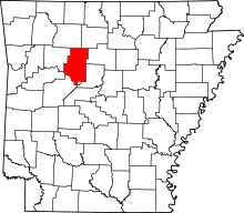
 Bullfrog Valley, Arkansas Bullfrog Valley's position in Arkansas.  Bullfrog Valley, Arkansas Bullfrog Valley, Arkansas (the US) | |
| Coordinates: 35°31′08″N 93°12′46″W / 35.51889°N 93.21278°WCoordinates: 35°31′08″N 93°12′46″W / 35.51889°N 93.21278°W | |
| Country |
|
| State |
|
| County | Pope County, Arkansas |
| Elevation | 204 m (669 ft) |
| Time zone | UTC-6 (Central (CST)) |
| • Summer (DST) | UTC-5 (CDT) |
| GNIS feature ID | 59138 |
Bullfrog Valley is an unincorporated community in Illinois Township, Pope County, Arkansas, United States.[1] It is located on Arkansas Highway 164 near the Johnson County line. The community is also located north of Silex.
References
This article is issued from
Wikipedia.
The text is licensed under Creative Commons - Attribution - Sharealike.
Additional terms may apply for the media files.