Nogo, Arkansas
| Nogo, Arkansas | |
|---|---|
| Unincorporated community | |
 Nogo, Arkansas  Nogo, Arkansas | |
| Coordinates: 35°38′27″N 92°52′46″W / 35.64083°N 92.87944°WCoordinates: 35°38′27″N 92°52′46″W / 35.64083°N 92.87944°W | |
| Country | United States |
| State | Arkansas |
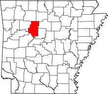
| County | Pope |
| Elevation | 1,726 ft (526 m) |
| Time zone | UTC-6 (Central (CST)) |
| • Summer (DST) | UTC-5 (CDT) |
| Area code(s) | 479 |
| GNIS feature ID | 72874[1] |
Nogo is a small unincorporated community in Smyrna Township, Pope County, Arkansas, United States.[1] It is part of the Russellville Micropolitan Statistical Area.
Nogo is situated in the Boston Mountains, 11 miles northwest of Kincannon Mountain and 28 miles northeast of Russellville on Arkansas Highway 27 at 35°38′27″N 92°52′46″W / 35.64083°N 92.87944°W, within the Ozark National Forest.
The elevation is 1720 feet above sea level.[2]
Nogo has been noted for its unusual place name.[3]
References
- 1 2 "Nogo, Arkansas". Geographic Names Information System. United States Geological Survey.
- ↑ USGS. Populated Place Data. Retrieved June 20, 2010.
- ↑ Thompson, George E. (1 July 2009). You Live Where?: Interesting and Unusual Facts about where We Live. iUniverse. p. 8. ISBN 978-1-4401-3421-0.
This article is issued from
Wikipedia.
The text is licensed under Creative Commons - Attribution - Sharealike.
Additional terms may apply for the media files.