Erquery
| Erquery | ||
|---|---|---|
| Commune | ||
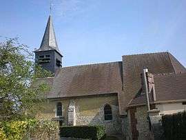 Church of Our Lady of Erquery | ||
| ||
 Erquery Location within Hauts-de-France region  Erquery | ||
| Coordinates: 49°24′34″N 2°27′30″E / 49.4094°N 2.4583°ECoordinates: 49°24′34″N 2°27′30″E / 49.4094°N 2.4583°E | ||
| Country | France | |
| Region | Hauts-de-France | |
| Department | Oise | |
| Arrondissement | Clermont | |
| Canton | Clermont | |
| Intercommunality | Pays du Clermontois | |
| Government | ||
| • Mayor (2008–2014) | Gilles Mouret | |
| Area1 | 5.91 km2 (2.28 sq mi) | |
| Population (2012)2 | 578 | |
| • Density | 98/km2 (250/sq mi) | |
| Time zone | UTC+1 (CET) | |
| • Summer (DST) | UTC+2 (CEST) | |
| INSEE/Postal code | 60215 /60600 | |
| Elevation |
57–135 m (187–443 ft) (avg. 100 m or 330 ft) | |
|
1 French Land Register data, which excludes lakes, ponds, glaciers > 1 km2 (0.386 sq mi or 247 acres) and river estuaries. 2 Population without double counting: residents of multiple communes (e.g., students and military personnel) only counted once. | ||

Erquery is a commune in the Oise department in northern France.
See also
References
| Wikimedia Commons has media related to Erquery. |
This article is issued from
Wikipedia.
The text is licensed under Creative Commons - Attribution - Sharealike.
Additional terms may apply for the media files.