Lavacquerie
| Lavacquerie | |
|---|---|
| Commune | |
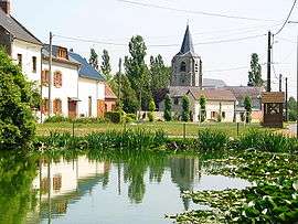 The church and lake in Lavacquerie | |
 Lavacquerie Location within Hauts-de-France region  Lavacquerie | |
| Coordinates: 49°40′56″N 2°05′38″E / 49.6822°N 2.0939°ECoordinates: 49°40′56″N 2°05′38″E / 49.6822°N 2.0939°E | |
| Country | France |
| Region | Hauts-de-France |
| Department | Oise |
| Arrondissement | Beauvais |
| Canton | Grandvilliers |
| Intercommunality | Picardie verte |
| Government | |
| • Mayor (2008–2014) | Marcel Goëythals |
| Area1 | 8.28 km2 (3.20 sq mi) |
| Population (2012)2 | 211 |
| • Density | 25/km2 (66/sq mi) |
| Time zone | UTC+1 (CET) |
| • Summer (DST) | UTC+2 (CEST) |
| INSEE/Postal code | 60353 /60120 |
| Elevation |
118–187 m (387–614 ft) (avg. 185 m or 607 ft) |
|
1 French Land Register data, which excludes lakes, ponds, glaciers > 1 km2 (0.386 sq mi or 247 acres) and river estuaries. 2 Population without double counting: residents of multiple communes (e.g., students and military personnel) only counted once. | |
Lavacquerie is a commune in the Oise department in northern France.
See also
References
| Wikimedia Commons has media related to Lavacquerie. |
This article is issued from
Wikipedia.
The text is licensed under Creative Commons - Attribution - Sharealike.
Additional terms may apply for the media files.